 |
|
Location & QuickFacts
| FAA Information Effective: | 2008-09-25 |
| Airport Identifier: | 9MI3 |
| Airport Status: | Operational |
| Longitude/Latitude: | 085-40-16.1110W/42-57-56.0950N
-85.671142/42.965582 (Estimated) |
| Elevation: | 670 ft / 204.22 m (Estimated) |
| Land: | 0 acres |
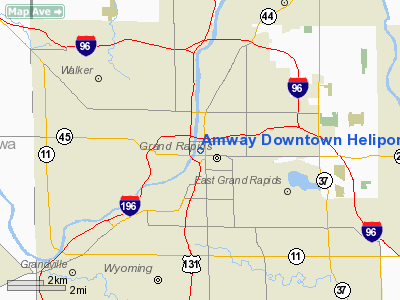
| From nearest city: | 0 nautical miles N of Grand Rapids, MI |
| Location: | Kent County, MI |
| Magnetic Variation: | 04W (1984) |
Owner & Manager
| Ownership: | Privately owned |
| Owner: | Amway Corporation |
| Address: | 7575 East Fulton
Ada, MI 49355 |
| Phone number: | 616-949-0790 |
| Manager: | Rick J Fiddler
DIRECTOR OF AVIATION |
| Address: | Amway Hgr-5410 44th St S.e.
Grand Rapids, MI 49512 |
| Phone number: | 616-949-0790 |
Airport Operations and Facilities
| Airport Use: | Private
PERSONAL USE. |
| Wind indicator: | Yes |
| Segmented Circle: | No |
| Control Tower: | No |
| Landing fee charge: | No |
| Sectional chart: | Chicago |
| Region: | AGL - Great Lakes |
| Boundary ARTCC: | ZAU - Chicago |
| Tie-in FSS: | LAN - Lansing |
| FSS on Airport: | No |
| FSS Toll Free: | 1-800-WX-BRIEF |
Runway Information
Helipad H1
| Dimension: | 30 x 30 ft / 9.1 x 9.1 m |
| Surface: | ASPH, |
| |
Runway H1 |
Runway |
| Traffic Pattern: | Left | Left |
|
Radio Navigation Aids
| ID |
Type |
Name |
Ch |
Freq |
Var |
Dist |
| HLM | NDB | Holland | | 233.00 | 03W | 23.7 nm |
| BT | NDB | Batol | | 272.00 | 04W | 42.2 nm |
| AMN | NDB | Alma | | 329.00 | 05W | 44.4 nm |
| GRR | VOR/DME | Grand Rapids | 106Y | 115.95 | 04W | 13.2 nm |
| PMM | VOR/DME | Pullman | 058X | 112.10 | 00E | 35.6 nm |
| HIC | VOR/DME | White Cloud | 123X | 117.60 | 01W | 36.7 nm |
| AZO | VOR/DME | Kalamazoo | 027X | 109.00 | 01W | 44.1 nm |
| MKG | VORTAC | Muskegon | 099X | 115.20 | 01W | 20.3 nm |
| BTL | VORTAC | Battle Creek | 031X | 109.40 | 02W | 43.6 nm |
| LAN | VORTAC | Lansing | 045X | 110.80 | 05W | 45.4 nm |
Remarks
- OPERATIONS ARE CONDUCTED IN AREA FROM 220-270 DEGS CLOCKWISE; AREA IS APPROPRIATELY MARKED; WIND INDICATOR IS MAINTAINED, LIGHT STANDARD FURTHEST SOUTH IS REMOVED, ESTABLISH TAILWIND LIMITATIONS.
Images and information placed above are from
http://www.airport-data.com/airport/9MI3/
We thank them for the data!
| General Info
|
| Country |
United States
|
| State |
MICHIGAN
|
| FAA ID |
9MI3
|
| Latitude |
42-57-56.095N
|
| Longitude |
085-40-16.111W
|
| Elevation |
670 feet
|
| Near City |
GRAND RAPIDS
|
We don't guarantee the information is fresh and accurate. The data may
be wrong or outdated.
For more up-to-date information please refer to other sources.
|
|


