 |
|
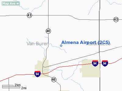
Location & QuickFacts
| FAA Information Effective: | 2008-09-25 |
| Airport Identifier: | 2C5 |
| Airport Status: | Operational |
| Longitude/Latitude: | 085-51-01.0470W/42-15-09.1380N
-85.850291/42.252538 (Estimated) |
| Elevation: | 740 ft / 225.55 m (Estimated) |
| Land: | 33 acres |
| From nearest city: | 3 nautical miles NE of Paw Paw, MI |
| Location: | Van Buren County, MI |
| Magnetic Variation: | 03W (1985) |
Owner & Manager
| Ownership: | Privately owned |
| Owner: | James Manning |
| Address: | 46236 N 30th Street
Paw Paw, MI 49079 |
| Phone number: | 269-657-3839 |
| Manager: | James Manning |
| Address: | 46236 N 30th Street
Paw Paw, MI 49079 |
| Phone number: | 269-657-3839 |
Airport Operations and Facilities
| Airport Use: | Open to public |
| Wind indicator: | Yes |
| Segmented Circle: | No |
| Control Tower: | No |
| Landing fee charge: | No |
| Sectional chart: | Chicago |
| Region: | AGL - Great Lakes |
| Boundary ARTCC: | ZAU - Chicago |
| Tie-in FSS: | LAN - Lansing |
| FSS on Airport: | No |
| FSS Toll Free: | 1-800-WX-BRIEF |
| NOTAMs Facility: | LAN (NOTAM-d service avaliable) |
Airport Communications
Airport Services
| Airframe Repair: | NONE |
| Power Plant Repair: | NONE |
| Bottled Oxygen: | NONE |
| Bulk Oxygen: | NONE |
Runway Information
Runway 09/27
| Dimension: | 3300 x 100 ft / 1005.8 x 30.5 m |
| Surface: | TURF, Good Condition |
| |
Runway 09 |
Runway 27 |
| Longitude: | 085-51-22.6400W | 085-50-39.4300W |
| Latitude: | 42-15-09.1200N | 42-15-09.1200N |
| Elevation: | 740.00 ft | 740.00 ft |
| Traffic Pattern: | Left | Left |
| Displaced threshold: | 1085.00 ft | 1159.00 ft |
| Runway End Identifier: | No | No |
| Centerline Lights: | No | No |
| Touchdown Lights: | No | No |
| Obstruction: | 58 ft trees, 78.0 ft from runway, 50 ft right of centerline, 1:1 slope to clear
RWY 09 APCH RATIO 20:1 AT DSPLCD THLD. BASED ON 58 FT TREE, 50 FT R, 1163 FT DSTC. | 50 ft trees, 25.0 ft from runway, 70 ft right of centerline
RWY 27 APCH RATIO 15:1 AT DSPLCD THLD; 112 FT TREES 1,687 FT FM DSPLCD THLD 75 FT R. |
|
Radio Navigation Aids
| ID |
Type |
Name |
Ch |
Freq |
Var |
Dist |
| HAI | NDB | Three Rivers | | 407.00 | 02W | 21.1 nm |
| BT | NDB | Batol | | 272.00 | 04W | 30.3 nm |
| IRS | NDB | Sturgis | | 382.00 | 04W | 32.3 nm |
| HLM | NDB | Holland | | 233.00 | 03W | 35.4 nm |
| AZO | VOR/DME | Kalamazoo | 027X | 109.00 | 01W | 13.3 nm |
| ELX | VOR/DME | Keeler | 113X | 116.60 | 00E | 13.8 nm |
| PMM | VOR/DME | Pullman | 058X | 112.10 | 00E | 17.1 nm |
| GRR | VOR/DME | Grand Rapids | 106Y | 115.95 | 04W | 35.7 nm |
| LFD | VOR/DME | Litchfield | 049X | 111.20 | 05W | 49.7 nm |
| BTL | VORTAC | Battle Creek | 031X | 109.40 | 02W | 26.8 nm |
| GIJ | VORTAC | Gipper | 101X | 115.40 | 00E | 35.8 nm |
| GSH | VORTAC | Goshen | 084X | 113.70 | 00E | 44.4 nm |
Remarks
- OCCASIONAL DEER ON RWY.
- DETERMINATION PENDING
Images and information placed above are from
http://www.airport-data.com/airport/2C5/
We thank them for the data!
| General Info
|
| Country |
United States
|
| State |
MICHIGAN
|
| FAA ID |
2C5
|
| Latitude |
42-15-09.138N
|
| Longitude |
085-51-01.047W
|
| Elevation |
740 feet
|
| Near City |
PAW PAW
|
We don't guarantee the information is fresh and accurate. The data may
be wrong or outdated.
For more up-to-date information please refer to other sources.
|
|


