 |
|
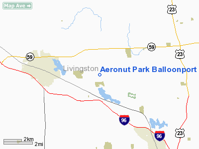
Location & QuickFacts
| FAA Information Effective: | 2008-09-25 |
| Airport Identifier: | 13M |
| Airport Status: | Operational |
| Longitude/Latitude: | 083-51-31.0000W/42-36-15.0000N
-83.858611/42.604167 (Estimated) |
| Elevation: | 980 ft / 298.70 m (Estimated) |
| Land: | 0 acres |
| From nearest city: | 4 nautical miles E of Howell, MI |
| Location: | Livingston County, MI |
| Magnetic Variation: | 06W (1995) |
Owner & Manager
| Ownership: | Privately owned |
| Owner: | James H Pratt |
| Address: | 285 N Hughes Rd
Howell, MI 48843 |
| Phone number: | 517-552-1236 |
| Manager: | James H Pratt |
| Address: | 285 N Hughes Rd
Howell, MI 48843 |
| Phone number: | 517-552-1236 |
Airport Operations and Facilities
| Airport Use: | Open to public |
| Wind indicator: | Yes |
| Segmented Circle: | No |
| Control Tower: | No |
| Sectional chart: | Detroit |
| Region: | AGL - Great Lakes |
| Boundary ARTCC: | ZOB - Cleveland |
| Tie-in FSS: | LAN - Lansing |
| FSS on Airport: | No |
| FSS Toll Free: | 1-800-WX-BRIEF |
| NOTAMs Facility: | LAN (NOTAM-d service avaliable) |
Airport Communications
Runway Information
Balloonport B1
| Dimension: | 900 x 250 ft / 274.3 x 76.2 m |
| Surface: | TURF, |
| |
Runway B1 |
Runway |
| Traffic Pattern: | Left | Left |
|
Radio Navigation Aids
| ID |
Type |
Name |
Ch |
Freq |
Var |
Dist |
| OZW | NDB | Howell | | 243.00 | 05W | 6.0 nm |
| TCU | NDB | Tecumseh | | 239.00 | 04W | 34.2 nm |
| G | NDB | Golf | | 398.00 | 05W | 42.0 nm |
| VQ | NDB | Cargl | | 230.00 | 05W | 42.8 nm |
| RYS | NDB | Grosse Ile | | 419.00 | 06W | 43.6 nm |
| ADG | NDB | Adrian | | 278.00 | 06W | 45.2 nm |
| QG | NDB | Windsor | | 353.00 | 06W | 47.3 nm |
| HYX | NDB | Browne | | 385.00 | 06W | 49.7 nm |
| MTC | TACAN | Selfridge | 064X | | 06W | 45.4 nm |
| DXO | VOR/DME | Detroit | 081X | 113.40 | 06W | 32.1 nm |
| JXN | VOR/DME | Jackson | 033X | 109.60 | 05W | 33.7 nm |
| PSI | VORTAC | Pontiac | 047X | 111.00 | 03W | 15.5 nm |
| SVM | VORTAC | Salem | 090X | 114.30 | 03W | 16.6 nm |
| FNT | VORTAC | Flint | 116X | 116.90 | 06W | 22.3 nm |
| LAN | VORTAC | Lansing | 045X | 110.80 | 05W | 37.7 nm |
| CRL | VORTAC | Carleton | 104X | 115.70 | 03W | 37.9 nm |
| YIP | VOT | Willow Run | | 112.00 | | 26.8 nm |
| DTW | VOT | Detroit Met Wayne | | 109.80 | | 31.5 nm |
| DET | VOT | Detroit City | | 111.60 | | 39.2 nm |
Remarks
- CONTACT OWNER AT 517-552-1236 WHEN USING FOR FIRST TIME.
- ACFT IN THE VCNTY USING RY 09/27 ADJACENT TO THE S AT MCKENZIE'S LANDING ARPT (1MI5).
- NO SNOW REMOVAL.
- SUPPORT VEHICLES BE ALERT WHEN DRIVING ON GRASS IN SPRING AND FALL WHEN WET DUE TO POSSIBLE SOFT AREAS.
Images and information placed above are from
http://www.airport-data.com/airport/13M/
We thank them for the data!
| General Info
|
| Country |
United States
|
| State |
MICHIGAN
|
| FAA ID |
13M
|
| Latitude |
42-36-15.000N
|
| Longitude |
083-51-31.000W
|
| Elevation |
980 feet
|
| Near City |
HOWELL
|
We don't guarantee the information is fresh and accurate. The data may
be wrong or outdated.
For more up-to-date information please refer to other sources.
|
|


