 |
|
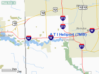
Location & QuickFacts
| FAA Information Effective: | 2008-09-25 |
| Airport Identifier: | 7MI9 |
| Airport Status: | Operational |
| Longitude/Latitude: | 083-28-35.7670W/42-13-15.1410N
-83.476602/42.220872 (Estimated) |
| Elevation: | 716 ft / 218.24 m (Estimated) |
| Land: | 32 acres |
| From nearest city: | 2 nautical miles N of Belleville, MI |
| Location: | Wayne County, MI |
| Magnetic Variation: | 05W (1985) |
Owner & Manager
| Ownership: | Privately owned |
| Owner: | Synthetex, Inc. |
| Address: | 15850 Wahman St
Romulus, MI 48174 |
| Phone number: | 313-941-4300 |
| Manager: | Ron Mondrush |
| Address: | 44700 N. I-94 Service Dr.
Belleville, MI 48105 |
| Phone number: | 313-699-9430 |
Airport Operations and Facilities
| Airport Use: | Private |
| Wind indicator: | Yes |
| Segmented Circle: | No |
| Control Tower: | No |
| Landing fee charge: | No |
| Sectional chart: | Detroit |
| Region: | AGL - Great Lakes |
| Boundary ARTCC: | ZOB - Cleveland |
| Tie-in FSS: | LAN - Lansing |
| FSS on Airport: | No |
| FSS Toll Free: | 1-800-WX-BRIEF |
Runway Information
Helipad H1
| Dimension: | 75 x 75 ft / 22.9 x 22.9 m |
| Surface: | ASPH, |
| |
Runway H1 |
Runway |
| Traffic Pattern: | Left | Left |
|
Radio Navigation Aids
| ID |
Type |
Name |
Ch |
Freq |
Var |
Dist |
| RYS | NDB | Grosse Ile | | 419.00 | 06W | 16.1 nm |
| G | NDB | Golf | | 398.00 | 05W | 19.2 nm |
| TCU | NDB | Tecumseh | | 239.00 | 04W | 21.2 nm |
| VQ | NDB | Cargl | | 230.00 | 05W | 24.6 nm |
| QG | NDB | Windsor | | 353.00 | 06W | 27.6 nm |
| OZW | NDB | Howell | | 243.00 | 05W | 33.6 nm |
| ADG | NDB | Adrian | | 278.00 | 06W | 34.1 nm |
| PT | NDB | Pelee Island | | 283.00 | 05W | 44.7 nm |
| USE | NDB | Fulton | | 375.00 | 05W | 47.0 nm |
| MTC | TACAN | Selfridge | 064X | | 06W | 37.1 nm |
| TOL | TACAN | Toledo | 072X | | 05W | 40.4 nm |
| DXO | VOR/DME | Detroit | 081X | 113.40 | 06W | 4.9 nm |
| YQG | VOR/DME | Windsor | 085X | 113.80 | 06W | 28.9 nm |
| JXN | VOR/DME | Jackson | 033X | 109.60 | 05W | 43.8 nm |
| VWV | VOR/DME | Waterville | 078X | 113.10 | 02W | 46.8 nm |
| CRL | VORTAC | Carleton | 104X | 115.70 | 03W | 10.4 nm |
| SVM | VORTAC | Salem | 090X | 114.30 | 03W | 12.5 nm |
| PSI | VORTAC | Pontiac | 047X | 111.00 | 03W | 29.0 nm |
| FNT | VORTAC | Flint | 116X | 116.90 | 06W | 46.4 nm |
| YIP | VOT | Willow Run | | 112.00 | | 2.2 nm |
| DTW | VOT | Detroit Met Wayne | | 109.80 | | 5.0 nm |
| DET | VOT | Detroit City | | 111.60 | | 23.3 nm |
Remarks
- ALL OPNS ARE CONDUCTED IN AN AREA FROM 350 DEGS CLOCKWISE TO 110 DEGS; AREA IS APPROPRIATELY MARKED; WIND INDICATOR IS MAINTAINED; LIGHT POLE 150' NORTH & 50' TREE 200' NE ARE REMOVED.
Images and information placed above are from
http://www.airport-data.com/airport/7MI9/
We thank them for the data!
| General Info
|
| Country |
United States
|
| State |
MICHIGAN
|
| FAA ID |
7MI9
|
| Latitude |
42-13-15.141N
|
| Longitude |
083-28-35.767W
|
| Elevation |
716 feet
|
| Near City |
BELLEVILLE
|
We don't guarantee the information is fresh and accurate. The data may
be wrong or outdated.
For more up-to-date information please refer to other sources.
|
|


