 |
|
Washington Executive / Hyde Field Airport |
Washington Executive Airport
Hyde Field |
| IATA: none – ICAO: none – FAA LID: W32 |
| Summary |
| Airport type |
Public |
| Operator |
Zachair, Ltd. |
| Location |
Clinton, Maryland |
| Elevation AMSL |
249 ft / 75.9 m |
| Coordinates |
38°44′54″N 76°55′58″W / 38.74833°N 76.93278°W / 38.74833; -76.93278Coordinates: 38°44′54″N 76°55′58″W / 38.74833°N 76.93278°W / 38.74833; -76.93278 |
| Runways |
| Direction |
Length |
Surface |
| ft |
m |
| 5/23 |
3,000 |
914 |
Asphalt |
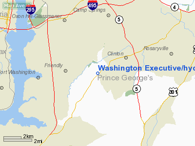
Washington Executive Airport (FAA LID: W32), also known as Hyde Field, is a public use airport located two miles (3.2 km) southwest of the central business district (CBD) of Clinton, in Prince Georges County, Maryland, USA. Recent news states that the airport is likely to close in 2011 as a direct result of reduced business due to the significant airspace restrictions imposed by the FAA after September 11, 2001.
Facilities
Washington Executive Airport/Hyde Field covers 140 acres (57 ha) and has one runway:
- Runway 5/23: 3,000 x 60 ft. (914 x 18 m), Surface: Asphalt
The above content comes from Wikipedia and is published under free licenses – click here to read more.
Location & QuickFacts
| FAA Information Effective: | 2008-09-25 |
| Airport Identifier: | W32 |
| Airport Status: | Operational |
| Longitude/Latitude: | 076-55-58.1410W/38-44-53.7410N
-76.932817/38.748261 (Estimated) |
| Elevation: | 249 ft / 75.90 m (Estimated) |
| Land: | 140 acres |
| From nearest city: | 2 nautical miles SW of Clinton, MD |
| Location: | Prince Georges County, MD |
| Magnetic Variation: | 11W (2005) |
Owner & Manager
| Ownership: | Privately owned |
| Owner: | Nabil J. Asterbadi |
| Address: | 2440 M Street, Nw, Suite 503
Washington, DC 20037 |
| Phone number: | 202-293-2444 |
| Manager: | Stan Fetter |
| Address: | 10399 Piscataway Rd
Clinton, MD 20735 |
| Phone number: | 301-297-7388 |
Airport Operations and Facilities
| Airport Use: | Open to public |
| Wind indicator: | Yes |
| Segmented Circle: | No |
| Control Tower: | No |
| Lighting Schedule: | DUSK-DAWN |
| Beacon Color: | Clear-Green (lighted land airport) |
| Landing fee charge: | No |
| Sectional chart: | Washington |
| Region: | AEA - Eastern |
| Traffic Pattern Alt: | 800 ft |
| Boundary ARTCC: | ZDC - Washington |
| Tie-in FSS: | DCA - Leesburg |
| FSS on Airport: | No |
| FSS Toll Free: | 1-800-WX-BRIEF |
| NOTAMs Facility: | DCA (NOTAM-d service avaliable) |
| Federal Agreements: | NGY |
Airport Communications
| CTAF: | 122.800 |
| Unicom: | 122.800
UNICOM UNMON. |
Airport Services
| Fuel available: | 100LLA
SELF SERVE CREDIT CARD FUELING AVBL 24 HRS. |
| Airframe Repair: | MAJOR |
| Power Plant Repair: | MAJOR |
| Bottled Oxygen: | NONE |
| Bulk Oxygen: | NONE |
Runway Information
Runway 05/23
| Dimension: | 3000 x 60 ft / 914.4 x 18.3 m |
| Surface: | ASPH, Fair Condition |
| Edge Lights: | Low |
| |
Runway 05 |
Runway 23 |
| Longitude: | 076-56-10.5540W | 076-55-45.7270W |
| Latitude: | 38-44-42.5460N | 38-45-04.9360N |
| Elevation: | 239.00 ft | 238.00 ft |
| Alignment: | 41 | 127 |
| Traffic Pattern: | Left | Left |
| Markings: | Non-precision instrument, Fair Condition | Basic, Fair Condition |
| Crossing Height: | 19.00 ft | 43.00 ft |
| VASI: | system of panels on left side that may or may not be lighted | system of panels on left side that may or may not be lighted |
| Visual Glide Angle: | 3.50° | 4.00° |
| Runway End Identifier: | Yes | |
| Obstruction: | 44 ft trees, 504.0 ft from runway, 250 ft right of centerline, 7:1 slope to clear
TREES/BRUSH +15 FT AND 100 FT FM RY END,180 FT L. | 19 ft road, 550.0 ft from runway, 18:1 slope to clear |
|
Radio Navigation Aids
| ID |
Type |
Name |
Ch |
Freq |
Var |
Dist |
| VKX | NDB | Potomac | | 241.00 | 10W | 1.1 nm |
| DC | NDB | Oxonn | | 332.00 | 11W | 4.5 nm |
| GTN | NDB | Georgetown | | 323.00 | 09W | 14.1 nm |
| BUH | NDB | Anne Arundel | | 260.00 | 10W | 21.7 nm |
| GAI | NDB | Gaithersburg | | 385.00 | 09W | 27.6 nm |
| FND | NDB | Ellicott | | 371.00 | 11W | 33.2 nm |
| IUB | NDB | Institute | | 404.00 | 08W | 35.4 nm |
| NHK | NDB | Patuxent | | 400.00 | 10W | 37.3 nm |
| EZF | NDB | Shannon | | 237.00 | 10W | 37.8 nm |
| ESN | NDB | Easton | | 212.00 | 10W | 40.6 nm |
| MTN | NDB | Martin | | 342.00 | 11W | 42.0 nm |
| APH | NDB | A P Hill | | 396.00 | 10W | 43.8 nm |
| GDX | NDB | Goodwin Lake | | 227.00 | 08W | 43.8 nm |
| CGE | NDB | Cambridge | | 355.00 | 10W | 44.1 nm |
| CJR | NDB | Culpeper | | 252.00 | 09W | 45.4 nm |
| MSQ | NDB | Nailr | | 351.00 | 10W | 49.0 nm |
| MTN | TACAN | Martin | 068X | | 11W | 42.7 nm |
| FDK | VOR | Frederick | | 109.00 | 08W | 44.9 nm |
| DCA | VOR/DME | Washington | 047X | 111.00 | 09W | 8.3 nm |
| ADW | VORTAC | Andrews | 078X | 113.10 | 10W | 4.7 nm |
| OTT | VORTAC | Nottingham | 084X | 113.70 | 10W | 9.2 nm |
| AML | VORTAC | Armel | 082X | 113.50 | 08W | 27.4 nm |
| BAL | VORTAC | Baltimore | 098X | 115.10 | 11W | 28.4 nm |
| BRV | VORTAC | Brooke | 092X | 114.50 | 09W | 31.7 nm |
| PXT | VORTAC | Patuxent | 123X | 117.60 | 10W | 37.3 nm |
| CSN | VORTAC | Casanova | 110X | 116.30 | 06W | 44.2 nm |
| EMI | VORTAC | Westminster | 126X | 117.90 | 08W | 44.9 nm |
| ADW | VOT | Andrews Afb | | 109.60 | | 3.4 nm |
| DCA | VOT | Washington National | | 109.40 | | 7.5 nm |
Remarks
- RY 05/23 HAS SOFT SHOULDERS - ACFT REMAIN ON HARD SFC.
- COMPLIANCE WITH SFAR 94 IS REQUIRED BEFORE PILOTS MAY OPERATE TO/FROM THIS AIRPORT.
- SOFT SHOULDERS ALL TWYS.
- NO PRACTICE TKOF/LDG 2200-0700 DLY.
- RIGHT TFC PAT FOR HELICOPTERS - 849 FT MSL PAT ALT.
- +70' POWERLINE 1300' FM AER 23.
- RY 05/23 - NO LINE OF SIGHT BETWEEN RY ENDS.
- BIRDS & WILDLIFE ON & INVOF ARPT.
- EXISTED PRIOR TO 1959.
Images and information placed above are from
http://www.airport-data.com/airport/W32/
We thank them for the data!
| General Info
|
| Country |
United States
|
| State |
MARYLAND
|
| FAA ID |
W32
|
| Latitude |
38-44-53.741N
|
| Longitude |
076-55-58.141W
|
| Elevation |
249 feet
|
| Near City |
CLINTON
|
We don't guarantee the information is fresh and accurate. The data may
be wrong or outdated.
For more up-to-date information please refer to other sources.
|
|


