 |
|
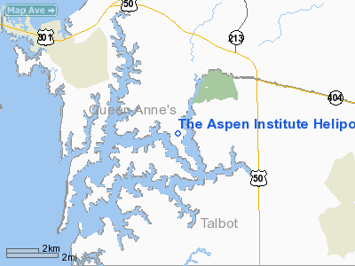
The Aspen Institute Heliport |
Location & QuickFacts
| FAA Information Effective: | 2008-09-25 |
| Airport Identifier: | 0MD7 |
| Airport Status: | Operational |
| Longitude/Latitude: | 076-07-10.8030W/38-54-33.4100N
-76.119668/38.909281 (Estimated) |
| Elevation: | 20 ft / 6.10 m (Estimated) |
| Land: | 4 acres |
| From nearest city: | 0 nautical miles N of Queenstown, MD |
| Location: | Queen Annes County, MD |
| Magnetic Variation: | 10W (1985) |
Owner & Manager
| Ownership: | Privately owned |
| Owner: | The Aspen Institute |
| Address: | Box 222
Queenstown, MD 21658 |
| Phone number: | 410-820-5341 |
| Manager: | John A. Covert |
| Address: | Box 222
Queenstown, MD 21658 |
| Phone number: | 410-827-3033 |
Airport Operations and Facilities
| Airport Use: | Private |
| Wind indicator: | Yes |
| Segmented Circle: | No |
| Control Tower: | No |
| Sectional chart: | Washington |
| Region: | AEA - Eastern |
| Boundary ARTCC: | ZDC - Washington |
| Tie-in FSS: | DCA - Leesburg |
| FSS on Airport: | No |
| FSS Toll Free: | 1-800-WX-BRIEF |
Runway Information
Helipad H1
| Dimension: | 100 x 100 ft / 30.5 x 30.5 m
CIRCULAR PAD. |
| Surface: | TURF, |
| |
Runway H1 |
Runway |
| Traffic Pattern: | Left | Left |
|
Radio Navigation Aids
| ID |
Type |
Name |
Ch |
Freq |
Var |
Dist |
| ESN | NDB | Easton | | 212.00 | 10W | 6.7 nm |
| CGE | NDB | Cambridge | | 355.00 | 10W | 22.7 nm |
| MTN | NDB | Martin | | 342.00 | 11W | 26.4 nm |
| BUH | NDB | Anne Arundel | | 260.00 | 10W | 31.7 nm |
| IUB | NDB | Institute | | 404.00 | 08W | 32.7 nm |
| APG | NDB | Aberdeen | | 349.00 | 11W | 37.6 nm |
| FND | NDB | Ellicott | | 371.00 | 11W | 38.2 nm |
| NHK | NDB | Patuxent | | 400.00 | 10W | 39.8 nm |
| VKX | NDB | Potomac | | 241.00 | 10W | 40.3 nm |
| DC | NDB | Oxonn | | 332.00 | 11W | 43.3 nm |
| GTN | NDB | Georgetown | | 323.00 | 09W | 47.0 nm |
| MTN | TACAN | Martin | 068X | | 11W | 28.8 nm |
| DOV | TACAN | Dover | 037X | | 09W | 33.3 nm |
| PPM | VOR/DME | Phillips | 021X | 108.40 | 09W | 33.6 nm |
| ATR | VOR/DME | Waterloo | 073X | 112.60 | 09W | 42.9 nm |
| DCA | VOR/DME | Washington | 047X | 111.00 | 09W | 43.0 nm |
| BAL | VORTAC | Baltimore | 098X | 115.10 | 11W | 29.8 nm |
| OTT | VORTAC | Nottingham | 084X | 113.70 | 10W | 31.7 nm |
| ENO | VORTAC | Smyrna | 051X | 111.40 | 09W | 34.2 nm |
| ADW | VORTAC | Andrews | 078X | 113.10 | 10W | 35.5 nm |
| PXT | VORTAC | Patuxent | 123X | 117.60 | 10W | 39.6 nm |
| SBY | VORTAC | Salisbury | 049X | 111.20 | 12W | 44.4 nm |
| ADW | VOT | Andrews Afb | | 109.60 | | 36.3 nm |
| DCA | VOT | Washington National | | 109.40 | | 42.9 nm |
Remarks
- PRVDD USED FOR VFR OPNS ONLY.
Images and information placed above are from
http://www.airport-data.com/airport/0MD7/
We thank them for the data!
| General Info
|
| Country |
United States
|
| State |
MARYLAND
|
| FAA ID |
0MD7
|
| Latitude |
38-54-33.410N
|
| Longitude |
076-07-10.803W
|
| Elevation |
20 feet
|
| Near City |
QUEENSTOWN
|
We don't guarantee the information is fresh and accurate. The data may
be wrong or outdated.
For more up-to-date information please refer to other sources.
|
|


