 |
|
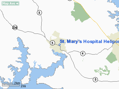
St. Mary's Hospital Heliport |
Location & QuickFacts
| FAA Information Effective: | 2008-09-25 |
| Airport Identifier: | 7MD5 |
| Airport Status: | Operational |
| Longitude/Latitude: | 076-38-13.8500W/38-18-00.4500N
-76.637181/38.300125 (Estimated) |
| Elevation: | 110 ft / 33.53 m (Estimated) |
| Land: | 0 acres |
| From nearest city: | 1 nautical miles NW of Leonardtown, MD |
| Location: | St Marys County, MD |
| Magnetic Variation: | 10W (1995) |
Owner & Manager
| Ownership: | Privately owned |
| Owner: | St. Mary's Hospital |
| Address: | 25500 Point Lookout Rd
Leonardtown, MD 20650 |
| Phone number: | 301-475-6012 |
| Manager: | Michael D. Kesting |
| Address: | 25500 Point Lookout Rd
Leonardtown, MD 20650 |
| Phone number: | 301-475-6012 |
Airport Operations and Facilities
| Airport Use: | Private
MEDICAL USE |
| Wind indicator: | Yes |
| Segmented Circle: | No |
| Control Tower: | No |
| Lighting Schedule: | PHONE REQ
FOR ROTG BCN; PERIMITER & FLOODLIGHTS CALL 301-475-6012. |
| Beacon Color: | Clear-Green-Yellow (heliport) |
| Sectional chart: | Washington |
| Region: | AEA - Eastern |
| Boundary ARTCC: | ZDC - Washington |
| Tie-in FSS: | DCA - Leesburg |
| FSS Toll Free: | 1-800-WX-BRIEF |
Runway Information
Helipad H1
| Dimension: | 45 x 45 ft / 13.7 x 13.7 m |
| Surface: | CONC, |
| |
Runway H1 |
Runway |
| Traffic Pattern: | Left | Left |
|
Radio Navigation Aids
| ID |
Type |
Name |
Ch |
Freq |
Var |
Dist |
| NHK | NDB | Patuxent | | 400.00 | 10W | 11.1 nm |
| VKX | NDB | Potomac | | 241.00 | 10W | 30.9 nm |
| CGE | NDB | Cambridge | | 355.00 | 10W | 31.9 nm |
| DC | NDB | Oxonn | | 332.00 | 11W | 33.5 nm |
| APH | NDB | A P Hill | | 396.00 | 10W | 34.9 nm |
| EZF | NDB | Shannon | | 237.00 | 10W | 38.4 nm |
| ESN | NDB | Easton | | 212.00 | 10W | 40.4 nm |
| GTN | NDB | Georgetown | | 323.00 | 09W | 44.2 nm |
| BUH | NDB | Anne Arundel | | 260.00 | 10W | 47.5 nm |
| DCA | VOR/DME | Washington | 047X | 111.00 | 09W | 38.5 nm |
| PXT | VORTAC | Patuxent | 123X | 117.60 | 10W | 11.2 nm |
| OTT | VORTAC | Nottingham | 084X | 113.70 | 10W | 24.9 nm |
| ADW | VORTAC | Andrews | 078X | 113.10 | 10W | 32.3 nm |
| BRV | VORTAC | Brooke | 092X | 114.50 | 09W | 33.8 nm |
| ADW | VOT | Andrews Afb | | 109.60 | | 31.5 nm |
| DCA | VOT | Washington National | | 109.40 | | 37.7 nm |
Remarks
- NO IFR OPNS; LIGHTED WINDSOCK; MAX WEIGHT 12500 LBS.
Images and information placed above are from
http://www.airport-data.com/airport/7MD5/
We thank them for the data!
| General Info
|
| Country |
United States
|
| State |
MARYLAND
|
| FAA ID |
7MD5
|
| Latitude |
38-18-00.450N
|
| Longitude |
076-38-13.850W
|
| Elevation |
110 feet
|
| Near City |
LEONARDTOWN
|
We don't guarantee the information is fresh and accurate. The data may
be wrong or outdated.
For more up-to-date information please refer to other sources.
|
|


