 |
|
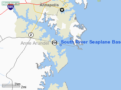
South River Seaplane Base |
Location & QuickFacts
| FAA Information Effective: | 2008-09-25 |
| Airport Identifier: | MD81 |
| Airport Status: | Operational |
| Longitude/Latitude: | 076-30-17.0000W/38-54-53.0000N
-76.504722/38.914722 (Estimated) |
| Elevation: | 0 ft / 0.00 m (Estimated) |
| Land: | 0 acres |
| From nearest city: | 4 nautical miles SE of Edgewater, MD |
| Location: | Anne Arundel County, MD |
| Magnetic Variation: | 10W (1990) |
Owner & Manager
| Ownership: | Privately owned |
| Owner: | Dimitri Sfakiyanudis |
| Address: | 45 Old Solomon's Island Road
Annapolis, MD 21401 |
| Phone number: | 410-266-5599 |
| Manager: | Dimitri Sfakiyanudis |
| Address: | 45 Old Solomon's Island Road
Annapolis, MD 21401 |
| Phone number: | 410-266-5599 |
Airport Operations and Facilities
| Airport Use: | Private |
| Wind indicator: | Yes |
| Segmented Circle: | No |
| Control Tower: | No |
| Sectional chart: | Washington |
| Region: | AEA - Eastern |
| Boundary ARTCC: | ZDC - Washington |
| Tie-in FSS: | DCA - Leesburg |
| FSS on Airport: | No |
| FSS Toll Free: | 1-800-WX-BRIEF |
Runway Information
Runway 16/34
| Dimension: | 5000 x 150 ft / 1524.0 x 45.7 m |
| Surface: | WATER, |
| |
Runway 16 |
Runway 34 |
| Traffic Pattern: | Left | Left |
|
Radio Navigation Aids
| ID |
Type |
Name |
Ch |
Freq |
Var |
Dist |
| BUH | NDB | Anne Arundel | | 260.00 | 10W | 15.7 nm |
| ESN | NDB | Easton | | 212.00 | 10W | 21.4 nm |
| IUB | NDB | Institute | | 404.00 | 08W | 23.1 nm |
| VKX | NDB | Potomac | | 241.00 | 10W | 23.4 nm |
| MTN | NDB | Martin | | 342.00 | 11W | 23.9 nm |
| FND | NDB | Ellicott | | 371.00 | 11W | 25.7 nm |
| DC | NDB | Oxonn | | 332.00 | 11W | 26.0 nm |
| GTN | NDB | Georgetown | | 323.00 | 09W | 29.0 nm |
| CGE | NDB | Cambridge | | 355.00 | 10W | 31.7 nm |
| GAI | NDB | Gaithersburg | | 385.00 | 09W | 34.5 nm |
| NHK | NDB | Patuxent | | 400.00 | 10W | 38.1 nm |
| APG | NDB | Aberdeen | | 349.00 | 11W | 41.6 nm |
| MTN | TACAN | Martin | 068X | | 11W | 25.4 nm |
| DCA | VOR/DME | Washington | 047X | 111.00 | 09W | 25.1 nm |
| PPM | VOR/DME | Phillips | 021X | 108.40 | 09W | 36.6 nm |
| OTT | VORTAC | Nottingham | 084X | 113.70 | 10W | 16.9 nm |
| BAL | VORTAC | Baltimore | 098X | 115.10 | 11W | 17.1 nm |
| ADW | VORTAC | Andrews | 078X | 113.10 | 10W | 18.1 nm |
| PXT | VORTAC | Patuxent | 123X | 117.60 | 10W | 38.0 nm |
| EMI | VORTAC | Westminster | 126X | 117.90 | 08W | 41.3 nm |
| AML | VORTAC | Armel | 082X | 113.50 | 08W | 45.0 nm |
| ENO | VORTAC | Smyrna | 051X | 111.40 | 09W | 49.9 nm |
| ADW | VOT | Andrews Afb | | 109.60 | | 19.1 nm |
| DCA | VOT | Washington National | | 109.40 | | 25.1 nm |
Remarks
- PRVDD SPB USED FOR DALGT OPNS, COORDINATE LDG AREA WITH AGENCIES WHO HAVE CONTROL OR JURISDICTION OVER THE WATERWAY, & OPERATE IN A MANNER TO MINIMIZE NOISE OVER RESIDENCES NEAR THIS FACILITY.
Images and information placed above are from
http://www.airport-data.com/airport/MD81/
We thank them for the data!
We don't guarantee the information is fresh and accurate. The data may
be wrong or outdated.
For more up-to-date information please refer to other sources.
|
|


