 |
|
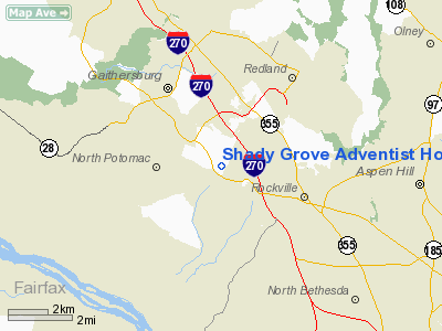
Shady Grove Adventist Hospital Heliport |
Location & QuickFacts
| FAA Information Effective: | 2008-09-25 |
| Airport Identifier: | 1MD7 |
| Airport Status: | Operational |
| Longitude/Latitude: | 077-11-48.9310W/39-05-53.3890N
-77.196925/39.098164 (Estimated) |
| Elevation: | 475 ft / 144.78 m (Estimated) |
| Land: | 1 acres |
| From nearest city: | 3 nautical miles NW of Rockville, MD |
| Location: | Montgomery County, MD |
| Magnetic Variation: | 09W (1985) |
Owner & Manager
| Ownership: | Privately owned |
| Owner: | Shady Grove Adventist Hosp |
| Address: | 9901 Medical Center Dr
Rockville, MD 20850 |
| Phone number: | 301-279-6532 |
| Manager: | Stephen St. Laurent |
| Address: | 9901 Medical Center Dr
Rockville, MD 20850 |
| Phone number: | 301-279-6671 |
Airport Operations and Facilities
| Airport Use: | Private
MEDICAL USE. |
| Wind indicator: | Yes |
| Segmented Circle: | No |
| Control Tower: | No |
| Landing fee charge: | No |
| Sectional chart: | Washington |
| Region: | AEA - Eastern |
| Boundary ARTCC: | ZDC - Washington |
| Tie-in FSS: | DCA - Leesburg |
| FSS on Airport: | No |
| FSS Toll Free: | 1-800-WX-BRIEF |
Runway Information
Helipad H1
| Dimension: | 35 x 35 ft / 10.7 x 10.7 m |
| Surface: | CONC, |
| Edge Lights: | High |
| |
Runway H1 |
Runway |
| Traffic Pattern: | Left | Left |
| Markings: | Basic, | , |
|
Radio Navigation Aids
| ID |
Type |
Name |
Ch |
Freq |
Var |
Dist |
| GAI | NDB | Gaithersburg | | 385.00 | 09W | 4.5 nm |
| GTN | NDB | Georgetown | | 323.00 | 09W | 10.7 nm |
| BUH | NDB | Anne Arundel | | 260.00 | 10W | 20.4 nm |
| DC | NDB | Oxonn | | 332.00 | 11W | 21.5 nm |
| FND | NDB | Ellicott | | 371.00 | 11W | 22.6 nm |
| VKX | NDB | Potomac | | 241.00 | 10W | 23.8 nm |
| IUB | NDB | Institute | | 404.00 | 08W | 29.0 nm |
| GDX | NDB | Goodwin Lake | | 227.00 | 08W | 30.9 nm |
| MTN | NDB | Martin | | 342.00 | 11W | 39.9 nm |
| TZ | NDB | Cogan | | 364.00 | 10W | 40.7 nm |
| CJR | NDB | Culpeper | | 252.00 | 09W | 46.1 nm |
| MTN | TACAN | Martin | 068X | | 11W | 39.2 nm |
| FDK | VOR | Frederick | | 109.00 | 08W | 20.6 nm |
| HGR | VOR | Hagerstown | | 109.80 | 07W | 47.3 nm |
| DCA | VOR/DME | Washington | 047X | 111.00 | 09W | 16.2 nm |
| AML | VORTAC | Armel | 082X | 113.50 | 08W | 16.0 nm |
| ADW | VORTAC | Andrews | 078X | 113.10 | 10W | 23.3 nm |
| BAL | VORTAC | Baltimore | 098X | 115.10 | 11W | 25.4 nm |
| EMI | VORTAC | Westminster | 126X | 117.90 | 08W | 25.9 nm |
| OTT | VORTAC | Nottingham | 084X | 113.70 | 10W | 31.7 nm |
| MRB | VORTAC | Martinsburg | 058X | 112.10 | 07W | 34.9 nm |
| CSN | VORTAC | Casanova | 110X | 116.30 | 06W | 41.6 nm |
| BRV | VORTAC | Brooke | 092X | 114.50 | 09W | 46.4 nm |
| LDN | VORTAC | Linden | 090X | 114.30 | 06W | 49.4 nm |
| DCA | VOT | Washington National | | 109.40 | | 17.0 nm |
| ADW | VOT | Andrews Afb | | 109.60 | | 23.8 nm |
Remarks
- PROVIDED HELIPORT IS LGTD IN ACCORD WITH AC 150/5390.1B; SECURITY GUARD AVAILABLE DURING ALL OPERATIONS; FIRE PROTECTION BE PROVIDED; WIND INDICATOR IS INSTALLED.
Images and information placed above are from
http://www.airport-data.com/airport/1MD7/
We thank them for the data!
| General Info
|
| Country |
United States
|
| State |
MARYLAND
|
| FAA ID |
1MD7
|
| Latitude |
39-05-53.389N
|
| Longitude |
077-11-48.931W
|
| Elevation |
475 feet
|
| Near City |
ROCKVILLE
|
We don't guarantee the information is fresh and accurate. The data may
be wrong or outdated.
For more up-to-date information please refer to other sources.
|
|


