 |
|
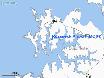
Location & QuickFacts
| FAA Information Effective: | 2008-09-25 |
| Airport Identifier: | MD04 |
| Airport Status: | Operational |
| Longitude/Latitude: | 076-14-09.0000W/38-34-08.0000N
-76.235833/38.568889 (Estimated) |
| Elevation: | 5 ft / 1.52 m (Estimated) |
| Land: | 22 acres |
| From nearest city: | 8 nautical miles W of Cambridge, MD |
| Location: | Dorchester County, MD |
| Magnetic Variation: | 10W (1990) |
Owner & Manager
| Ownership: | Privately owned |
| Owner: | Jonathan Titus |
| Address: | 5528 Rossneck Rd
Cambridge, MD 21613 |
| Phone number: | 410-228-8498 |
| Manager: | Jonathan Titus |
| Address: | 5528 Rossneck Rd
Cambridge, MD 21613 |
| Phone number: | 410-228-8498 |
Airport Operations and Facilities
| Airport Use: | Private |
| Wind indicator: | Yes |
| Segmented Circle: | No |
| Control Tower: | No |
| Sectional chart: | Washington |
| Region: | AEA - Eastern |
| Boundary ARTCC: | ZDC - Washington |
| Tie-in FSS: | DCA - Leesburg |
| FSS on Airport: | No |
| FSS Toll Free: | 1-800-WX-BRIEF |
Runway Information
Runway 09/27
| Dimension: | 1600 x 50 ft / 487.7 x 15.2 m |
| Surface: | TURF, |
| |
Runway 09 |
Runway 27 |
| Traffic Pattern: | Left | Left |
| Displaced threshold: | 480.00 ft | 0.00 ft |
| Obstruction: | 30 ft bldg, 50.0 ft from runway | |
|
Radio Navigation Aids
| ID |
Type |
Name |
Ch |
Freq |
Var |
Dist |
| CGE | NDB | Cambridge | | 355.00 | 10W | 9.8 nm |
| ESN | NDB | Easton | | 212.00 | 10W | 16.2 nm |
| NHK | NDB | Patuxent | | 400.00 | 10W | 18.7 nm |
| VKX | NDB | Potomac | | 241.00 | 10W | 35.5 nm |
| DC | NDB | Oxonn | | 332.00 | 11W | 39.0 nm |
| BUH | NDB | Anne Arundel | | 260.00 | 10W | 39.5 nm |
| MTN | NDB | Martin | | 342.00 | 11W | 44.4 nm |
| IUB | NDB | Institute | | 404.00 | 08W | 46.9 nm |
| GTN | NDB | Georgetown | | 323.00 | 09W | 47.0 nm |
| MTN | TACAN | Martin | 068X | | 11W | 46.5 nm |
| DOV | TACAN | Dover | 037X | | 09W | 49.4 nm |
| DCA | VOR/DME | Washington | 047X | 111.00 | 09W | 41.4 nm |
| PXT | VORTAC | Patuxent | 123X | 117.60 | 10W | 18.6 nm |
| OTT | VORTAC | Nottingham | 084X | 113.70 | 10W | 25.3 nm |
| ADW | VORTAC | Andrews | 078X | 113.10 | 10W | 32.9 nm |
| SBY | VORTAC | Salisbury | 049X | 111.20 | 12W | 36.7 nm |
| BAL | VORTAC | Baltimore | 098X | 115.10 | 11W | 41.3 nm |
| SWL | VORTAC | Snow Hill | 071X | 112.40 | 08W | 47.7 nm |
| ADW | VOT | Andrews Afb | | 109.60 | | 33.0 nm |
| DCA | VOT | Washington National | | 109.40 | | 40.9 nm |
Remarks
- PRVDD DAYLIGHT OPERATIONS ONLY & IFR OPERATIONS ARE NOT CONDUCTED.
Images and information placed above are from
http://www.airport-data.com/airport/MD04/
We thank them for the data!
| General Info
|
| Country |
United States
|
| State |
MARYLAND
|
| FAA ID |
MD04
|
| Latitude |
38-34-08.000N
|
| Longitude |
076-14-09.000W
|
| Elevation |
5 feet
|
| Near City |
CAMBRIDGE
|
We don't guarantee the information is fresh and accurate. The data may
be wrong or outdated.
For more up-to-date information please refer to other sources.
|
|


