 |
|
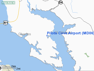
Location & QuickFacts
| FAA Information Effective: | 2008-09-25 |
| Airport Identifier: | MD06 |
| Airport Status: | Operational |
| Longitude/Latitude: | 076-52-42.8920W/38-20-07.4570N
-76.878581/38.335405 (Estimated) |
| Elevation: | 20 ft / 6.10 m (Estimated) |
| Land: | 0 acres |
| From nearest city: | 1 nautical miles NE of Tompkinsville, MD |
| Location: | Charles County, MD |
| Magnetic Variation: | 09W (1985) |
Owner & Manager
| Ownership: | Privately owned |
| Owner: | James R Puckett |
| Address: | Pilots Cove Farm
Mt. Victoria, MD 20661 |
| Phone number: | 301-870-2190 |
| Manager: | James R Puckett |
| Address: | Pilots Cove Farm
Mt. Victoria, MD 20661 |
| Phone number: | 301-870-2190 |
Airport Operations and Facilities
| Airport Use: | Private |
| Wind indicator: | No |
| Segmented Circle: | No |
| Control Tower: | No |
| Landing fee charge: | No |
| Sectional chart: | Washington |
| Region: | AEA - Eastern |
| Boundary ARTCC: | ZDC - Washington |
| Tie-in FSS: | DCA - Leesburg |
| FSS on Airport: | No |
| FSS Toll Free: | 1-800-WX-BRIEF |
Runway Information
Runway 12/30
| Dimension: | 1200 x 50 ft / 365.8 x 15.2 m |
| Surface: | TURF, |
| |
Runway 12 |
Runway 30 |
| Traffic Pattern: | Right | Left |
| Obstruction: | | 200 ft trees, 700.0 ft from runway |
|
Radio Navigation Aids
| ID |
Type |
Name |
Ch |
Freq |
Var |
Dist |
| NHK | NDB | Patuxent | | 400.00 | 10W | 22.6 nm |
| VKX | NDB | Potomac | | 241.00 | 10W | 25.1 nm |
| APH | NDB | A P Hill | | 396.00 | 10W | 25.8 nm |
| DC | NDB | Oxonn | | 332.00 | 11W | 26.8 nm |
| EZF | NDB | Shannon | | 237.00 | 10W | 27.3 nm |
| GTN | NDB | Georgetown | | 323.00 | 09W | 37.5 nm |
| CGE | NDB | Cambridge | | 355.00 | 10W | 41.7 nm |
| LJK | NDB | Ashey | | 280.00 | 09W | 44.2 nm |
| BUH | NDB | Anne Arundel | | 260.00 | 10W | 45.3 nm |
| ESN | NDB | Easton | | 212.00 | 10W | 47.4 nm |
| CJR | NDB | Culpeper | | 252.00 | 09W | 47.6 nm |
| MSQ | NDB | Nailr | | 351.00 | 10W | 48.9 nm |
| DCA | VOR/DME | Washington | 047X | 111.00 | 09W | 32.4 nm |
| BRV | VORTAC | Brooke | 092X | 114.50 | 09W | 22.4 nm |
| PXT | VORTAC | Patuxent | 123X | 117.60 | 10W | 22.7 nm |
| OTT | VORTAC | Nottingham | 084X | 113.70 | 10W | 23.1 nm |
| ADW | VORTAC | Andrews | 078X | 113.10 | 10W | 28.4 nm |
| AML | VORTAC | Armel | 082X | 113.50 | 08W | 45.4 nm |
| CSN | VORTAC | Casanova | 110X | 116.30 | 06W | 49.9 nm |
| ADW | VOT | Andrews Afb | | 109.60 | | 27.2 nm |
| DCA | VOT | Washington National | | 109.40 | | 31.5 nm |
Images and information placed above are from
http://www.airport-data.com/airport/MD06/
We thank them for the data!
| General Info
|
| Country |
United States
|
| State |
MARYLAND
|
| FAA ID |
MD06
|
| Latitude |
38-20-07.457N
|
| Longitude |
076-52-42.892W
|
| Elevation |
20 feet
|
| Near City |
TOMPKINSVILLE
|
We don't guarantee the information is fresh and accurate. The data may
be wrong or outdated.
For more up-to-date information please refer to other sources.
|
|


