 |
|
Ocean City Municipal Airport |
| Ocean City Municipal Airport |
| IATA: OCE – ICAO: KOXB – FAA LID: OXB |
| Summary |
| Airport type |
Public |
| Owner |
Town of Ocean City |
| Location |
Ocean City, Maryland |
| Elevation AMSL |
11 ft / 3 m |
| Coordinates |
38°18′38″N 075°07′26″W / 38.31056°N 75.12389°W / 38.31056; -75.12389 |
| Website |
www.ococean.com/airport.html |
| Runways |
| Direction |
Length |
Surface |
| ft |
m |
| 2/20 |
3,201 |
976 |
Asphalt/Concrete |
| 14/32 |
4,072 |
1,241 |
Asphalt/Concrete |
| Statistics (2006) |
| Aircraft operations |
37,000 |
| Based aircraft |
62 |
| Source: Federal Aviation Administration |
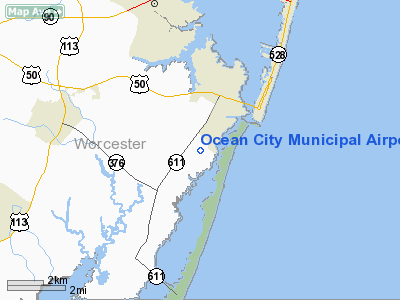
Ocean City Municipal Airport (IATA: OCE, ICAO: KOXB, FAA LID: OXB) Opened in October 1960. The airport is a public facility serving Ocean City, a town in Worcester County, Maryland, United States. It is located 3 statute miles (5 km) southwest of town, off Route 611 in West Ocean City.
Although most U.S. airports use the same three-letter location identifier for the FAA and IATA, Ocean City Municipal Airport is assigned OXB by the FAA and OCE by the IATA, (which assigned OXB to Osvaldo Vieira International Airport in Bissau, Guinea-Bissau).
Facilities and aircraft
Ocean City Municipal Airport covers an area of 578 acres (234 ha) which contains two asphalt and concrete paved runways: 2/20 measuring 3,201 x 75 ft (976 x 23 m) and 14/32 measuring 4,072 x 75 ft (1,241 x 23 m).
For the 12-month period ending 28 May 2009, the airport had an average of 101 operations per day: 78% Transientgeneral aviation, 20% Local general aviation, and 2% military. There are 44 aircraft based at this airport: 36 single engine, 5 multi-engine, 2 helicopters and 1 ultralight.
The above content comes from Wikipedia and is published under free licenses – click here to read more.
|
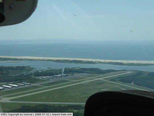 |
(Click on the photo to enlarge) |
|
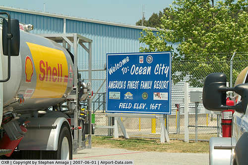 |
(Click on the photo to enlarge) |
Location & QuickFacts
| FAA Information Effective: | 2008-09-25 |
| Airport Identifier: | OXB |
| Airport Status: | Operational |
| Longitude/Latitude: | 075-07-26.3000W/38-18-37.6000N
-75.123972/38.310444 (Estimated) |
| Elevation: | 11 ft / 3.35 m (Surveyed) |
| Land: | 578 acres |
| From nearest city: | 2 nautical miles SW of Ocean City, MD |
| Location: | Worcester County, MD |
| Magnetic Variation: | 12W (2000) |
Owner & Manager
| Ownership: | Publicly owned |
| Owner: | Mayor & City Council |
| Address: | City Hall, Po Box 158
Ocean City, MD 21842 |
| Phone number: | 410-213-2471 |
| Manager: | George Goodrow |
| Address: | 12724 Airport Rd
Berlin, MD 21811 |
| Phone number: | 410-213-1980
EMERGENCY NUMBER 410-289-0927. |
Airport Operations and Facilities
| Airport Use: | Open to public |
| Wind indicator: | Yes |
| Segmented Circle: | Yes |
| Control Tower: | No |
| Lighting Schedule: | DUSK-DAWN
ACTVT MIRL RY 14/32 & RY 02/20 - CTAF. |
| Beacon Color: | Clear-Green (lighted land airport) |
| Landing fee charge: | No |
| Sectional chart: | Washington |
| Region: | AEA - Eastern |
| Boundary ARTCC: | ZDC - Washington |
| Tie-in FSS: | DCA - Leesburg |
| FSS on Airport: | No |
| FSS Toll Free: | 1-800-WX-BRIEF |
| NOTAMs Facility: | OXB (NOTAM-d service avaliable) |
| Federal Agreements: | NG |
Airport Communications
| CTAF: | 122.800 |
| Unicom: | 122.800 |
Airport Services
| Fuel available: | 100LLA |
| Airframe Repair: | MAJOR |
| Power Plant Repair: | MAJOR |
| Bottled Oxygen: | NONE |
| Bulk Oxygen: | NONE |
Runway Information
Runway 02/20
| Dimension: | 3201 x 75 ft / 975.7 x 22.9 m |
| Surface: | ASPH-CONC, Good Condition |
| Edge Lights: | Medium |
| |
Runway 02 |
Runway 20 |
| Longitude: | 075-07-39.8219W | 075-07-32.7508W |
| Latitude: | 38-18-23.2405N | 38-18-54.3843N |
| Elevation: | 9.00 ft | 11.00 ft |
| Alignment: | 10 | 127 |
| Traffic Pattern: | Left | Left |
| Markings: | Basic, Fair Condition | Basic, Fair Condition |
| Obstruction: | 13 ft trees, 381.0 ft from runway, 13:1 slope to clear | 48 ft trees, 1588.0 ft from runway, 195 ft left of centerline, 28:1 slope to clear |
|
Runway 14/32
| Dimension: | 4072 x 75 ft / 1241.1 x 22.9 m |
| Surface: | ASPH-CONC, Good Condition |
| Weight Limit: | Single wheel: 20000 lbs. |
| Edge Lights: | Medium |
| |
Runway 14 |
Runway 32 |
| Longitude: | 075-07-37.1452W | 075-06-59.8631W |
| Latitude: | 38-18-50.4258N | 38-18-22.9088N |
| Elevation: | 11.00 ft | 11.00 ft |
| Alignment: | 127 | 127 |
| ILS Type: | LOCALIZER
| |
| Traffic Pattern: | Left | Left |
| Markings: | Non-precision instrument, Fair Condition | Non-precision instrument, Fair Condition |
| Crossing Height: | 34.00 ft | 27.00 ft |
| VASI: | 4-box on left side | 4-box on left side |
| Visual Glide Angle: | 3.00° | 3.00° |
| Obstruction: | 59 ft trees, 1504.0 ft from runway, 105 ft left of centerline, 22:1 slope to clear | , 50:1 slope to clear |
|
Radio Navigation Aids
| ID |
Type |
Name |
Ch |
Freq |
Var |
Dist |
| OX | NDB | Landy | | 407.00 | 12W | 4.7 nm |
| CGE | NDB | Cambridge | | 355.00 | 10W | 44.9 nm |
| ATR | VOR/DME | Waterloo | 073X | 112.60 | 09W | 30.3 nm |
| SBY | VORTAC | Salisbury | 049X | 111.20 | 12W | 18.3 nm |
| SWL | VORTAC | Snow Hill | 071X | 112.40 | 08W | 22.2 nm |
| SIE | VORTAC | Sea Isle | 095X | 114.80 | 09W | 49.6 nm |
Remarks
- ULTRALGT OPNS ON AND INVOF ARPT.
- DEER & BIRDS ON & INVOF ARPT.
- TRUCKS AND VEHICLES CROSSING TWY, NORTH OF HOLD BLOCK RY 02.
Images and information placed above are from
http://www.airport-data.com/airport/OXB/
We thank them for the data!
| General Info
|
| Country |
United States
|
| State |
MARYLAND
|
| FAA ID |
OXB
|
| Latitude |
38-18-37.600N
|
| Longitude |
075-07-26.300W
|
| Elevation |
11 feet
|
| Near City |
OCEAN CITY
|
We don't guarantee the information is fresh and accurate. The data may
be wrong or outdated.
For more up-to-date information please refer to other sources.
|
|


