 |
|
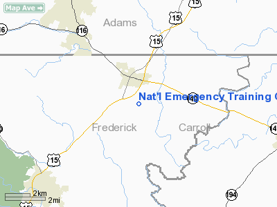
Nat'l Emergency Training Cntr Heliport |
Location & QuickFacts
| FAA Information Effective: | 2008-09-25 |
| Airport Identifier: | 7MD2 |
| Airport Status: | Operational |
| Longitude/Latitude: | 077-19-06.0000W/39-41-06.0000N
-77.318333/39.685000 (Estimated) |
| Elevation: | 416 ft / 126.80 m (Estimated) |
| Land: | 0 acres |
| From nearest city: | 1 nautical miles S of Emmitsburg, MD |
| Location: | Frederick County, MD |
| Magnetic Variation: | 10W (1995) |
Owner & Manager
| Ownership: | Publicly owned |
| Owner: | Fed Emerg Management Agency |
| Address: | 16825 S Seton Ave
Emmitsburg, MD 21727 |
| Phone number: | 301-447-1000 |
| Manager: | Ron Face |
| Address: | 16825 S Seton Ave
Emmitsburg, MD 21727 |
| Phone number: | 301-447-1027 |
Airport Operations and Facilities
| Airport Use: | Private |
| Wind indicator: | Yes |
| Segmented Circle: | No |
| Control Tower: | No |
| Lighting Schedule: | PHONE REQ
FOR PERIMETER LGTS CALL 301-447-1111 OR REQ ON 126.2. |
| Sectional chart: | Washington |
| Region: | AEA - Eastern |
| Boundary ARTCC: | ZNY - New York |
| Tie-in FSS: | DCA - Leesburg |
| FSS Toll Free: | 1-800-WX-BRIEF |
Runway Information
Helipad H1
| Dimension: | 60 x 60 ft / 18.3 x 18.3 m |
| Surface: | CONC, Good Condition |
| |
Runway H1 |
Runway |
| Traffic Pattern: | Left | Left |
|
Radio Navigation Aids
| ID |
Type |
Name |
Ch |
Freq |
Var |
Dist |
| EUD | NDB | York | | 254.00 | 11W | 24.8 nm |
| GAI | NDB | Gaithersburg | | 385.00 | 09W | 31.8 nm |
| FND | NDB | Ellicott | | 371.00 | 11W | 34.7 nm |
| IUB | NDB | Institute | | 404.00 | 08W | 40.1 nm |
| BUH | NDB | Anne Arundel | | 260.00 | 10W | 44.5 nm |
| GTN | NDB | Georgetown | | 323.00 | 09W | 46.3 nm |
| MTN | NDB | Martin | | 342.00 | 11W | 49.3 nm |
| GDX | NDB | Goodwin Lake | | 227.00 | 08W | 50.0 nm |
| MTN | TACAN | Martin | 068X | | 11W | 47.1 nm |
| FDK | VOR | Frederick | | 109.00 | 08W | 16.6 nm |
| HGR | VOR | Hagerstown | | 109.80 | 07W | 24.9 nm |
| EMI | VORTAC | Westminster | 126X | 117.90 | 08W | 19.4 nm |
| MRB | VORTAC | Martinsburg | 058X | 112.10 | 07W | 30.5 nm |
| THS | VORTAC | St Thomas | 097X | 115.00 | 07W | 32.8 nm |
| HAR | VORTAC | Harrisburg | 072X | 112.50 | 10W | 38.8 nm |
| BAL | VORTAC | Baltimore | 098X | 115.10 | 11W | 43.4 nm |
| AML | VORTAC | Armel | 082X | 113.50 | 08W | 45.6 nm |
| MDT | VOT | Harrisburg International | | 110.00 | | 40.0 nm |
Remarks
- VFR ONLY; MAINTAIN CLEAR 8:1 APCH; APPROPRIATE MARKINGS FOR INGRESS/EGRESS;MINIMIZE NOISE.
Images and information placed above are from
http://www.airport-data.com/airport/7MD2/
We thank them for the data!
| General Info
|
| Country |
United States
|
| State |
MARYLAND
|
| FAA ID |
7MD2
|
| Latitude |
39-41-06.000N
|
| Longitude |
077-19-06.000W
|
| Elevation |
416 feet
|
| Near City |
EMMITSBURG
|
We don't guarantee the information is fresh and accurate. The data may
be wrong or outdated.
For more up-to-date information please refer to other sources.
|
|


