 |
|
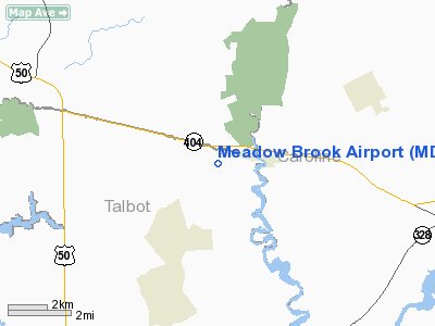
Location & QuickFacts
| FAA Information Effective: | 2008-09-25 |
| Airport Identifier: | MD09 |
| Airport Status: | Operational |
| Longitude/Latitude: | 075-58-15.7790W/38-54-55.4080N
-75.971050/38.915391 (Estimated) |
| Elevation: | 50 ft / 15.24 m (Estimated) |
| Land: | 3 acres |
| From nearest city: | 1 nautical miles W of Queen Anne, MD |
| Location: | Talbot County, MD |
| Magnetic Variation: | 11W (1990) |
Owner & Manager
| Ownership: | Privately owned |
| Owner: | Robert Wood |
| Address: | 31763 Old Queen Anne Rd
Queen Anne, MD 21657 |
| Phone number: | 410-758-1983 |
| Manager: | Jack C Wood |
| Address: | 105 Brown Street
Centreville, MD 21617 |
| Phone number: | 410-758-1983 |
Airport Operations and Facilities
| Airport Use: | Private |
| Segmented Circle: | No |
| Control Tower: | No |
| Sectional chart: | Washington |
| Region: | AEA - Eastern |
| Boundary ARTCC: | ZDC - Washington |
| Tie-in FSS: | DCA - Leesburg |
| FSS on Airport: | No |
| FSS Toll Free: | 1-800-WX-BRIEF |
Runway Information
Runway 18/36
| Dimension: | 2000 x 80 ft / 609.6 x 24.4 m |
| Surface: | TURF, |
| |
Runway 18 |
Runway 36 |
| Traffic Pattern: | Left | Left |
| Obstruction: | 20 ft trees, 250.0 ft from runway | |
|
Radio Navigation Aids
| ID |
Type |
Name |
Ch |
Freq |
Var |
Dist |
| ESN | NDB | Easton | | 212.00 | 10W | 8.1 nm |
| CGE | NDB | Cambridge | | 355.00 | 10W | 22.9 nm |
| MTN | NDB | Martin | | 342.00 | 11W | 30.0 nm |
| APG | NDB | Aberdeen | | 349.00 | 11W | 37.8 nm |
| IUB | NDB | Institute | | 404.00 | 08W | 37.8 nm |
| BUH | NDB | Anne Arundel | | 260.00 | 10W | 38.2 nm |
| NHK | NDB | Patuxent | | 400.00 | 10W | 42.9 nm |
| FND | NDB | Ellicott | | 371.00 | 11W | 43.7 nm |
| VKX | NDB | Potomac | | 241.00 | 10W | 47.2 nm |
| OX | NDB | Landy | | 407.00 | 12W | 49.2 nm |
| RNB | NDB | Rainbow | | 363.00 | 11W | 49.3 nm |
| DOV | TACAN | Dover | 037X | | 09W | 26.9 nm |
| MTN | TACAN | Martin | 068X | | 11W | 32.3 nm |
| PPM | VOR/DME | Phillips | 021X | 108.40 | 09W | 34.4 nm |
| ATR | VOR/DME | Waterloo | 073X | 112.60 | 09W | 36.1 nm |
| DCA | VOR/DME | Washington | 047X | 111.00 | 09W | 50.0 nm |
| ENO | VORTAC | Smyrna | 051X | 111.40 | 09W | 28.5 nm |
| BAL | VORTAC | Baltimore | 098X | 115.10 | 11W | 35.7 nm |
| OTT | VORTAC | Nottingham | 084X | 113.70 | 10W | 38.4 nm |
| SBY | VORTAC | Salisbury | 049X | 111.20 | 12W | 40.5 nm |
| ADW | VORTAC | Andrews | 078X | 113.10 | 10W | 42.4 nm |
| PXT | VORTAC | Patuxent | 123X | 117.60 | 10W | 42.8 nm |
| DQO | VORTAC | Dupont | 087X | 114.00 | 10W | 48.9 nm |
| ADW | VOT | Andrews Afb | | 109.60 | | 43.2 nm |
| DCA | VOT | Washington National | | 109.40 | | 49.9 nm |
Remarks
- (E111-1) THE ARPT OPERATOR/PILOTS USING ARPTS CONFER WITH OPERATORS AT CARMEAU & GARY ARPTS TO ASSURE FAMILIARITY WITH PATTERN EXTREMITIES & CHECKPOINTS USED BY EACH FACILITY. ACFT USING THE ARPT ARE LMTD TO SINGLE ENG WITH A MAX GWT OF 3500 LBS.
- PRVDD ARPT IS USED DURG DALGT ONLY & IFT OPNS ARE NOT CONDUCTED. THE PRIMARY & TSNL SFCS TO THE RY ARE NOT PENETRATED. TREES/STRUCTURES W OF RY & TREE E OF RY DO NOT PENETRATE THE PRIMARY/TSNL SFCS OF RY. RY 17 THR IS DSPLCD TO PROVIDE A 20:1 APCH SFC TO RY.
Images and information placed above are from
http://www.airport-data.com/airport/MD09/
We thank them for the data!
| General Info
|
| Country |
United States
|
| State |
MARYLAND
|
| FAA ID |
MD09
|
| Latitude |
38-54-55.408N
|
| Longitude |
075-58-15.779W
|
| Elevation |
50 feet
|
| Near City |
QUEEN ANNE
|
We don't guarantee the information is fresh and accurate. The data may
be wrong or outdated.
For more up-to-date information please refer to other sources.
|
|


