 |
|
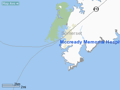
Mccready Memorial Hospital Heliport |
Location & QuickFacts
| FAA Information Effective: | 2008-09-25 |
| Airport Identifier: | MD52 |
| Airport Status: | Operational |
| Longitude/Latitude: | 075-51-58.7570W/37-58-00.0000N
-75.866321/37.966667 (Estimated) |
| Elevation: | 3 ft / 0.91 m (Estimated) |
| Land: | 0 acres |
| From nearest city: | 1 nautical miles SE of Crisfield, MD |
| Location: | Somerset County, MD |
| Magnetic Variation: | 10W (1990) |
Owner & Manager
| Ownership: | Privately owned |
| Owner: | Mccready Memorial Hospital |
| Address: | 201 Hall Highway
Crisfield, MD 21817 |
| Phone number: | 410-968-1200 |
| Manager: | Dean B. Massey D.d.s. |
| Address: | 201 Hall Highway
Crisfield, MD 21817 |
| Phone number: | 410-968-1200 |
Airport Operations and Facilities
| Airport Use: | Private
MEDICAL USE. |
| Segmented Circle: | No |
| Control Tower: | No |
| Lighting Schedule: | PHONE REQ
FOR PERIMETER LGTS CALL 410-968-1200. |
| Sectional chart: | Washington |
| Region: | AEA - Eastern |
| Boundary ARTCC: | ZDC - Washington |
| Tie-in FSS: | DCA - Leesburg |
| FSS Toll Free: | 1-800-WX-BRIEF |
Runway Information
Helipad H1
| Dimension: | 20 x 20 ft / 6.1 x 6.1 m |
| Surface: | CONC, |
| |
Runway H1 |
Runway |
| Traffic Pattern: | Left | Left |
|
Radio Navigation Aids
| ID |
Type |
Name |
Ch |
Freq |
Var |
Dist |
| BDB | NDB | Accomack | | 336.00 | 11W | 24.0 nm |
| NHK | NDB | Patuxent | | 400.00 | 10W | 31.8 nm |
| CGE | NDB | Cambridge | | 355.00 | 10W | 35.2 nm |
| OX | NDB | Landy | | 407.00 | 12W | 39.6 nm |
| SWL | VORTAC | Snow Hill | 071X | 112.40 | 08W | 19.8 nm |
| SBY | VORTAC | Salisbury | 049X | 111.20 | 12W | 28.3 nm |
| PXT | VORTAC | Patuxent | 123X | 117.60 | 10W | 31.8 nm |
| CCV | VORTAC | Cape Charles | 059X | 112.20 | 10W | 37.7 nm |
Remarks
- PRVDD INGRESS/EGRESS RTS TO N/S OR PARALLEL TO THE SHORELINE OF DOUGHERTY CREEK; L POLES OBST LGTS; FIRST L POLE ON THE BOAT DOCK BE LOWERED TO THE HEIGHT OF THE DOCK; PROVIDE FIRE PROTECTION; & HOSP PRVD SECURITY GUARD DURING OPS.
Images and information placed above are from
http://www.airport-data.com/airport/MD52/
We thank them for the data!
| General Info
|
| Country |
United States
|
| State |
MARYLAND
|
| FAA ID |
MD52
|
| Latitude |
37-58-00.000N
|
| Longitude |
075-51-58.757W
|
| Elevation |
3 feet
|
| Near City |
CRISFIELD
|
We don't guarantee the information is fresh and accurate. The data may
be wrong or outdated.
For more up-to-date information please refer to other sources.
|
|


