 |
|
|
 |
(Click on the photo to enlarge) |
Location & QuickFacts
| FAA Information Effective: | 2008-09-25 |
| Airport Identifier: | MD1 |
| Airport Status: | Operational |
| Longitude/Latitude: | 075-47-57.8000W/39-17-57.7000N
-75.799389/39.299361 (Estimated) |
| Elevation: | 73 ft / 22.25 m (Estimated) |
| Land: | 93 acres |
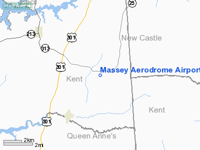
| From nearest city: | 2 nautical miles E of Massey, MD |
| Location: | Kent County, MD |
| Magnetic Variation: | 12W (2000) |
Owner & Manager
| Ownership: | Privately owned |
| Owner: | Massey Aero Llc |
| Address: | 33541 Maryland Line Rd
Massey, MD 21650 |
| Phone number: | 410-928-5270 |
| Manager: | Jim Douglas |
| Address: | 28560 Cove Point Rd
Kennedyville, MD 21645 |
| Phone number: | 410-928-5270 |
Airport Operations and Facilities
| Airport Use: | Open to public |
| Wind indicator: | Yes |
| Segmented Circle: | No |
| Control Tower: | No |
| Sectional chart: | Washington |
| Region: | AEA - Eastern |
| Boundary ARTCC: | ZDC - Washington |
| Tie-in FSS: | DCA - Leesburg |
| FSS Toll Free: | 1-800-WX-BRIEF |
| NOTAMs Facility: | DCA (NOTAM-d service avaliable) |
Airport Communications
Airport Services
Runway Information
Runway 02/20
| Dimension: | 3000 x 100 ft / 914.4 x 30.5 m |
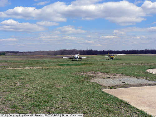
| Surface: | TURF, Good Condition |
| |
Runway 02 |
Runway 20 |
| Longitude: | 075-48-02.5400W | 075-47-53.0000W |
| Latitude: | 39-17-43.3100N | 39-18-12.0300N |
| Traffic Pattern: | Left | Left |
| Displaced threshold: | 0.00 ft | 400.00 ft |
| Obstruction: | , 50:1 slope to clear | 31 ft trees, 115.0 ft from runway, 3:1 slope to clear
APCH RATIO 20:1 TO DSPL THLD |
|
Radio Navigation Aids
| ID |
Type |
Name |
Ch |
Freq |
Var |
Dist |
| APG | NDB | Aberdeen | | 349.00 | 11W | 20.1 nm |
| MTN | NDB | Martin | | 342.00 | 11W | 27.0 nm |
| RNB | NDB | Rainbow | | 363.00 | 11W | 31.7 nm |
| ESN | NDB | Easton | | 212.00 | 10W | 32.3 nm |
| IUB | NDB | Institute | | 404.00 | 08W | 38.4 nm |
| FND | NDB | Ellicott | | 371.00 | 11W | 45.5 nm |
| BUH | NDB | Anne Arundel | | 260.00 | 10W | 46.6 nm |
| CGE | NDB | Cambridge | | 355.00 | 10W | 47.0 nm |
| DOV | TACAN | Dover | 037X | | 09W | 18.4 nm |
| MTN | TACAN | Martin | 068X | | 11W | 28.5 nm |
| PPM | VOR/DME | Phillips | 021X | 108.40 | 09W | 20.0 nm |
| ATR | VOR/DME | Waterloo | 073X | 112.60 | 09W | 40.2 nm |
| ENO | VORTAC | Smyrna | 051X | 111.40 | 09W | 13.8 nm |
| DQO | VORTAC | Dupont | 087X | 114.00 | 10W | 24.5 nm |
| OOD | VORTAC | Woodstown | 075X | 112.80 | 10W | 30.7 nm |
| MXE | VORTAC | Modena | 079X | 113.20 | 09W | 37.7 nm |
| BAL | VORTAC | Baltimore | 098X | 115.10 | 11W | 40.9 nm |
| VCN | VORTAC | Cedar Lake | 099X | 115.20 | 10W | 41.2 nm |
| SIE | VORTAC | Sea Isle | 095X | 114.80 | 09W | 48.1 nm |
| PHL | VOT | Philadelphia Intl | | 109.80 | | 42.9 nm |
Remarks
- GLIDERS,HANG-GLIDERS,POWERED PARACHUTES, ULTRALIGHT ACTIVITY, ON AND INVOF. AIRPORT
Images and information placed above are from
http://www.airport-data.com/airport/MD1/
We thank them for the data!
| General Info
|
| Country |
United States
|
| State |
MARYLAND
|
| FAA ID |
MD1
|
| Latitude |
39-18-02.000N
|
| Longitude |
075-47-57.000W
|
| Elevation |
64 feet
|
| Near City |
MASSEY
|
We don't guarantee the information is fresh and accurate. The data may
be wrong or outdated.
For more up-to-date information please refer to other sources.
|
|


