 |
|
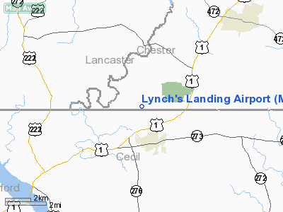
Location & QuickFacts
| FAA Information Effective: | 2008-09-25 |
| Airport Identifier: | MD61 |
| Airport Status: | Operational |
| Longitude/Latitude: | 076-04-13.8160W/39-43-28.3900N
-76.070504/39.724553 (Estimated) |
| Elevation: | 510 ft / 155.45 m (Estimated) |
| Land: | 0 acres |
| From nearest city: | 2 nautical miles N of Rising Sun, MD |
| Location: | Chester County, PA |
| Magnetic Variation: | 11W (1985) |
Owner & Manager
| Ownership: | Privately owned |
| Owner: | John M. Lynch, Jr. |
| Address: | 326 Red Pump Rd
Nottingham, PA 19362 |
| Phone number: | 215-932-3851 |
| Manager: | John M. Lynch, Jr. |
| Address: | 326 Red Pump Rd
Nottingham, PA 19362 |
| Phone number: | 215-932-3851 |
Airport Operations and Facilities
| Airport Use: | Private |
| Wind indicator: | Yes |
| Segmented Circle: | No |
| Control Tower: | No |
| Landing fee charge: | No |
| Sectional chart: | Washington |
| Region: | AEA - Eastern |
| Boundary ARTCC: | ZNY - New York |
| Responsible ARTCC: | ZDC - Washington |
| Tie-in FSS: | MIV - Millville |
| FSS on Airport: | No |
| FSS Toll Free: | 1-800-WX-BRIEF |
Runway Information
Runway 06/24
| Dimension: | 1200 x 100 ft / 365.8 x 30.5 m |
| Surface: | TURF, |
| |
Runway 06 |
Runway 24 |
| Traffic Pattern: | Left | Left |
| Obstruction: | | 30 ft pline, 200.0 ft from runway |
|
Radio Navigation Aids
| ID |
Type |
Name |
Ch |
Freq |
Var |
Dist |
| APG | NDB | Aberdeen | | 349.00 | 11W | 11.5 nm |
| MTN | NDB | Martin | | 342.00 | 11W | 29.3 nm |
| IUB | NDB | Institute | | 404.00 | 08W | 36.8 nm |
| EUD | NDB | York | | 254.00 | 11W | 39.1 nm |
| FND | NDB | Ellicott | | 371.00 | 11W | 42.0 nm |
| ING | NDB | Ambler | | 275.00 | 11W | 43.5 nm |
| RNB | NDB | Rainbow | | 363.00 | 11W | 47.1 nm |
| BZJ | NDB | Bellgrove | | 328.00 | 10W | 48.2 nm |
| MTN | TACAN | Martin | 068X | | 11W | 28.5 nm |
| DOV | TACAN | Dover | 037X | | 09W | 45.3 nm |
| PPM | VOR/DME | Phillips | 021X | 108.40 | 09W | 16.2 nm |
| DQO | VORTAC | Dupont | 087X | 114.00 | 10W | 21.6 nm |
| MXE | VORTAC | Modena | 079X | 113.20 | 09W | 21.8 nm |
| LRP | VORTAC | Lancaster | 120X | 117.30 | 09W | 25.9 nm |
| OOD | VORTAC | Woodstown | 075X | 112.80 | 10W | 35.9 nm |
| PTW | VORTAC | Pottstown | 112X | 116.50 | 09W | 38.0 nm |
| ENO | VORTAC | Smyrna | 051X | 111.40 | 09W | 39.2 nm |
| BAL | VORTAC | Baltimore | 098X | 115.10 | 11W | 43.1 nm |
| EMI | VORTAC | Westminster | 126X | 117.90 | 08W | 44.3 nm |
| PHL | VOT | Philadelphia Intl | | 109.80 | | 39.1 nm |
| MDT | VOT | Harrisburg International | | 110.00 | | 42.7 nm |
Remarks
- PROVIDED ONLY VFR OPERATIONS ARE CONDUCTED.
Images and information placed above are from
http://www.airport-data.com/airport/MD61/
We thank them for the data!
| General Info
|
| Country |
United States
|
| State |
MARYLAND
|
| FAA ID |
MD61
|
| Latitude |
39-43-28.390N
|
| Longitude |
076-04-13.816W
|
| Elevation |
510 feet
|
| Near City |
RISING SUN
|
We don't guarantee the information is fresh and accurate. The data may
be wrong or outdated.
For more up-to-date information please refer to other sources.
|
|


