 |
|
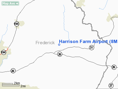
Location & QuickFacts
| FAA Information Effective: | 2008-09-25 |
| Airport Identifier: | 8MD5 |
| Airport Status: | Operational |
| Longitude/Latitude: | 077-13-18.0000W/39-29-54.0000N
-77.221667/39.498333 (Estimated) |
| Elevation: | 610 ft / 185.93 m (Estimated) |
| Land: | 136 acres |
| From nearest city: | 2 nautical miles NE of Libertytown, MD |
| Location: | Frederick County, MD |
| Magnetic Variation: | 10W (1995) |
Owner & Manager
| Ownership: | Privately owned |
| Owner: | Francis E Harrison |
| Address: | 9608 B Fountain School Rd
Union Bridge, MD 21791 |
| Phone number: | 301-829-0181 |
| Manager: | Francis E Harrison |
| Address: | 9608 B Fountain School Rd
Union Bridge, MD 21791 |
| Phone number: | 301-829-0181 |
Airport Operations and Facilities
| Airport Use: | Private |
| Wind indicator: | Yes |
| Segmented Circle: | Yes |
| Control Tower: | No |
| Sectional chart: | Washington |
| Region: | AEA - Eastern |
| Boundary ARTCC: | ZDC - Washington |
| Tie-in FSS: | DCA - Leesburg |
| FSS Toll Free: | 1-800-WX-BRIEF |
Airport Communications
Runway Information
Runway 01/19
| Dimension: | 2000 x 50 ft / 609.6 x 15.2 m |
| Surface: | TURF, |
| |
Runway 01 |
Runway 19 |
| Traffic Pattern: | Left | Right |
| Obstruction: | 30 ft pline, 363.0 ft from runway | |
|
Radio Navigation Aids
| ID |
Type |
Name |
Ch |
Freq |
Var |
Dist |
| GAI | NDB | Gaithersburg | | 385.00 | 09W | 19.9 nm |
| FND | NDB | Ellicott | | 371.00 | 11W | 24.2 nm |
| EUD | NDB | York | | 254.00 | 11W | 29.9 nm |
| IUB | NDB | Institute | | 404.00 | 08W | 30.5 nm |
| BUH | NDB | Anne Arundel | | 260.00 | 10W | 32.9 nm |
| GTN | NDB | Georgetown | | 323.00 | 09W | 34.5 nm |
| MTN | NDB | Martin | | 342.00 | 11W | 40.9 nm |
| GDX | NDB | Goodwin Lake | | 227.00 | 08W | 43.3 nm |
| DC | NDB | Oxonn | | 332.00 | 11W | 44.9 nm |
| TZ | NDB | Cogan | | 364.00 | 10W | 46.5 nm |
| VKX | NDB | Potomac | | 241.00 | 10W | 46.7 nm |
| MTN | TACAN | Martin | 068X | | 11W | 39.0 nm |
| FDK | VOR | Frederick | | 109.00 | 08W | 8.8 nm |
| HGR | VOR | Hagerstown | | 109.80 | 07W | 31.7 nm |
| DCA | VOR/DME | Washington | 047X | 111.00 | 09W | 39.4 nm |
| PPM | VOR/DME | Phillips | 021X | 108.40 | 09W | 48.8 nm |
| EMI | VORTAC | Westminster | 126X | 117.90 | 08W | 11.3 nm |
| MRB | VORTAC | Martinsburg | 058X | 112.10 | 07W | 29.9 nm |
| BAL | VORTAC | Baltimore | 098X | 115.10 | 11W | 32.6 nm |
| AML | VORTAC | Armel | 082X | 113.50 | 08W | 35.8 nm |
| THS | VORTAC | St Thomas | 097X | 115.00 | 07W | 42.7 nm |
| ADW | VORTAC | Andrews | 078X | 113.10 | 10W | 44.7 nm |
| HAR | VORTAC | Harrisburg | 072X | 112.50 | 10W | 48.8 nm |
| DCA | VOT | Washington National | | 109.40 | | 40.2 nm |
| ADW | VOT | Andrews Afb | | 109.60 | | 45.6 nm |
| MDT | VOT | Harrisburg International | | 110.00 | | 47.1 nm |
Remarks
- PRVDD VFR ONLY, CTC FDK MGR & BWI ATCT MGR PRIOR TO COMMENCING OPNS, CLEAR 20:1 APCH/DEP PATH FOR EACH RY, & PLINES TO SOUTH RECOMMENDED MKD.
Images and information placed above are from
http://www.airport-data.com/airport/8MD5/
We thank them for the data!
| General Info
|
| Country |
United States
|
| State |
MARYLAND
|
| FAA ID |
8MD5
|
| Latitude |
39-29-54.000N
|
| Longitude |
077-13-18.000W
|
| Elevation |
610 feet
|
| Near City |
LIBERTYTOWN
|
We don't guarantee the information is fresh and accurate. The data may
be wrong or outdated.
For more up-to-date information please refer to other sources.
|
|


