|
|
Hagerstown Rgnl - Richard A Henson Fld Airport |
Hagerstown Regional Airport
Richard A. Henson Field |
 |
 |
| IATA: HGR – ICAO: KHGR – FAA LID: HGR |
| Summary |
| Airport type |
Public |
| Owner/Operator |
Washington County |
| Serves |
Hagerstown, Maryland |
| Elevation AMSL |
703 ft / 214 m |
| Coordinates |
39°42′31″N 077°43′35″W / 39.70861°N 77.72639°W / 39.70861; -77.72639 |
| Website |
www.FlyHagerstown.com |
| Runways |
| Direction |
Length |
Surface |
| ft |
m |
| 9/27 |
7,000 |
2,134 |
Asphalt |
| 2/20 |
3,160 |
963 |
Asphalt |
| Statistics (2010) |
| Aircraft operations |
44,070 |
| Based aircraft |
150 |
| Source: Federal Aviation Administration |
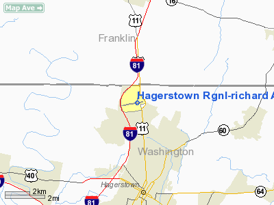
Hagerstown Regional Airport (IATA: HGR, ICAO: KHGR, FAA LID: HGR), also known as Richard A. Henson Field, is a county-owned public-use airport in Washington County, Maryland, United States. It is located four nautical miles (7 km) north of the central business district of Hagerstown, about a half mile from the Maryland/Pennsylvania border. The airport is in Western Maryland off of Interstate 81 and U.S. Route 11, not far from Northern Virginia, South Central Pennsylvania, and the Eastern Panhandle of West Virginia.
This airport is included in the FAA's National Plan of Integrated Airport Systems for 2009–2013, which categorized it as commercial service - non-primary. It is served by one commercial airline which is subsidized by the Essential Air Service program. History
The airfield opened in 1928 on 60 acres (24 ha) of farmland purchased by the Kreider-Reisner Aircraft Company. It was purchased by the City of Hagerstown in 1933.
The facility was named Washington County Regional Airport in 1981, when ownership was transferred from the City of Hagerstown to Washington County. In 1998, the county renamed it Hagerstown Regional Airport - Richard A. Henson Field.
US Airways Express served Hagerstown Regional for quite some time. The last discontinued destination from HGR was Pittsburgh International Airport. Due to low ridership and an expired federal subsidy, the airline cancelled service in September 2007. The airport was without an airline for a just over a year until the advent of Allegiant Air which ended its service in July 2010.
Allegiant Air flew from HGR to Orlando Sanford International Airport with two departures on Friday and two arrivals on Monday. The airline started commercial service on 14 November 2008. The airline used the McDonnell Douglas MD-82/MD-83 jet on this route. Scheduled service ended on July 19, 2010.
Facilities and aircraft
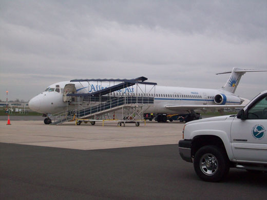 | |
Allegiant Air MD-83 at HGR |
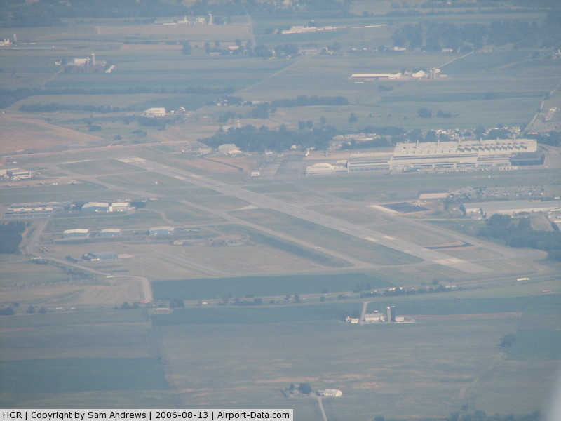
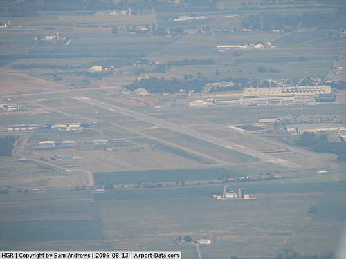
Hagerstown Regional Airport covers an area of 693 acres (280 ha) at an elevation of 703 feet (214 m) above mean sea level. It has two asphalt paved runways: 9/27 is 7,000 by 150 feet (2,134 x 46 m) and 2/20 is 3,160 by 100 feet (963 x 30 m).
For the 12-month period ending March 31, 2010, the airport had 44,070 aircraft operations, an average of 120 per day: 70% general aviation, 21% military, 6% scheduled commercial, and 3% air taxi, At that time there were 150 aircraft based at this airport: 76% single-engine, 17% multi-engine, 3% jet, 3% helicopter and 2% ultralight.
Airline and destination
 | |
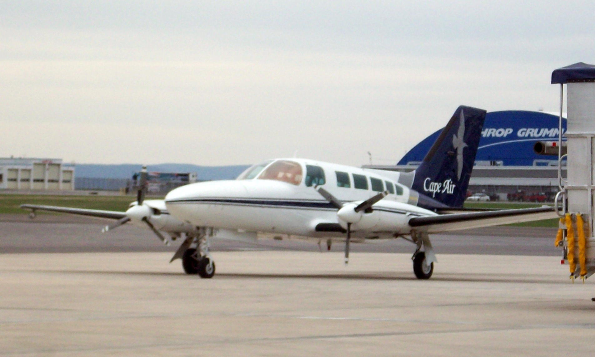
Cape Air Cessna 402 at HGR |
Cape Air serves Hagerstown Regional with four flights daily on Cessna 402 aircraft to Baltimore-Washington International Thurgood Marshall Airport. These flights are being subsidized by the Essential Air Service federal program.
| Airlines |
Destinations |
| Cape Air |
Baltimore |
Transportation
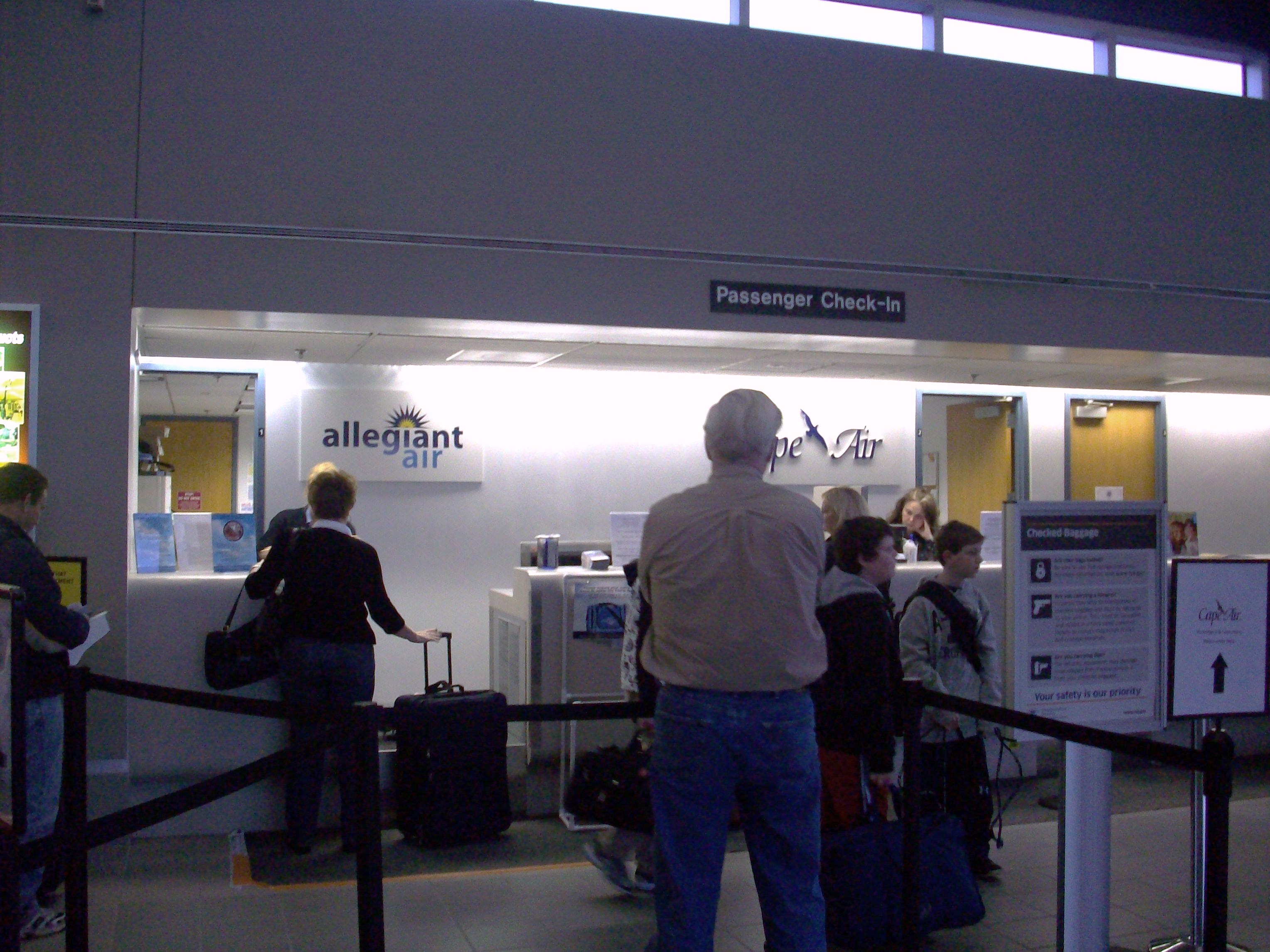
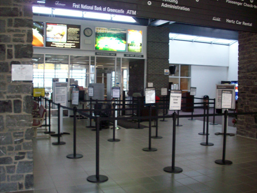
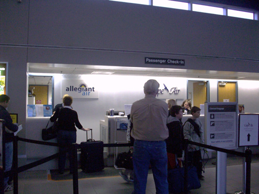 | |
Check-in counters |
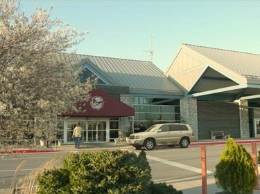
Hagerstown Regional Airport is 15 minutes by car from downtown Hagerstown, and it is located directly off of Interstate 81 and U.S. Route 11. Interstate 70 is 5 miles south of the airport and the airport is accessible via Interstate 81. Parking at the airport is free. Car rental service are available at the airport. Taxi service is available to and from the airport upon request. County Commuter buses make regular stops at the airport, and there are also buses to nearby hotels.
Incidents
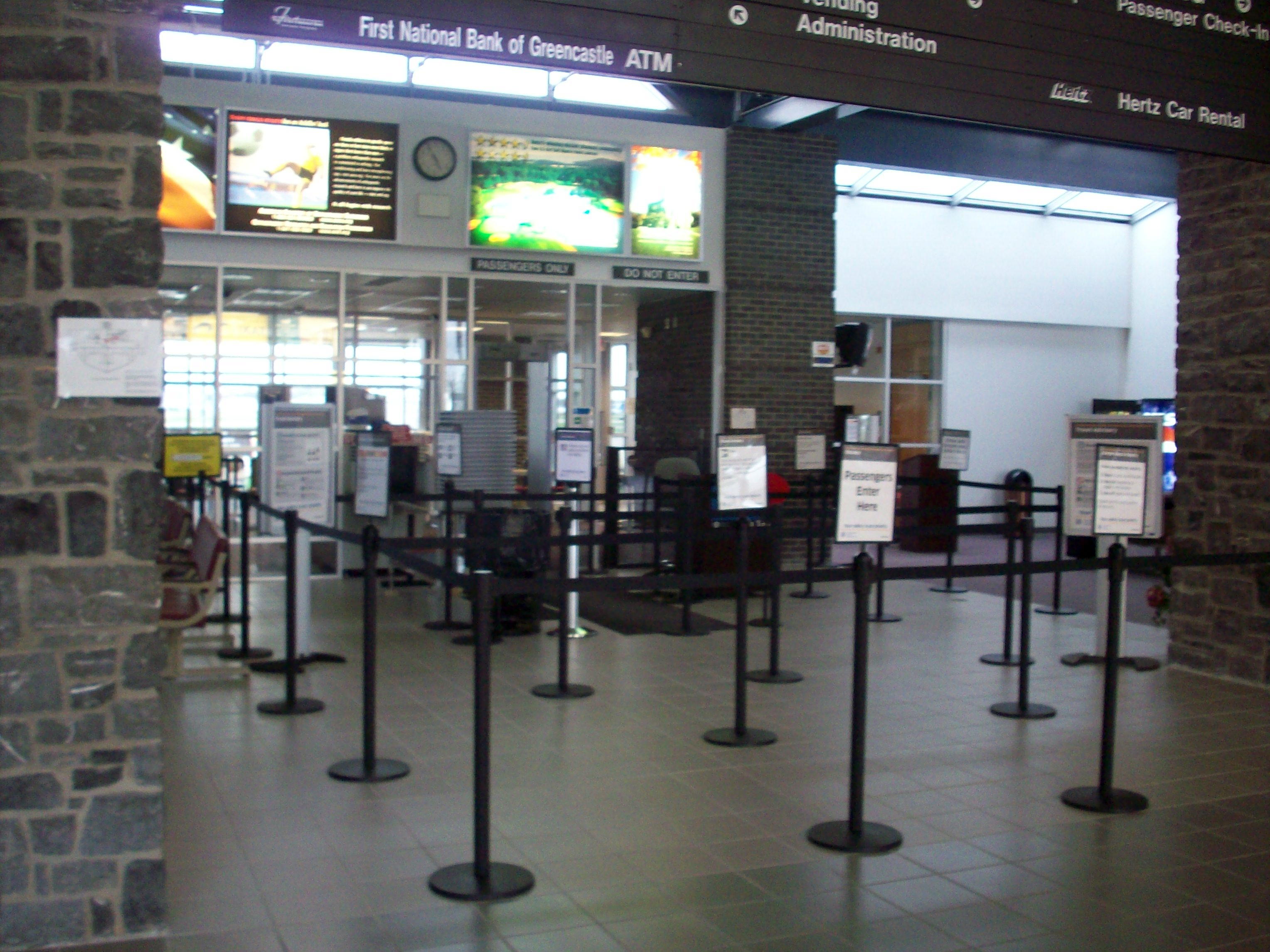
 | |
TSA security checkpoint |
On 19 February 2005, a Cessna 402 landed without the right wheel of the main landing gear. The pilot managed to burn most of the fuel off to prevent a fire. Most of the fuel is stored in the wings. The pilot was able to land on Runway 27 and all five people onboard deplaned within minutes. Nobody was hurt. Several fire departments around the Tri-State area responded to the incident.
On 23 July 2009, a Robinson R-44 helicopter crashed shortly after taking off from Hagerstown Regional Airport. The helicopter crashed onto Interstate 70 near South Mountain at 10:30 p.m. 4 people on board were killed and nobody on the ground was hurt. The NTSB is investigating the cause of the crash.
The above content comes from Wikipedia and is published under free licenses – click here to read more.
|
 |
(Click on the photo to enlarge) |
Location & QuickFacts
| FAA Information Effective: | 2008-09-25 |
| Airport Identifier: | HGR |
| Airport Status: | Operational |
| Longitude/Latitude: | 077-43-35.3560W/39-42-30.6010N
-77.726488/39.708500 (Estimated) |
| Elevation: | 704 ft / 214.58 m (Surveyed) |
| Land: | 693 acres |
| From nearest city: | 4 nautical miles N of Hagerstown, MD |
| Location: | Washington County, MD |
| Magnetic Variation: | 08W (1980) |
Owner & Manager
| Ownership: | Publicly owned |
| Owner: | Washington County |
| Address: | 100 West Washington St.
Hagerstown, MD 21740 |
| Phone number: | 240-313-2200 |
| Manager: | Carolyn Motz |
| Address: | 18434 Showalter Rd
Hagerstown, MD 21742 |
| Phone number: | 240-313-2777 |
Airport Operations and Facilities
| Airport Use: | Open to public |
| Wind indicator: | Yes |
| Segmented Circle: | No |
| Control Tower: | Yes |
| Lighting Schedule: | DUSK-DAWN
WHEN ATCT CLSD ACTVT MIRL RY 02/20, HIRL RY 09/27, MALSR RY 27, REIL RYS 02, 09, 20 & 27 - CTAF. HIRL RY 09/27 PRESET LOW INTST DUSK-DAWN. |
| Beacon Color: | Clear-Green (lighted land airport) |
| Landing fee charge: | Yes |
| Sectional chart: | Washington |
| Region: | AEA - Eastern |
| Boundary ARTCC: | ZDC - Washington |
| Tie-in FSS: | DCA - Leesburg |
| FSS on Airport: | No |
| FSS Toll Free: | 1-800-WX-BRIEF |
| NOTAMs Facility: | HGR (NOTAM-d service avaliable) |
| Certification type/date: | II A S 01/197
PPR 24 HRS FOR UNSKED ACR OPNS WITH MORE THAN 30 PSGR SEATS CALL AMGR 240-313-2777. |
| Federal Agreements: | NGHY3 |
Airport Communications
| CTAF: | 120.300 |
| Unicom: | 122.950 |
Airport Services
| Fuel available: | 100LLA A1
FUEL AVBL 0500-2200 CALL 301-791-9119. DOD CONTRACT FUEL AVBL. |
| Airframe Repair: | MAJOR |
| Power Plant Repair: | MAJOR |
| Bottled Oxygen: | HIGH/LOW |
| Bulk Oxygen: | HIGH/LOW |
Runway Information
Runway 02/20
| Dimension: | 3160 x 100 ft / 963.2 x 30.5 m |
| Surface: | ASPH, Good Condition |
| Weight Limit: | Single wheel: 80000 lbs.
Dual wheel: 100000 lbs.
Dual tandem wheel: 170000 lbs. |
| Edge Lights: | Medium |
| |
Runway 02 |
Runway 20 |
| Longitude: | 077-43-43.5750W | 077-43-33.2066W |
| Latitude: | 39-42-15.1360N | 39-42-45.3223N |
| Elevation: | 690.00 ft | 703.00 ft |
| Alignment: | 15 | 127 |
| Traffic Pattern: | Left | Left |
| Markings: | Basic, Good Condition | Basic, Good Condition |
| Crossing Height: | 51.00 ft | 33.00 ft |
| VASI: | 2-light PAPI on left side | 2-light PAPI on left side |
| Visual Glide Angle: | 4.00° | 4.00° |
| Runway End Identifier: | Yes | Yes |
| Obstruction: | 23 ft pole, 900.0 ft from runway, 250 ft left of centerline, 30:1 slope to clear | 45 ft bldg, 1100.0 ft from runway, 300 ft right of centerline, 20:1 slope to clear |
|
Runway 09/27
| Dimension: | 7000 x 150 ft / 2133.6 x 45.7 m |
| Surface: | ASPH, Good Condition |
| Surface Treatment: | Saw-cut or plastic Grooved |
| Weight Limit: | Single wheel: 100000 lbs.
Dual wheel: 150000 lbs.
Dual tandem wheel: 250000 lbs. |
| Edge Lights: | High |
| |
Runway 09 |
Runway 27 |
| Longitude: | 077-44-18.1540W | 077-42-49.8180W |
| Latitude: | 39-42-25.0640N | 39-42-36.4740N |
| Elevation: | 665.00 ft | 686.00 ft |
| Alignment: | 80 | 127 |
| ILS Type: | ILS/DME | ILS/DME
|
| Traffic Pattern: | Left | Left |
| Markings: | Precision instrument, Good Condition | Precision instrument, Good Condition |
| Crossing Height: | 55.00 ft | 55.00 ft |
| VASI: | 4-light PAPI on left side | 4-light PAPI on left side |
| Visual Glide Angle: | 3.00° | 3.00° |
| Approach lights: | | MALSR
MALSR RY 27 OTS INDEF. |
| Runway End Identifier: | Yes | Yes |
|
Radio Navigation Aids
| ID |
Type |
Name |
Ch |
Freq |
Var |
Dist |
| TZ | NDB | Cogan | | 364.00 | 10W | 40.6 nm |
| EUD | NDB | York | | 254.00 | 11W | 41.2 nm |
| GAI | NDB | Gaithersburg | | 385.00 | 09W | 41.5 nm |
| GDX | NDB | Goodwin Lake | | 227.00 | 08W | 45.6 nm |
| CBE | NDB | Cumberland | | 317.00 | 07W | 47.4 nm |
| HGR | VOR | Hagerstown | | 109.80 | 07W | 6.0 nm |
| FDK | VOR | Frederick | | 109.00 | 08W | 24.1 nm |
| AOO | VOR | Altoona | | 108.80 | 07W | 45.6 nm |
| THS | VORTAC | St Thomas | 097X | 115.00 | 07W | 17.0 nm |
| MRB | VORTAC | Martinsburg | 058X | 112.10 | 07W | 20.2 nm |
| EMI | VORTAC | Westminster | 126X | 117.90 | 08W | 36.9 nm |
| HAR | VORTAC | Harrisburg | 072X | 112.50 | 10W | 46.8 nm |
| AML | VORTAC | Armel | 082X | 113.50 | 08W | 48.1 nm |
Remarks
- BIRDS ON & INVOF ARPT.
- LOW LEVEL MILITARY ACFT 10 NM NORTH ON VR708 OPERATING EAST TO WEST.
- ULTRA-LGT ACTIVITY 12 NM EAST TO 5000 FT MSL.
- TXWYS JULIET, LIMA AND PAPA ARE NOT AVAILABLE FOR AIR CARRIER OPRS.
Images and information placed above are from
http://www.airport-data.com/airport/HGR/
We thank them for the data!
| General Info
|
| Country |
United States
|
| State |
MARYLAND
|
| FAA ID |
HGR
|
| Latitude |
39-42-28.600N
|
| Longitude |
077-43-46.200W
|
| Elevation |
703 feet
|
| Near City |
HAGERSTOWN
|
We don't guarantee the information is fresh and accurate. The data may
be wrong or outdated.
For more up-to-date information please refer to other sources.
|
|