 |
|
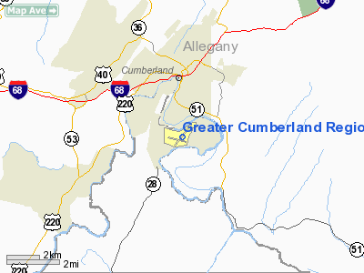
Greater Cumberland Regional Airport |
Coordinates: 39°36′56″N 078°45′39″W / 39.61556°N 78.76083°W / 39.61556; -78.76083
| Greater Cumberland Regional Airport |
 |
| IATA: CBE – ICAO: KCBE – FAA LID: CBE |
| Summary |
| Airport type |
Public |
| Operator |
Potomac Highlands Airport Authority |
| Serves |
Cumberland, Maryland |
| Location |
Wiley Ford, West Virginia |
| Elevation AMSL |
775 ft / 236 m |
| Website |
www.cumberlandairport.com |
| Runways |
| Direction |
Length |
Surface |
| ft |
m |
| 5/23 |
5,048 |
1,539 |
Asphalt |
| 11/29 |
2,442 |
744 |
Asphalt |
| Statistics (2006) |
| Aircraft operations |
14,300 |
| Based aircraft |
69 |
| Source: Federal Aviation Administration |
Greater Cumberland Regional Airport (IATA: CBE, ICAO: KCBE, FAA LID: CBE) is a public airport located in the town of Wiley Ford (population 1,095) in Mineral County, West Virginia. It is two miles (3 km) south of the larger city of Cumberland (population 21,518) in Allegany County, Maryland. Although the airport is located in the Potomac Highlands of West Virginia, the FAA lists this as a Maryland airport.
The airport has not had commercial service from a major airline since US Airways Express carrier Air Midwest left in September 2001.
Located on the second level of the airport terminal is the Cohongaronta Gallery (Cohongaronta being a Shawnee name for the Potomac River). It contains an array of historical displays pertaining to the history of the Potomac Highlands area. The centerpiece of the gallery is a 40% scaled replica of the Wright Brothers 1903 Wright Flyer that set the stage for aerial transportation. A 70-foot-long (21 m) time line highlights pertinent dates and events for the Potomac Highlands region. The gallery is open to the public during terminal business hours. Facilities and aircraft
Greater Cumberland Regional Airport covers an area of 314 acres (127 ha) which contains two asphalt paved runways: 5/23 measuring 5,048 x 150 ft (1,539 x 46 m) and 11/29 measuring 2,442 x 150 ft (744 x 46 m).
For the 12-month period ending August 2, 2006, the airport had 14,300 aircraft operations, an average of 39 per day: 98% general aviation and 2% military. There are 69 aircraft based at this airport: 81% single engine, 7% gliders, 6% multi-engine, 3% jet aircraft and 3% helicopters.
Racing
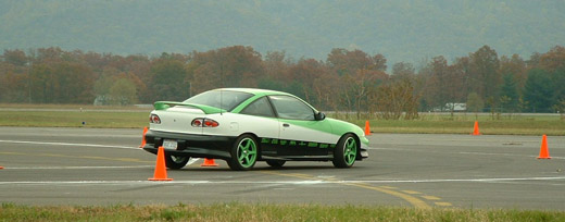 | |
Pumpkin Carve Autocross, 25 October 2003 |
The Cumberland Greater Regional Airport was used for a 1.6-mile (2.6 km) airport course run in Wiley Ford, West Virginia (just south of Cumberland, Maryland) in the 1950s and 1960s.
Currently National Road Autosport holds Autocross events at the airport on a monthly basis.
The above content comes from Wikipedia and is published under free licenses – click here to read more.
Location & QuickFacts
| FAA Information Effective: | 2008-09-25 |
| Airport Identifier: | CBE |
| Airport Status: | Operational |
| Longitude/Latitude: | 078-45-39.1090W/39-36-55.5000N
-78.760864/39.615417 (Estimated) |
| Elevation: | 775 ft / 236.22 m (Surveyed) |
| Land: | 314 acres |
| From nearest city: | 2 nautical miles S of Cumberland, MD |
| Location: | Mineral County, WV |
| Magnetic Variation: | 07W (1980) |
Owner & Manager
| Ownership: | Publicly owned |
| Owner: | Potomac Highland Arpt Auth |
| Address: | Route 1 Box 99
Wiley Ford, WV 26767 |
| Phone number: | 304-738-0002 |
| Manager: | Terry Malone |
| Address: | Route 1 Box 99
Wiley Ford, WV 26767 |
| Phone number: | 304-738-0002 |
Airport Operations and Facilities
| Airport Use: | Open to public |
| Wind indicator: | Yes |
| Segmented Circle: | Yes |
| Control Tower: | No |
| Lighting Schedule: | DUSK-DAWN
ACTVT MIRL RY 05/23; LIRL RY 11/29; REIL RY 23 & TWY LGTS - CTAF. |
| Beacon Color: | Clear-Green (lighted land airport)
ROTG BCN LOCATED OFF ARPT. |
| Landing fee charge: | No |
| Sectional chart: | Washington |
| Region: | AEA - Eastern |
| Traffic Pattern Alt: | 1024 ft |
| Boundary ARTCC: | ZOB - Cleveland |
| Tie-in FSS: | EKN - Elkins |
| FSS on Airport: | No |
| FSS Toll Free: | 1-800-WX-BRIEF |
| NOTAMs Facility: | EKN (NOTAM-d service avaliable) |
| Federal Agreements: | NGY3 |
Airport Communications
| CTAF: | 122.800 |
| Unicom: | 122.800 |
Airport Services
| Fuel available: | 100LLA |
| Airframe Repair: | MAJOR |
| Power Plant Repair: | MAJOR |
| Bottled Oxygen: | HIGH/LOW
BOTTLE OXYGEN AVBL FM 0630-1500 MON-FRI BY PRIOR ARRANGEMENT - CALL 304-738-0002 EXT 11. |
| Bulk Oxygen: | HIGH/LOW
BULK OXYGEN AVBL FM 0630-1500 MON-FRI BY PRIOR ARRANGEMENT - CALL 304-738-0002 EXT 11. |
Runway Information
Runway 05/23
| Dimension: | 5048 x 150 ft / 1538.6 x 45.7 m |
| Surface: | ASPH, Fair Condition |
| Surface Treatment: | Saw-cut or plastic Grooved |
| Weight Limit: | Single wheel: 38000 lbs.
Dual wheel: 52000 lbs. |
| Edge Lights: | Medium |
| |
Runway 05 |
Runway 23 |
| Longitude: | 078-45-53.1367W | 078-45-12.4885W |
| Latitude: | 39-36-39.8471N | 39-37-18.5792N |
| Elevation: | 722.00 ft | 775.00 ft |
| Alignment: | 39 | 127 |
| ILS Type: | | LOC/DME
|
| Traffic Pattern: | Right | Left |
| Markings: | Non-precision instrument, Fair Condition | Precision instrument, Fair Condition
ALL RWY MARKINGS FADED |
| Crossing Height: | 0.00 ft | 35.00 ft |
| VASI: | | 4-light PAPI on left side |
| Visual Glide Angle: | 0.00° | 3.00° |
| Runway End Identifier: | | Yes
RY 23 REIL OTS INDEFLY |
| Obstruction: | 210 ft tower, 2000.0 ft from runway, 250 ft left of centerline, 8:1 slope to clear | , 50:1 slope to clear |
|
Runway 11/29
| Dimension: | 2442 x 150 ft / 744.3 x 45.7 m |
| Surface: | ASPH, Fair Condition |
| Weight Limit: | Single wheel: 12000 lbs. |
| Edge Lights: | Low |
| |
Runway 11 |
Runway 29 |
| Longitude: | 078-46-07.5778W | 078-45-36.6115W |
| Latitude: | 39-36-49.3112N | 39-36-46.3831N |
| Elevation: | 722.00 ft | 727.00 ft |
| Alignment: | 97 | 127 |
| Traffic Pattern: | Left | Left |
| Markings: | Basic, Fair Condition | Basic, Fair Condition |
| Obstruction: | 764 ft hill, 4900.0 ft from runway, 6:1 slope to clear | , 50:1 slope to clear |
|
Radio Navigation Aids
| ID |
Type |
Name |
Ch |
Freq |
Var |
Dist |
| CBE | NDB | Cumberland | | 317.00 | 07W | 2.1 nm |
| SYS | NDB | Stoystown | | 209.00 | 08W | 29.2 nm |
| TZ | NDB | Cogan | | 364.00 | 10W | 45.2 nm |
| VV | NDB | Camor | | 299.00 | 08W | 48.2 nm |
| HGR | VOR | Hagerstown | | 109.80 | 07W | 42.2 nm |
| AOO | VOR | Altoona | | 108.80 | 07W | 47.6 nm |
| GRV | VOR/DME | Grantsville | 070X | 112.30 | 06W | 13.5 nm |
| ESL | VOR/DME | Kessel | 045X | 110.80 | 06W | 25.7 nm |
| IHD | VORTAC | Indian Head | 019X | 108.20 | 06W | 35.0 nm |
| THS | VORTAC | St Thomas | 097X | 115.00 | 07W | 42.0 nm |
| JST | VORTAC | Johnstown | 077X | 113.00 | 06W | 42.3 nm |
| MRB | VORTAC | Martinsburg | 058X | 112.10 | 07W | 44.5 nm |
Remarks
- RY 11 NGT OPNS & ANY LNDGS NOT RECOMMENDED DUE TO HIGH TERRAIN.
- GLIDER OPNS W OF ARPT USE RY 11 FOR DEP; RY 29 FOR ARR.
- DEER/BIRDS ON & INVOF ARPT.
- RY 23 900 FT TAXIWAY ALIGNED WITH RY WEST END.
- NUMEROUS AREAS ALONG RY 05/23 AND RY 11/29 WITH GRASS GROWTH FM PAVEMENT CRACKS.
- ESTAB PRIOR 1959
Images and information placed above are from
http://www.airport-data.com/airport/CBE/
We thank them for the data!
| General Info
|
| Country |
United States
|
| State |
MARYLAND
|
| FAA ID |
CBE
|
| Latitude |
39-36-55.500N
|
| Longitude |
078-45-39.109W
|
| Elevation |
775 feet
|
| Near City |
CUMBERLAND
|
We don't guarantee the information is fresh and accurate. The data may
be wrong or outdated.
For more up-to-date information please refer to other sources.
|
|


