 |
|
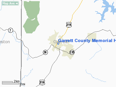
Garrett County Memorial Hospital Heliport |
Location & QuickFacts
| FAA Information Effective: | 2008-09-25 |
| Airport Identifier: | 3MD2 |
| Airport Status: | Operational |
| Longitude/Latitude: | 079-24-04.1600W/39-24-47.3470N
-79.401156/39.413152 (Estimated) |
| Elevation: | 2457 ft / 748.89 m (Estimated) |
| Land: | 0 acres |
| From nearest city: | 0 nautical miles NE of Oakland, MD |
| Location: | Garrett County, MD |
| Magnetic Variation: | 08W (1980) |
Owner & Manager
| Ownership: | Privately owned |
| Owner: | Garrett County Mem'l Hospital |
| Address: | 251 S. Fourth Street
Oakland, MD 21550 |
| Phone number: | 301-334-2155 |
| Manager: | Thomas G. Fowler |
| Address: | 251 S. Fourth Street
Oakland, MD 21550 |
| Phone number: | 301-334-2155 |
Airport Operations and Facilities
| Airport Use: | Private
MEDICAL USE. |
| Wind indicator: | Yes |
| Segmented Circle: | No |
| Control Tower: | No |
| Lighting Schedule: | PHONE REQ
FOR PERIMETER LGTS CALL 301-334-2155. |
| Landing fee charge: | No |
| Sectional chart: | Cincinnati |
| Region: | AEA - Eastern |
| Boundary ARTCC: | ZOB - Cleveland |
| Tie-in FSS: | EKN - Elkins |
| FSS Toll Free: | 1-800-WX-BRIEF |
Runway Information
Helipad H1
| Dimension: | 40 x 40 ft / 12.2 x 12.2 m |
| Surface: | ASPH, |
| |
Runway H1 |
Runway |
| Traffic Pattern: | Left | Left |
|
Radio Navigation Aids
| ID |
Type |
Name |
Ch |
Freq |
Var |
Dist |
| VV | NDB | Camor | | 299.00 | 08W | 32.4 nm |
| CBE | NDB | Cumberland | | 317.00 | 07W | 33.4 nm |
| RQY | NDB | Randolph County | | 284.00 | 07W | 37.8 nm |
| SYS | NDB | Stoystown | | 209.00 | 08W | 46.2 nm |
| GRV | VOR/DME | Grantsville | 070X | 112.30 | 06W | 21.0 nm |
| ESL | VOR/DME | Kessel | 045X | 110.80 | 06W | 22.2 nm |
| CKB | VOR/DME | Clarksburg | 073X | 112.60 | 04W | 41.4 nm |
| MGW | VORTAC | Morgantown | 053X | 111.60 | 05W | 23.0 nm |
| IHD | VORTAC | Indian Head | 019X | 108.20 | 06W | 33.8 nm |
| EKN | VORTAC | Elkins | 089X | 114.20 | 07W | 44.2 nm |
Remarks
- (E111-2) LOWERED OR LIGHTED; TREES BE LIGHTED; PARKING SPACE BE BLOCKED OFF; INADVERTANT ENTRY DURG OPERS BE PREVENTED; FIRE PROTECTION BE PROVIDED; WIND INDICATOR BE MAINTAINED; AREA LIGHTED FOR NGT OPERS.
- PROVIDED OPERS RESTRICTED TO/FROM N & S AS PAD IS MARKED; CORNERS OF HOSPITAL & POWERLINE BE OBSTRUCTION LIGHTED; FLAG POLE BE REMOVED,
Images and information placed above are from
http://www.airport-data.com/airport/3MD2/
We thank them for the data!
| General Info
|
| Country |
United States
|
| State |
MARYLAND
|
| FAA ID |
3MD2
|
| Latitude |
39-24-47.347N
|
| Longitude |
079-24-04.160W
|
| Elevation |
2457 feet
|
| Near City |
OAKLAND
|
|


