 |
|
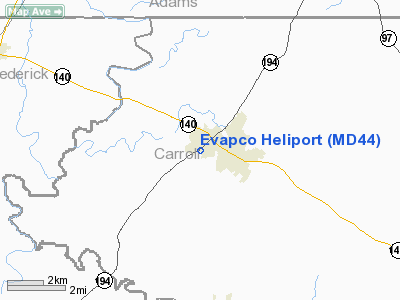
Location & QuickFacts
| FAA Information Effective: | 2008-09-25 |
| Airport Identifier: | MD44 |
| Airport Status: | Operational |
| Longitude/Latitude: | 077-11-00.9400W/39-39-13.3580N
-77.183594/39.653711 (Estimated) |
| Elevation: | 482 ft / 146.91 m (Estimated) |
| Land: | 2 acres |
| From nearest city: | 1 nautical miles SW of Taneytown, MD |
| Location: | Carroll County, MD |
| Magnetic Variation: | 10W (1985) |
Owner & Manager
| Ownership: | Privately owned |
| Owner: | Evapco, Inc |
| Address: | 5151 Allendale La
Taneytown, MD 21787 |
| Phone number: | 410-756-2600 |
| Manager: | William Corsini |
| Address: | 5151 Allendale La
Taneytown, MD 21787 |
| Phone number: | 410-756-2600 |
Airport Operations and Facilities
| Airport Use: | Private
PERSONAL USE ONLY. |
| Wind indicator: | Yes |
| Segmented Circle: | No |
| Control Tower: | No |
| Sectional chart: | Washington |
| Region: | AEA - Eastern |
| Boundary ARTCC: | ZNY - New York |
| Tie-in FSS: | DCA - Leesburg |
| FSS on Airport: | No |
| FSS Toll Free: | 1-800-WX-BRIEF |
Runway Information
Helipad H1
| Dimension: | 15 x 15 ft / 4.6 x 4.6 m |
| Surface: | ASPH-CONC, |
| |
Runway H1 |
Runway |
| Traffic Pattern: | Left | Left |
|
Radio Navigation Aids
| ID |
Type |
Name |
Ch |
Freq |
Var |
Dist |
| EUD | NDB | York | | 254.00 | 11W | 21.4 nm |
| FND | NDB | Ellicott | | 371.00 | 11W | 29.0 nm |
| GAI | NDB | Gaithersburg | | 385.00 | 09W | 29.1 nm |
| IUB | NDB | Institute | | 404.00 | 08W | 34.0 nm |
| BUH | NDB | Anne Arundel | | 260.00 | 10W | 39.5 nm |
| MTN | NDB | Martin | | 342.00 | 11W | 42.9 nm |
| GTN | NDB | Georgetown | | 323.00 | 09W | 43.6 nm |
| MTN | TACAN | Martin | 068X | | 11W | 40.7 nm |
| FDK | VOR | Frederick | | 109.00 | 08W | 17.0 nm |
| HGR | VOR | Hagerstown | | 109.80 | 07W | 31.2 nm |
| DCA | VOR/DME | Washington | 047X | 111.00 | 09W | 48.2 nm |
| PPM | VOR/DME | Phillips | 021X | 108.40 | 09W | 48.3 nm |
| EMI | VORTAC | Westminster | 126X | 117.90 | 08W | 13.5 nm |
| MRB | VORTAC | Martinsburg | 058X | 112.10 | 07W | 34.8 nm |
| BAL | VORTAC | Baltimore | 098X | 115.10 | 11W | 37.8 nm |
| THS | VORTAC | St Thomas | 097X | 115.00 | 07W | 39.2 nm |
| HAR | VORTAC | Harrisburg | 072X | 112.50 | 10W | 39.3 nm |
| AML | VORTAC | Armel | 082X | 113.50 | 08W | 45.2 nm |
| LRP | VORTAC | Lancaster | 120X | 117.30 | 09W | 49.8 nm |
| MDT | VOT | Harrisburg International | | 110.00 | | 38.0 nm |
| DCA | VOT | Washington National | | 109.40 | | 49.1 nm |
Remarks
- PRVDD USED IN VFR DALGT ONLY, AWARE THAT A TCA AIRSPACE SOUTH IS BEING PLANNED & SPECIAL EQUIP WILL BE REQUIRED; USE HEADINGS OF 280 DEGS & 180 DEGS FOR INGRESS/EGRESS; ENSURE SAFETY OF PEOPLE & CARS IN PARKING LOT NEXT TO HELIPORT; MAINTAIN A WIND INDICATOR.
Images and information placed above are from
http://www.airport-data.com/airport/MD44/
We thank them for the data!
| General Info
|
| Country |
United States
|
| State |
MARYLAND
|
| FAA ID |
MD44
|
| Latitude |
39-39-13.358N
|
| Longitude |
077-11-00.940W
|
| Elevation |
482 feet
|
| Near City |
TANEYTOWN
|
We don't guarantee the information is fresh and accurate. The data may
be wrong or outdated.
For more up-to-date information please refer to other sources.
|
|


