 |
|
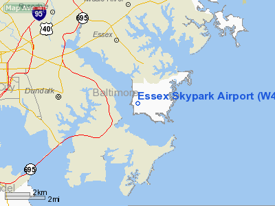
Location & QuickFacts
| FAA Information Effective: | 2008-09-25 |
| Airport Identifier: | W48 |
| Airport Status: | Operational |
| Longitude/Latitude: | 076-25-55.6000W/39-15-44.7000N
-76.432111/39.262417 (Estimated) |
| Elevation: | 15 ft / 4.57 m (Surveyed) |
| Land: | 45 acres |
| From nearest city: | 3 nautical miles SE of Baltimore, MD |
| Location: | Baltimore County, MD |
| Magnetic Variation: | 10W (1985) |
Owner & Manager
| Ownership: | Publicly owned |
| Owner: | Baltimore County |
| Address: | 400 Washingon Ave
Towson, MD 12104 |
| Phone number: | 410-887-4420 |
| Manager: | Ron Lane |
| Address: | 1401 Diffendall Road
Essex, MD 21221 |
| Phone number: | 410-282-8091 |
Airport Operations and Facilities
| Airport Use: | Open to public |
| Wind indicator: | Yes |
| Segmented Circle: | No |
| Control Tower: | No |
| Lighting Schedule: | DUSK-DAWN
ACTVT LIRL RY 16/34 - CTAF. |
| Beacon Color: | Clear-Green (lighted land airport)
ROTG BCN OTS INDEFLY. |
| Landing fee charge: | No |
| Sectional chart: | Washington |
| Region: | AEA - Eastern |
| Boundary ARTCC: | ZDC - Washington |
| Tie-in FSS: | DCA - Leesburg |
| FSS on Airport: | No |
| FSS Toll Free: | 1-800-WX-BRIEF |
| NOTAMs Facility: | DCA (NOTAM-d service avaliable) |
Airport Communications
| CTAF: | 122.700 |
| Unicom: | 122.700 |
Airport Services
| Airframe Repair: | NONE |
| Power Plant Repair: | MINOR |
| Bottled Oxygen: | NONE |
| Bulk Oxygen: | NONE |
Runway Information
Runway 16/34
| Dimension: | 2084 x 30 ft / 635.2 x 9.1 m |
| Surface: | ASPH, |
| Edge Lights: | Low |
| |
Runway 16 |
Runway 34 |
| Longitude: | 076-26-02.8500W | 076-25-48.3600W |
| Latitude: | 39-15-53.3400N | 39-15-36.0900N |
| Traffic Pattern: | Left | Left |
| Markings: | Basic, Good Condition | Basic, Good Condition |
| Crossing Height: | 19.00 ft | 20.00 ft |
| VASI: | system of panels on left side that may or may not be lighted | system of panels on right side that may or may not be lighted |
| Visual Glide Angle: | 4.50° | 4.50° |
| Obstruction: | 25 ft tree, 210.0 ft from runway, 125 ft right of centerline | 15 ft road, 200.0 ft from runway |
|
Runway 16W/34W
| Dimension: | 3000 x 300 ft / 914.4 x 91.4 m |
| Surface: | WATER, |
| |
Runway 16W |
Runway 34W |
| Traffic Pattern: | Left | Left |
|
Radio Navigation Aids
| ID |
Type |
Name |
Ch |
Freq |
Var |
Dist |
| MTN | NDB | Martin | | 342.00 | 11W | 3.3 nm |
| IUB | NDB | Institute | | 404.00 | 08W | 9.1 nm |
| FND | NDB | Ellicott | | 371.00 | 11W | 16.1 nm |
| BUH | NDB | Anne Arundel | | 260.00 | 10W | 18.7 nm |
| APG | NDB | Aberdeen | | 349.00 | 11W | 22.3 nm |
| ESN | NDB | Easton | | 212.00 | 10W | 32.3 nm |
| GAI | NDB | Gaithersburg | | 385.00 | 09W | 34.6 nm |
| GTN | NDB | Georgetown | | 323.00 | 09W | 38.0 nm |
| VKX | NDB | Potomac | | 241.00 | 10W | 39.4 nm |
| DC | NDB | Oxonn | | 332.00 | 11W | 40.8 nm |
| EUD | NDB | York | | 254.00 | 11W | 44.6 nm |
| CGE | NDB | Cambridge | | 355.00 | 10W | 47.4 nm |
| MTN | TACAN | Martin | 068X | | 11W | 4.2 nm |
| DOV | TACAN | Dover | 037X | | 09W | 45.6 nm |
| FDK | VOR | Frederick | | 109.00 | 08W | 44.8 nm |
| PPM | VOR/DME | Phillips | 021X | 108.40 | 09W | 17.3 nm |
| DCA | VOR/DME | Washington | 047X | 111.00 | 09W | 37.2 nm |
| BAL | VORTAC | Baltimore | 098X | 115.10 | 11W | 12.0 nm |
| EMI | VORTAC | Westminster | 126X | 117.90 | 08W | 29.0 nm |
| ADW | VORTAC | Andrews | 078X | 113.10 | 10W | 34.1 nm |
| OTT | VORTAC | Nottingham | 084X | 113.70 | 10W | 36.5 nm |
| ENO | VORTAC | Smyrna | 051X | 111.40 | 09W | 42.7 nm |
| DQO | VORTAC | Dupont | 087X | 114.00 | 10W | 45.7 nm |
| ADW | VOT | Andrews Afb | | 109.60 | | 35.4 nm |
| DCA | VOT | Washington National | | 109.40 | | 37.6 nm |
Remarks
- NO TOUCH AND GO LANDINGS.
- ARPT EXISTED PRIOR TO 1959; SPB AIRSPACING NO OBJECTION.
Images and information placed above are from
http://www.airport-data.com/airport/W48/
We thank them for the data!
| General Info
|
| Country |
United States
|
| State |
MARYLAND
|
| FAA ID |
W48
|
| Latitude |
39-15-45.388N
|
| Longitude |
076-25-58.856W
|
| Elevation |
15 feet
|
| Near City |
BALTIMORE
|
We don't guarantee the information is fresh and accurate. The data may
be wrong or outdated.
For more up-to-date information please refer to other sources.
|
|


