 |
|
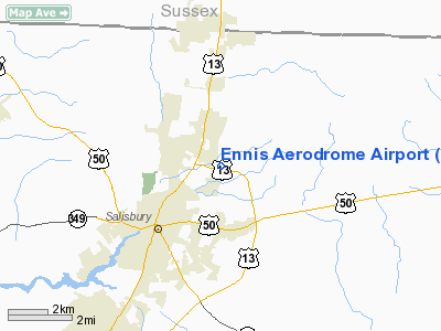
Location & QuickFacts
| FAA Information Effective: | 2008-09-25 |
| Airport Identifier: | 2MD4 |
| Airport Status: | Operational |
| Longitude/Latitude: | 075-33-26.7240W/38-23-40.4210N
-75.557423/38.394561 (Estimated) |
| Elevation: | 44 ft / 13.41 m (Surveyed) |
| Land: | 50 acres |
| From nearest city: | 2 nautical miles NE of Salisbury, MD |
| Location: | Wicomico County, MD |
| Magnetic Variation: | 11W (1990) |
Owner & Manager
| Ownership: | Privately owned |
| Owner: | Paul A. Ennis |
| Address: | 800 Parker Rd
Salisbury, MD 21801 |
| Phone number: | 410-742-5332 |
| Manager: | Paul A. Ennis |
| Address: | 800 Parker Rd
Salisbury, MD 21801 |
| Phone number: | 410-742-1566
EXT 25. |
Airport Operations and Facilities
| Airport Use: | Private |
| Wind indicator: | Yes |
| Segmented Circle: | No |
| Control Tower: | No |
| Sectional chart: | Washington |
| Region: | AEA - Eastern |
| Boundary ARTCC: | ZDC - Washington |
| Tie-in FSS: | DCA - Leesburg |
| FSS on Airport: | No |
| FSS Toll Free: | 1-800-WX-BRIEF |
Runway Information
Runway 08/26
| Dimension: | 2100 x 100 ft / 640.1 x 30.5 m |
| Surface: | TURF, |
| |
Runway 08 |
Runway 26 |
| Traffic Pattern: | Right | Left |
| Obstruction: | | 50 ft trees, 0.0 ft from runway |
|
Radio Navigation Aids
| ID |
Type |
Name |
Ch |
Freq |
Var |
Dist |
| OX | NDB | Landy | | 407.00 | 12W | 17.1 nm |
| CGE | NDB | Cambridge | | 355.00 | 10W | 23.9 nm |
| ESN | NDB | Easton | | 212.00 | 10W | 34.4 nm |
| NHK | NDB | Patuxent | | 400.00 | 10W | 40.4 nm |
| DOV | TACAN | Dover | 037X | | 09W | 44.5 nm |
| ATR | VOR/DME | Waterloo | 073X | 112.60 | 09W | 29.8 nm |
| SBY | VORTAC | Salisbury | 049X | 111.20 | 12W | 3.7 nm |
| SWL | VORTAC | Snow Hill | 071X | 112.40 | 08W | 20.8 nm |
| PXT | VORTAC | Patuxent | 123X | 117.60 | 10W | 40.2 nm |
Remarks
- (E111-1) A DSPLCD THR OF 500 FT TO AVOID THE 50 FT TREES AT END OF RY; APCH SHOULD BE 20:1; REMOVEL OR RELOCATION OF TREES & A HANGAR AT THE END OF RY 08 TO PROVIDE A 7:1 TRANSITIONAL SLOPE.
- DALGT USE ONLY; OPS TO & FM ARPT BE CONDUCTED TO MINIMIZE NOISE OVR ADJ COMMUNITIES; COORDINATE TFC & VISUAL CHK POINTS W/MGMT OF BENNETT & SALISBURY APRTS; CTC ATREP 301-797-2039 FOR BRIEFING ON SPECIAL USE ARPTS TO W OF LOCATION.
Images and information placed above are from
http://www.airport-data.com/airport/2MD4/
We thank them for the data!
| General Info
|
| Country |
United States
|
| State |
MARYLAND
|
| FAA ID |
2MD4
|
| Latitude |
38-23-40.421N
|
| Longitude |
075-33-26.724W
|
| Elevation |
44 feet
|
| Near City |
SALISBURY
|
We don't guarantee the information is fresh and accurate. The data may
be wrong or outdated.
For more up-to-date information please refer to other sources.
|
|


