 |
|
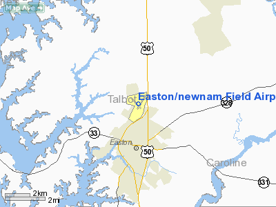
Easton / Newnam Field Airport |
Easton Airport
Newnam Field |
| IATA: ESN – ICAO: KESN – FAA LID: ESN |
| Summary |
| Airport type |
Public |
| Owner |
Talbot County |
| Serves |
Easton, Maryland |
| Elevation AMSL |
72 ft / 22 m |
| Coordinates |
38°48′15″N 076°04′08″W / 38.80417°N 76.06889°W / 38.80417; -76.06889 |
| Website |
www.EastonAirport.com |
| Runways |
| Direction |
Length |
Surface |
| ft |
m |
| 4/22 |
5,500 |
1,676 |
Asphalt |
| 15/33 |
4,003 |
1,220 |
Asphalt |
| Statistics (2007) |
| Aircraft operations |
160,000 |
| Based aircraft |
170 |
| Source: FAA and airport web site |
Easton Airport (IATA: ESN, ICAO: KESN, FAA LID: ESN), also known as Newnam Field, is a county-owned, public-use airport located two nautical miles (4 km) north of the central business district of Easton, a town in Talbot County, Maryland, United States.
Facilities and aircraft
Easton Airport covers an area of 500 acres (202 ha) at an elevation of 72 feet (22 m) above mean sea level. It has two asphalt paved runways: 4/22 measuring 5,500 x 100 ft (1,676 x 30 m) and 15/33 measuring 4,003 x 100 ft. (1,220 x 30 m).
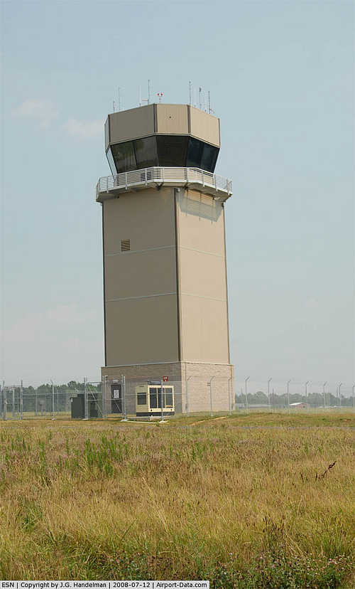
There are precision approaches on runway 4 and 22. Runway 4 uses an ILS approach while runway 22 uses a GPS or NDB approach. All four runways use PAPI precision approach lights to help guide pilots on their final approach on landing. As of late 2007, an Air traffic control tower has been built on field, due to the increasing number of aircraft at Easton Airport. Easton is now a Class D (Delta) controlled airport with a ceiling of 2,600 feet.
For the 12-month period ending June 22, 2007, the airport had 160,000 aircraft operations, an average of 438 per day: 85% general aviation, 11% air taxi and 4% military. At that time there were 170 aircraft based at this airport: 72% single-engine, 15% multi-engine, 9% jet and 5% helicopter.
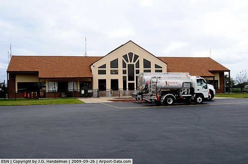
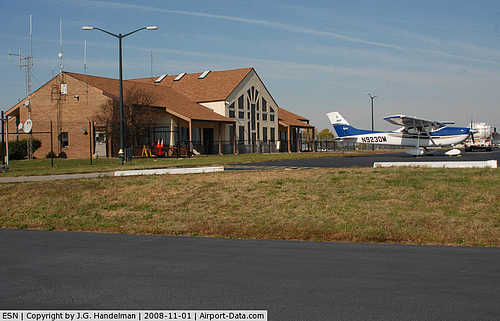
On field services include: 100LL and Jet A fuel, aircraft rental, aircraft sales, aircraft maintenance, aerial photography, flight school, charter flights, car rental, oxygen and T-hangars.
The above content comes from Wikipedia and is published under free licenses – click here to read more.
|
 |
(Click on the photo to enlarge) |
|
 |
(Click on the photo to enlarge) |
|
 |
(Click on the photo to enlarge) |
|
 |
(Click on the photo to enlarge) |
Location & QuickFacts
| FAA Information Effective: | 2008-09-25 |
| Airport Identifier: | ESN |
| Airport Status: | Operational |
| Longitude/Latitude: | 076-04-08.4000W/38-48-15.0000N
-76.069000/38.804167 (Estimated) |
| Elevation: | 72 ft / 21.95 m (Surveyed) |
| Land: | 500 acres |
| From nearest city: | 2 nautical miles N of Easton, MD |
| Location: | Talbot County, MD |
| Magnetic Variation: | 10W (1985) |
Owner & Manager
| Ownership: | Publicly owned |
| Owner: | Talbot Co |
| Address: | Talbot County Court House
Easton, MD 21601 |
| Phone number: | 410-770-8001 |
| Manager: | Mike Henry |
| Address: | 29137 Airport Rd, Unit 1
Easton, MD 21601 |
| Phone number: | 410-770-8055 |
Airport Operations and Facilities
| Airport Use: | Open to public |
| Wind indicator: | Yes |
| Segmented Circle: | Yes |
| Control Tower: | Yes |
| Lighting Schedule: | DUSK-DAWN
WHEN TWR CLSD ACTIVATE MIRL RYS 15-33 & 04-22 AND REIL RY 04 -CTAF. |
| Beacon Color: | Clear-Green (lighted land airport) |
| Landing fee charge: | No |
| Sectional chart: | Washington |
| Region: | AEA - Eastern |
| Boundary ARTCC: | ZDC - Washington |
| Tie-in FSS: | DCA - Leesburg |
| FSS on Airport: | No |
| FSS Toll Free: | 1-800-WX-BRIEF |
| NOTAMs Facility: | ESN (NOTAM-d service avaliable) |
| Federal Agreements: | NGY3 |
Airport Communications
| CTAF: | 118.525 |
| Unicom: | 122.950 |
Airport Services
| Fuel available: | 100LLA |
| Airframe Repair: | MAJOR |
| Power Plant Repair: | MAJOR |
| Bottled Oxygen: | LOW |
| Bulk Oxygen: | NONE |
Runway Information
Runway 04/22
| Dimension: | 5500 x 100 ft / 1676.4 x 30.5 m |
| Surface: | ASPH, |
| Surface Treatment: | Saw-cut or plastic Grooved |
| Weight Limit: | Single wheel: 40000 lbs.
Dual wheel: 60000 lbs.
Dual tandem wheel: 100000 lbs. |
| Edge Lights: | Medium |
| |
Runway 04 |
Runway 22 |
| Longitude: | 076-04-19.0621W | 076-03-43.7996W |
| Latitude: | 38-47-50.6303N | 38-48-37.4708N |
| Elevation: | 36.00 ft | 72.00 ft |
| Alignment: | 30 | 127 |
| ILS Type: | ILS/DME
| |
| Traffic Pattern: | Left | Right |
| Markings: | Precision instrument, Good Condition | Non-precision instrument, Good Condition |
| Crossing Height: | 43.00 ft | 34.00 ft |
| VASI: | 4-light PAPI on left side | 4-light PAPI on left side |
| Visual Glide Angle: | 3.00° | 3.00° |
| Runway End Identifier: | Yes | Yes |
| Obstruction: | 40 ft trees, 1228.0 ft from runway, 493 ft left of centerline, 25:1 slope to clear | 18 ft pole, 920.0 ft from runway, 80 ft left of centerline, 40:1 slope to clear |
|
Runway 15/33
| Dimension: | 4003 x 100 ft / 1220.1 x 30.5 m |
| Surface: | ASPH, Good Condition |
| Weight Limit: | Single wheel: 40000 lbs.
Dual wheel: 60000 lbs.
Dual tandem wheel: 100000 lbs. |
| Edge Lights: | Medium |
| |
Runway 15 |
Runway 33 |
| Longitude: | 076-04-34.9455W | 076-04-00.8357W |
| Latitude: | 38-48-30.8496N | 38-48-01.6441N |
| Elevation: | 33.00 ft | 51.00 ft |
| Alignment: | 127 | 127 |
| Traffic Pattern: | Left | Right |
| Markings: | Basic, Good Condition | Basic, Good Condition |
| Crossing Height: | 45.00 ft | 45.00 ft |
| VASI: | 2-light PAPI on left side | 2-light PAPI on left side |
| Visual Glide Angle: | 3.50° | 3.50° |
| Obstruction: | 47 ft tree, 1154.0 ft from runway, 204 ft right of centerline, 20:1 slope to clear | 74 ft trees, 1915.0 ft from runway, 23:1 slope to clear |
|
Radio Navigation Aids
| ID |
Type |
Name |
Ch |
Freq |
Var |
Dist |
| CGE | NDB | Cambridge | | 355.00 | 10W | 16.1 nm |
| MTN | NDB | Martin | | 342.00 | 11W | 33.1 nm |
| NHK | NDB | Patuxent | | 400.00 | 10W | 34.9 nm |
| BUH | NDB | Anne Arundel | | 260.00 | 10W | 36.4 nm |
| IUB | NDB | Institute | | 404.00 | 08W | 38.9 nm |
| VKX | NDB | Potomac | | 241.00 | 10W | 41.7 nm |
| APG | NDB | Aberdeen | | 349.00 | 11W | 44.0 nm |
| FND | NDB | Ellicott | | 371.00 | 11W | 44.0 nm |
| DC | NDB | Oxonn | | 332.00 | 11W | 44.9 nm |
| OX | NDB | Landy | | 407.00 | 12W | 48.8 nm |
| GTN | NDB | Georgetown | | 323.00 | 09W | 50.0 nm |
| DOV | TACAN | Dover | 037X | | 09W | 34.3 nm |
| MTN | TACAN | Martin | 068X | | 11W | 35.5 nm |
| PPM | VOR/DME | Phillips | 021X | 108.40 | 09W | 40.1 nm |
| ATR | VOR/DME | Waterloo | 073X | 112.60 | 09W | 40.2 nm |
| DCA | VOR/DME | Washington | 047X | 111.00 | 09W | 45.4 nm |
| OTT | VORTAC | Nottingham | 084X | 113.70 | 10W | 32.2 nm |
| PXT | VORTAC | Patuxent | 123X | 117.60 | 10W | 34.7 nm |
| BAL | VORTAC | Baltimore | 098X | 115.10 | 11W | 35.4 nm |
| ENO | VORTAC | Smyrna | 051X | 111.40 | 09W | 36.4 nm |
| ADW | VORTAC | Andrews | 078X | 113.10 | 10W | 37.3 nm |
| SBY | VORTAC | Salisbury | 049X | 111.20 | 12W | 38.1 nm |
| ADW | VOT | Andrews Afb | | 109.60 | | 38.0 nm |
| DCA | VOT | Washington National | | 109.40 | | 45.2 nm |
Remarks
- DEER & BIRDS ON & INVOF ARPT.
- NOISE ABATEMENT; DEP RY 22 AVOID OVERFLIGHT OF TOWN OF EASTON; DEP RY 04 LEFT TURN AT RY END TO PARALLEL HWY 50 UNTIL PAST TRAILER PARK.
- RY 15/33 DISTANCE MARKERS EVERY 1000 FT WEST SIDE RY.
- EXISTED PRIOR TO 1959.
Images and information placed above are from
http://www.airport-data.com/airport/ESN/
We thank them for the data!
| General Info
|
| Country |
United States
|
| State |
MARYLAND
|
| FAA ID |
ESN
|
| Latitude |
38-48-15.000N
|
| Longitude |
076-04-08.400W
|
| Elevation |
72 feet
|
| Near City |
EASTON
|
We don't guarantee the information is fresh and accurate. The data may
be wrong or outdated.
For more up-to-date information please refer to other sources.
|
|


