 |
|
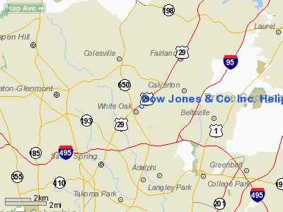
Dow Jones & Co. Inc. Heliport |
Location & QuickFacts
| FAA Information Effective: | 2008-09-25 |
| Airport Identifier: | MD67 |
| Airport Status: | Operational |
| Longitude/Latitude: | 076-59-00.9140W/39-02-47.3930N
-76.983587/39.046498 (Estimated) |
| Elevation: | 365 ft / 111.25 m (Estimated) |
| Land: | 0 acres |
| From nearest city: | 3 nautical miles NE of Silver Spring, MD |
| Location: | Montgomery County, MD |
| Magnetic Variation: | 10W (1985) |
Owner & Manager
| Ownership: | Privately owned |
| Owner: | Dow Jones & Co |
| Address: | 11501 Columbia Pike
Silver Spring, MD 20904 |
| Phone number: | 301-622-2900 |
| Manager: | William C. Horner |
| Address: | 11501 Columbia Pike
Silver Spring, MD 20904 |
| Phone number: | 301-622-2900 |
Airport Operations and Facilities
| Airport Use: | Private |
| Wind indicator: | Yes |
| Segmented Circle: | No |
| Control Tower: | No |
| Landing fee charge: | No |
| Sectional chart: | Washington |
| Region: | AEA - Eastern |
| Boundary ARTCC: | ZDC - Washington |
| Tie-in FSS: | DCA - Leesburg |
| FSS on Airport: | No |
| FSS Toll Free: | 1-800-WX-BRIEF |
Runway Information
Helipad H1
| Dimension: | 40 x 40 ft / 12.2 x 12.2 m |
| Surface: | ASPH, |
| |
Runway H1 |
Runway |
| Traffic Pattern: | Left | Left |
|
Radio Navigation Aids
| ID |
Type |
Name |
Ch |
Freq |
Var |
Dist |
| GTN | NDB | Georgetown | | 323.00 | 09W | 9.6 nm |
| BUH | NDB | Anne Arundel | | 260.00 | 10W | 10.7 nm |
| GAI | NDB | Gaithersburg | | 385.00 | 09W | 11.3 nm |
| DC | NDB | Oxonn | | 332.00 | 11W | 17.0 nm |
| FND | NDB | Ellicott | | 371.00 | 11W | 17.4 nm |
| VKX | NDB | Potomac | | 241.00 | 10W | 17.9 nm |
| IUB | NDB | Institute | | 404.00 | 08W | 22.1 nm |
| MTN | NDB | Martin | | 342.00 | 11W | 32.0 nm |
| GDX | NDB | Goodwin Lake | | 227.00 | 08W | 40.0 nm |
| ESN | NDB | Easton | | 212.00 | 10W | 45.1 nm |
| MTN | TACAN | Martin | 068X | | 11W | 31.7 nm |
| FDK | VOR | Frederick | | 109.00 | 08W | 28.6 nm |
| DCA | VOR/DME | Washington | 047X | 111.00 | 09W | 11.5 nm |
| PPM | VOR/DME | Phillips | 021X | 108.40 | 09W | 45.5 nm |
| ADW | VORTAC | Andrews | 078X | 113.10 | 10W | 15.4 nm |
| BAL | VORTAC | Baltimore | 098X | 115.10 | 11W | 16.8 nm |
| OTT | VORTAC | Nottingham | 084X | 113.70 | 10W | 23.3 nm |
| AML | VORTAC | Armel | 082X | 113.50 | 08W | 23.6 nm |
| EMI | VORTAC | Westminster | 126X | 117.90 | 08W | 27.0 nm |
| MRB | VORTAC | Martinsburg | 058X | 112.10 | 07W | 45.1 nm |
| BRV | VORTAC | Brooke | 092X | 114.50 | 09W | 46.1 nm |
| CSN | VORTAC | Casanova | 110X | 116.30 | 06W | 47.9 nm |
| DCA | VOT | Washington National | | 109.40 | | 12.3 nm |
| ADW | VOT | Andrews Afb | | 109.60 | | 16.3 nm |
Remarks
- WIND INDICATOR INSTLD & LGTD, IF NGT OPNS PLANNED, MRKGS & RSTRNS IDENTIFY HELIPORT TO CTL ENTRY OF NON-AUZD PERSONS.
Images and information placed above are from
http://www.airport-data.com/airport/MD67/
We thank them for the data!
| General Info
|
| Country |
United States
|
| State |
MARYLAND
|
| FAA ID |
MD67
|
| Latitude |
39-02-47.393N
|
| Longitude |
076-59-00.914W
|
| Elevation |
365 feet
|
| Near City |
SILVER SPRING
|
We don't guarantee the information is fresh and accurate. The data may
be wrong or outdated.
For more up-to-date information please refer to other sources.
|
|


