 |
|
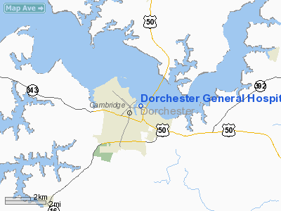
Dorchester General Hospital Heliport |
Location & QuickFacts
| FAA Information Effective: | 2008-09-25 |
| Airport Identifier: | MD33 |
| Airport Status: | Operational |
| Longitude/Latitude: | 076-04-03.7830W/38-34-18.4270N
-76.067718/38.571785 (Estimated) |
| Elevation: | 12 ft / 3.66 m (Surveyed) |
| Land: | 0 acres |
| From nearest city: | 0 nautical miles N of Cambridge, MD |
| Location: | Dorchester County, MD |
| Magnetic Variation: | 10W (1985) |
Owner & Manager
| Ownership: | Privately owned |
| Owner: | Dorchester General Hosp. Inc. |
| Address: | Po Box 439
Cambridge, MD 21613 |
| Phone number: | 410-228-5511 |
| Manager: | Kenneth A. Richmond |
| Address: | Po Box 439
Cambridge, MD 21613 |
| Phone number: | 410-228-5511 |
Airport Operations and Facilities
| Airport Use: | Private
MEDICAL USE. |
| Wind indicator: | Yes |
| Segmented Circle: | No |
| Control Tower: | No |
| Lighting Schedule: | PHONE REQ
RWY LGTS ON REQ ... CALL 301-228-5511. |
| Landing fee charge: | No |
| Sectional chart: | Washington |
| Region: | AEA - Eastern |
| Boundary ARTCC: | ZDC - Washington |
| Tie-in FSS: | DCA - Leesburg |
| FSS on Airport: | No |
| FSS Toll Free: | 1-800-WX-BRIEF |
Runway Information
Helipad H1
| Dimension: | 140 x 140 ft / 42.7 x 42.7 m |
| Surface: | CONC,
90 X 90'CONC CENTER WITH ASPH EDGES - RED CROSS PAINTED ON PAD. |
| Edge Lights: | Low |
| |
Runway H1 |
Runway |
| Traffic Pattern: | Left | Left |
|
Radio Navigation Aids
| ID |
Type |
Name |
Ch |
Freq |
Var |
Dist |
| CGE | NDB | Cambridge | | 355.00 | 10W | 2.6 nm |
| ESN | NDB | Easton | | 212.00 | 10W | 14.0 nm |
| NHK | NDB | Patuxent | | 400.00 | 10W | 23.3 nm |
| OX | NDB | Landy | | 407.00 | 12W | 42.8 nm |
| VKX | NDB | Potomac | | 241.00 | 10W | 43.0 nm |
| BUH | NDB | Anne Arundel | | 260.00 | 10W | 44.7 nm |
| MTN | NDB | Martin | | 342.00 | 11W | 46.1 nm |
| DC | NDB | Oxonn | | 332.00 | 11W | 46.5 nm |
| DOV | TACAN | Dover | 037X | | 09W | 43.9 nm |
| MTN | TACAN | Martin | 068X | | 11W | 48.4 nm |
| ATR | VOR/DME | Waterloo | 073X | 112.60 | 09W | 42.6 nm |
| DCA | VOR/DME | Washington | 047X | 111.00 | 09W | 48.6 nm |
| PXT | VORTAC | Patuxent | 123X | 117.60 | 10W | 23.2 nm |
| SBY | VORTAC | Salisbury | 049X | 111.20 | 12W | 29.6 nm |
| OTT | VORTAC | Nottingham | 084X | 113.70 | 10W | 32.8 nm |
| ADW | VORTAC | Andrews | 078X | 113.10 | 10W | 40.0 nm |
| SWL | VORTAC | Snow Hill | 071X | 112.40 | 08W | 42.1 nm |
| BAL | VORTAC | Baltimore | 098X | 115.10 | 11W | 45.5 nm |
| ENO | VORTAC | Smyrna | 051X | 111.40 | 09W | 47.3 nm |
| ADW | VOT | Andrews Afb | | 109.60 | | 40.3 nm |
| DCA | VOT | Washington National | | 109.40 | | 48.2 nm |
Remarks
- 4'CHAIN LINK FENCE 5'OFF PAD SURROUNDS HELIPORT.
- 6 LEAD-IN LGTS ON NE & SE APCH TO PAD.
Images and information placed above are from
http://www.airport-data.com/airport/MD33/
We thank them for the data!
| General Info
|
| Country |
United States
|
| State |
MARYLAND
|
| FAA ID |
MD33
|
| Latitude |
38-34-18.427N
|
| Longitude |
076-04-03.783W
|
| Elevation |
12 feet
|
| Near City |
CAMBRIDGE
|
We don't guarantee the information is fresh and accurate. The data may
be wrong or outdated.
For more up-to-date information please refer to other sources.
|
|


