 |
|
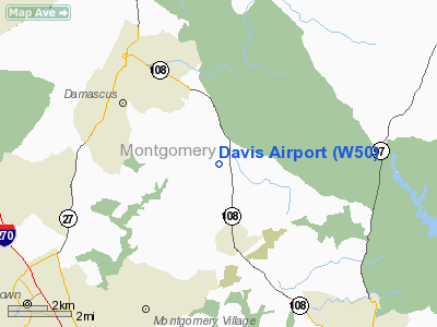
Location & QuickFacts
| FAA Information Effective: | 2008-09-25 |
| Airport Identifier: | W50 |
| Airport Status: | Operational |
| Longitude/Latitude: | 077-09-01.2000W/39-14-36.8000N
-77.150333/39.243556 (Estimated) |
| Elevation: | 630 ft / 192.02 m (Surveyed) |
| Land: | 20 acres |
| From nearest city: | 3 nautical miles N of Laytonsville, MD |
| Location: | Montgomery County, MD |
| Magnetic Variation: | 09W (1985) |
Owner & Manager
| Ownership: | Privately owned |
| Owner: | Estate Of Mrs W.h. Paille
ESTATE IN CARE OF MR. DAVID CAMPBELL |
| Address: | 114053 Piedmont Road
Murcanton, NC 21874 |
| Phone number: | 828-437-6779 |
| Manager: | Frank Schmidt |
| Address: | 7200 Hawkins Creamery Rd
Laytonsville, MD 20882 |
| Phone number: | 301-253-2897 |
Airport Operations and Facilities
| Airport Use: | Open to public |
| Wind indicator: | Yes |
| Segmented Circle: | No |
| Control Tower: | No |
| Landing fee charge: | No |
| Sectional chart: | Washington |
| Region: | AEA - Eastern |
| Boundary ARTCC: | ZDC - Washington |
| Tie-in FSS: | DCA - Leesburg |
| FSS on Airport: | No |
| FSS Toll Free: | 1-800-WX-BRIEF |
| NOTAMs Facility: | DCA (NOTAM-d service avaliable) |
Airport Communications
| CTAF: | 122.800 |
| Unicom: | 122.800
UNICOM UNMONITORED. |
Airport Services
| Airframe Repair: | MINOR |
| Power Plant Repair: | MINOR |
| Bottled Oxygen: | NONE |
| Bulk Oxygen: | NONE |
Runway Information
Runway 08/26
| Dimension: | 2005 x 25 ft / 611.1 x 7.6 m |
| Surface: | ASPH-TURF, Fair Condition |
| |
Runway 08 |
Runway 26 |
| Longitude: | 077-09-12.8100W | 077-08-49.6100W |
| Latitude: | 39-14-32.7200N | 39-14-40.9500N |
| Traffic Pattern: | Left | Left |
| Markings: | Basic, Good Condition | Basic, Good Condition |
| Crossing Height: | 17.00 ft | 18.00 ft |
| VASI: | system of panels on left side that may or may not be lighted | system of panels on left side that may or may not be lighted |
| Visual Glide Angle: | 4.00° | 5.00° |
| Obstruction: | 27 ft trees, 266.0 ft from runway, 130 ft right of centerline, 2:1 slope to clear
TREES + 45 FT, 115 FT RIGHT @ THLD. | 50 ft tree, 295.0 ft from runway, 90 ft right of centerline, 1:1 slope to clear
+ 44 FT TREES, 150 FT FM THLD, 115 FT RIGHT. TREES + 45 FT @THLD 110 FT LEFT |
|
Radio Navigation Aids
| ID |
Type |
Name |
Ch |
Freq |
Var |
Dist |
| GAI | NDB | Gaithersburg | | 385.00 | 09W | 4.5 nm |
| FND | NDB | Ellicott | | 371.00 | 11W | 17.6 nm |
| GTN | NDB | Georgetown | | 323.00 | 09W | 18.9 nm |
| BUH | NDB | Anne Arundel | | 260.00 | 10W | 20.6 nm |
| IUB | NDB | Institute | | 404.00 | 08W | 24.6 nm |
| DC | NDB | Oxonn | | 332.00 | 11W | 29.3 nm |
| VKX | NDB | Potomac | | 241.00 | 10W | 31.1 nm |
| MTN | NDB | Martin | | 342.00 | 11W | 36.0 nm |
| GDX | NDB | Goodwin Lake | | 227.00 | 08W | 36.2 nm |
| EUD | NDB | York | | 254.00 | 11W | 42.6 nm |
| TZ | NDB | Cogan | | 364.00 | 10W | 43.8 nm |
| MTN | TACAN | Martin | 068X | | 11W | 34.8 nm |
| FDK | VOR | Frederick | | 109.00 | 08W | 14.6 nm |
| HGR | VOR | Hagerstown | | 109.80 | 07W | 42.6 nm |
| DCA | VOR/DME | Washington | 047X | 111.00 | 09W | 23.7 nm |
| PPM | VOR/DME | Phillips | 021X | 108.40 | 09W | 47.5 nm |
| EMI | VORTAC | Westminster | 126X | 117.90 | 08W | 17.1 nm |
| BAL | VORTAC | Baltimore | 098X | 115.10 | 11W | 23.2 nm |
| AML | VORTAC | Armel | 082X | 113.50 | 08W | 23.7 nm |
| ADW | VORTAC | Andrews | 078X | 113.10 | 10W | 29.4 nm |
| MRB | VORTAC | Martinsburg | 058X | 112.10 | 07W | 33.6 nm |
| OTT | VORTAC | Nottingham | 084X | 113.70 | 10W | 37.5 nm |
| CSN | VORTAC | Casanova | 110X | 116.30 | 06W | 49.3 nm |
| DCA | VOT | Washington National | | 109.40 | | 24.6 nm |
| ADW | VOT | Andrews Afb | | 109.60 | | 30.1 nm |
Remarks
- ARPT CLSD DUSK-DAWN.
- RY 26 SHALLOW POND 80 FT R OF THLD.
- BIRDS ON & INVOF ARPT.
- ESTAB PRIOR TO 1959.
Images and information placed above are from
http://www.airport-data.com/airport/W50/
We thank them for the data!
| General Info
|
| Country |
United States
|
| State |
MARYLAND
|
| FAA ID |
W50
|
| Latitude |
39-14-40.379N
|
| Longitude |
077-08-54.933W
|
| Elevation |
630 feet
|
| Near City |
LAYTONSVILLE
|
We don't guarantee the information is fresh and accurate. The data may
be wrong or outdated.
For more up-to-date information please refer to other sources.
|
|


