 |
|
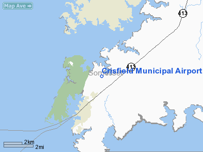
Crisfield Municipal Airport |
| Crisfield Municipal Airport |
| IATA: none – ICAO: none – FAA LID: W41 |
| Summary |
| Airport type |
Public |
| Owner/Operator |
Crisfield-Somerset County |
| Serves |
Somerset County, Maryland |
| Location |
Crisfield, Maryland, U.S. |
| Elevation AMSL |
4 ft / 1 m |
| Coordinates |
38°01′00″N 75°49′44″W / 38.0166667°N 75.82889°W / 38.0166667; -75.82889 |
| Runways |
| Direction |
Length |
Surface |
| ft |
m |
| 06/24 |
3280 |
1000 |
Grass/Earth |
| 14/32 |
2490 |
759 |
Asphalt |
| Source: DAFIF |
Crisfield Municipal Airport (FAA LID: W41) is a public airport located 3 miles (4.8 km) from Crisfield in Somerset County, Maryland, United States. Crisfield is located near the center of the Delmarva Peninsula in the heart of Bay Country. The Atlantic Ocean is 28 miles (45 km) to the east and the Chesapeake Bay just a few miles to the west. The Crisfield-Somerset County Airport is a joint venture of Somerset County and the City of Crisfield.
The airport averages 33 flights per week and has 9 aircraft based at the field.
The above content comes from Wikipedia and is published under free licenses – click here to read more.
Location & QuickFacts
| FAA Information Effective: | 2008-09-25 |
| Airport Identifier: | W41 |
| Airport Status: | Operational |
| Longitude/Latitude: | 075-49-40.0540W/38-01-03.3150N
-75.827793/38.017587 (Estimated) |
| Elevation: | 4 ft / 1.22 m (Estimated) |
| Land: | 110 acres |
| From nearest city: | 3 nautical miles NE of Crisfield, MD |
| Location: | Somerset County, MD |
| Magnetic Variation: | 10W (1985) |
Owner & Manager
| Ownership: | Publicly owned |
| Owner: | Crisfield-somerset County |
| Address: | Box 37
Princess Anne, MD 21817 |
| Phone number: | 410-968-1333 |
| Manager: | Jocelyn Quintanilha |
| Address: | 4784 Jacksonville Road
Crisfield, MD 21817 |
| Phone number: | 410-968-3062 |
Airport Operations and Facilities
| Airport Use: | Open to public |
| Wind indicator: | Yes |
| Segmented Circle: | No |
| Control Tower: | No |
| Lighting Schedule: | DUSK-DAWN
ACTVT MIRL RY 14/32; REIL RYS 14 & 32 - CTAF. |
| Beacon Color: | Clear-Green (lighted land airport) |
| Landing fee charge: | No |
| Sectional chart: | Washington |
| Region: | AEA - Eastern |
| Boundary ARTCC: | ZDC - Washington |
| Tie-in FSS: | DCA - Leesburg |
| FSS on Airport: | No |
| FSS Toll Free: | 1-800-WX-BRIEF |
| NOTAMs Facility: | DCA (NOTAM-d service avaliable) |
| Federal Agreements: | NGY |
Airport Communications
| CTAF: | 122.800 |
| Unicom: | 122.800 |
Airport Services
| Fuel available: | 100LL |
| Airframe Repair: | MAJOR |
| Power Plant Repair: | MAJOR |
| Bottled Oxygen: | NONE |
| Bulk Oxygen: | NONE |
Runway Information
Runway 06/24
| Dimension: | 3280 x 120 ft / 999.7 x 36.6 m |
| Surface: | TURF, Good Condition |
| |
Runway 06 |
Runway 24 |
| Longitude: | 075-49-58.1320W | 075-49-30.2320W |
| Latitude: | 38-00-48.5690N | 38-01-12.3220N |
| Alignment: | 43 | 127 |
| Traffic Pattern: | Left | Left |
| Displaced threshold: | 540.00 ft | 0.00 ft |
| Obstruction: | 79 ft tree, 413.0 ft from runway, 126 ft right of centerline, 5:1 slope to clear
APCH SLOPE 20:1 TO DSPLCD THLD. | 15 ft brush, 0.0 ft from runway, 110 ft right of centerline |
|
Runway 14/32
| Dimension: | 2490 x 75 ft / 759.0 x 22.9 m |
| Surface: | ASPH, Good Condition |
| Weight Limit: | Single wheel: 12000 lbs. |
| Edge Lights: | Medium |
| |
Runway 14 |
Runway 32 |
| Longitude: | 075-49-46.2300W | 075-49-23.0000W |
| Latitude: | 38-01-15.2800N | 38-00-58.9100N |
| Elevation: | 4.00 ft | 3.00 ft |
| Alignment: | 127 | 127 |
| Traffic Pattern: | Left | Left |
| Markings: | Non-precision instrument, Good Condition | Non-precision instrument, Good Condition |
| Crossing Height: | 34.00 ft | 33.00 ft |
| VASI: | 2-light PAPI on left side | 2-light PAPI on left side |
| Visual Glide Angle: | 2.75° | 3.25° |
| Runway End Identifier: | Yes | Yes |
| Obstruction: | , 50:1 slope to clear | 15 ft road, 400.0 ft from runway, 13:1 slope to clear |
|
Radio Navigation Aids
| ID |
Type |
Name |
Ch |
Freq |
Var |
Dist |
| BDB | NDB | Accomack | | 336.00 | 11W | 26.9 nm |
| NHK | NDB | Patuxent | | 400.00 | 10W | 31.6 nm |
| CGE | NDB | Cambridge | | 355.00 | 10W | 32.7 nm |
| OX | NDB | Landy | | 407.00 | 12W | 36.3 nm |
| ESN | NDB | Easton | | 212.00 | 10W | 48.7 nm |
| SWL | VORTAC | Snow Hill | 071X | 112.40 | 08W | 17.4 nm |
| SBY | VORTAC | Salisbury | 049X | 111.20 | 12W | 24.7 nm |
| PXT | VORTAC | Patuxent | 123X | 117.60 | 10W | 31.6 nm |
| CCV | VORTAC | Cape Charles | 059X | 112.20 | 10W | 41.1 nm |
Remarks
- TURF AREAS OF ARPT MAY BE SOFT.
- BIRDS & WILDLIFE ON & INVOF ARPT.
- EXISTED PRIOR TO 1959.
Images and information placed above are from
http://www.airport-data.com/airport/W41/
We thank them for the data!
| General Info
|
| Country |
United States
|
| State |
MARYLAND
|
| FAA ID |
W41
|
| Latitude |
38-01-00.445N
|
| Longitude |
075-49-43.754W
|
| Elevation |
4 feet
|
| Near City |
CRISFIELD
|
We don't guarantee the information is fresh and accurate. The data may
be wrong or outdated.
For more up-to-date information please refer to other sources.
|
|


