 |
|
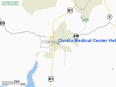
Civista Medical Center Heliport |
Location & QuickFacts
| FAA Information Effective: | 2008-09-25 |
| Airport Identifier: | 6MD6 |
| Airport Status: | Operational |
| Longitude/Latitude: | 076-58-28.0000W/38-31-42.6000N
-76.974444/38.528500 (Estimated) |
| Elevation: | 168 ft / 51.21 m (Estimated) |
| Land: | 0 acres |
| From nearest city: | 0 nautical miles SE of La Plata, MD |
| Location: | Charles County, MD |
| Magnetic Variation: | () |
Owner & Manager
| Ownership: | Privately owned |
| Owner: | Civista Medical Center |
| Address: | 701 E. Charles St.
La Plata, MD 20646 |
| Phone number: | 301-609-4000 |
| Manager: | Lauri Cress
DIRECTOR OF FACILITIES. |
| Address: | 701 E. Charles St.
La Plata, MD 20646 |
| Phone number: | 301-609-4453 |
Airport Operations and Facilities
| Airport Use: | Private
MEDICAL USE. |
| Wind indicator: | Yes |
| Control Tower: | No |
| Lighting Schedule: | RDO CTL
ACTVT PERIMETER LGTS - 123.05. |
| Sectional chart: | Washington |
| Region: | AEA - Eastern |
| Boundary ARTCC: | ZDC - Washington |
| Tie-in FSS: | DCA - Leesburg |
| FSS Toll Free: | 1-800-WX-BRIEF |
Runway Information
Helipad H1
| Dimension: | 42 x 42 ft / 12.8 x 12.8 m |
| Surface: | CONC, |
| |
Runway H1 |
Runway |
| Traffic Pattern: | Left | Left |
|
Radio Navigation Aids
| ID |
Type |
Name |
Ch |
Freq |
Var |
Dist |
| VKX | NDB | Potomac | | 241.00 | 10W | 13.3 nm |
| DC | NDB | Oxonn | | 332.00 | 11W | 14.5 nm |
| GTN | NDB | Georgetown | | 323.00 | 09W | 25.1 nm |
| EZF | NDB | Shannon | | 237.00 | 10W | 27.4 nm |
| NHK | NDB | Patuxent | | 400.00 | 10W | 30.6 nm |
| APH | NDB | A P Hill | | 396.00 | 10W | 31.2 nm |
| BUH | NDB | Anne Arundel | | 260.00 | 10W | 34.9 nm |
| GAI | NDB | Gaithersburg | | 385.00 | 09W | 39.6 nm |
| CJR | NDB | Culpeper | | 252.00 | 09W | 41.5 nm |
| MSQ | NDB | Nailr | | 351.00 | 10W | 44.0 nm |
| CGE | NDB | Cambridge | | 355.00 | 10W | 44.3 nm |
| ESN | NDB | Easton | | 212.00 | 10W | 45.6 nm |
| FND | NDB | Ellicott | | 371.00 | 11W | 46.5 nm |
| GDX | NDB | Goodwin Lake | | 227.00 | 08W | 47.6 nm |
| IUB | NDB | Institute | | 404.00 | 08W | 48.4 nm |
| DCA | VOR/DME | Washington | 047X | 111.00 | 09W | 20.1 nm |
| OTT | VORTAC | Nottingham | 084X | 113.70 | 10W | 15.2 nm |
| ADW | VORTAC | Andrews | 078X | 113.10 | 10W | 17.5 nm |
| BRV | VORTAC | Brooke | 092X | 114.50 | 09W | 21.2 nm |
| PXT | VORTAC | Patuxent | 123X | 117.60 | 10W | 30.7 nm |
| AML | VORTAC | Armel | 082X | 113.50 | 08W | 33.6 nm |
| BAL | VORTAC | Baltimore | 098X | 115.10 | 11W | 41.3 nm |
| CSN | VORTAC | Casanova | 110X | 116.30 | 06W | 42.4 nm |
| ADW | VOT | Andrews Afb | | 109.60 | | 16.2 nm |
| DCA | VOT | Washington National | | 109.40 | | 19.2 nm |
Remarks
- PRVDD VFR OPNS; PVT USE; AREA IS MARKED AND WIND INDICATOR IS MAINTAINED.
Images and information placed above are from
http://www.airport-data.com/airport/6MD6/
We thank them for the data!
We don't guarantee the information is fresh and accurate. The data may
be wrong or outdated.
For more up-to-date information please refer to other sources.
|
|


