 |
|
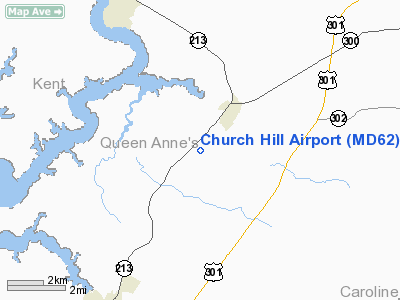
Location & QuickFacts
| FAA Information Effective: | 2008-09-25 |
| Airport Identifier: | MD62 |
| Airport Status: | Operational |
| Longitude/Latitude: | 076-00-05.7910W/39-07-29.8990N
-76.001609/39.124972 (Estimated) |
| Elevation: | 70 ft / 21.34 m (Estimated) |
| Land: | 353 acres |
| From nearest city: | 1 nautical miles SW of Church Hill, MD |
| Location: | Queen Annes County, MD |
| Magnetic Variation: | 10W (1985) |
Owner & Manager
| Ownership: | Privately owned |
| Owner: | Archibald A Mac Glashan Iii |
| Address: | Box 25
Church Hill, MD 21623 |
| Phone number: | 301-758-1623 |
| Manager: | Scott Mac Glashan |
| Address: | 200 Brynawel Lane
Church Hill, MD 21623 |
| Phone number: | 301-556-6241
301-758-2644 |
Airport Operations and Facilities
| Airport Use: | Private |
| Wind indicator: | Yes |
| Segmented Circle: | No |
| Control Tower: | No |
| Sectional chart: | Washington |
| Region: | AEA - Eastern |
| Boundary ARTCC: | ZDC - Washington |
| Tie-in FSS: | DCA - Leesburg |
| FSS on Airport: | No |
| FSS Toll Free: | 1-800-WX-BRIEF |
Runway Information
Runway 13/31
| Dimension: | 2700 x 100 ft / 823.0 x 30.5 m |
| Surface: | TURF, |
| |
Runway 13 |
Runway 31 |
| Traffic Pattern: | Left | Left |
| Displaced threshold: | 540.00 ft | 915.00 ft |
| Obstruction: | 27 ft plines | 55 ft trees, 185.0 ft from runway |
|
Radio Navigation Aids
| ID |
Type |
Name |
Ch |
Freq |
Var |
Dist |
| ESN | NDB | Easton | | 212.00 | 10W | 19.5 nm |
| MTN | NDB | Martin | | 342.00 | 11W | 20.5 nm |
| APG | NDB | Aberdeen | | 349.00 | 11W | 25.1 nm |
| IUB | NDB | Institute | | 404.00 | 08W | 30.6 nm |
| CGE | NDB | Cambridge | | 355.00 | 10W | 35.3 nm |
| BUH | NDB | Anne Arundel | | 260.00 | 10W | 35.5 nm |
| FND | NDB | Ellicott | | 371.00 | 11W | 37.4 nm |
| RNB | NDB | Rainbow | | 363.00 | 11W | 44.0 nm |
| MTN | TACAN | Martin | 068X | | 11W | 22.7 nm |
| DOV | TACAN | Dover | 037X | | 09W | 24.9 nm |
| PPM | VOR/DME | Phillips | 021X | 108.40 | 09W | 22.0 nm |
| ATR | VOR/DME | Waterloo | 073X | 112.60 | 09W | 41.5 nm |
| ENO | VORTAC | Smyrna | 051X | 111.40 | 09W | 23.5 nm |
| BAL | VORTAC | Baltimore | 098X | 115.10 | 11W | 30.9 nm |
| DQO | VORTAC | Dupont | 087X | 114.00 | 10W | 38.0 nm |
| OTT | VORTAC | Nottingham | 084X | 113.70 | 10W | 42.9 nm |
| OOD | VORTAC | Woodstown | 075X | 112.80 | 10W | 44.7 nm |
| ADW | VORTAC | Andrews | 078X | 113.10 | 10W | 44.7 nm |
| ADW | VOT | Andrews Afb | | 109.60 | | 45.8 nm |
Remarks
- PRVDD VFR; THR RY 31 DSPLCD 915' & THR RY 13 DSPLCD 540' TO ENSURE A 20:1 CLNC SLOPE; & DSPLCD THRS MKD PER AC 150/5300-4B.
Images and information placed above are from
http://www.airport-data.com/airport/MD62/
We thank them for the data!
| General Info
|
| Country |
United States
|
| State |
MARYLAND
|
| FAA ID |
MD62
|
| Latitude |
39-07-29.899N
|
| Longitude |
076-00-05.791W
|
| Elevation |
70 feet
|
| Near City |
CHURCH HILL
|
We don't guarantee the information is fresh and accurate. The data may
be wrong or outdated.
For more up-to-date information please refer to other sources.
|
|


