 |
|
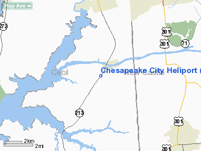
Location & QuickFacts
| FAA Information Effective: | 2008-09-25 |
| Airport Identifier: | 04MD |
| Airport Status: | Operational |
| Longitude/Latitude: | 075-49-17.2200W/39-31-05.0400N
-75.821450/39.518067 (Estimated) |
| Elevation: | 40 ft / 12.19 m () |
| Land: | 3 acres |
| From nearest city: | 1 nautical miles SE of Chesapeake City, MD |
| Location: | Cecil County, MD |
| Magnetic Variation: | 12W (2000) |
Owner & Manager
| Ownership: | Privately owned |
| Owner: | Dr. Edward E. Boas Jr. |
| Address: | 2615 Augustine Herman Hwy.
Chesapeake City, MD 21915-0742 |
| Phone number: | 410-885-2365 |
| Manager: | Dr. Edward E. Boas Jr. |
| Address: | 2615 Augustine Herman Hwy.
Chesapeake City, MD 21915-0742 |
| Phone number: | 410-885-2365 |
Airport Operations and Facilities
| Airport Use: | Private |
| Wind indicator: | Yes |
| Segmented Circle: | No |
| Control Tower: | No |
| Lighting Schedule: | DUSK-DAWN |
| Region: | AEA - Eastern |
| Boundary ARTCC: | ZDC - Washington |
| Tie-in FSS: | DCA - Leesburg |
| FSS Toll Free: | 1-800-WX-BRIEF |
Airport Communications
Runway Information
Helipad H1
| Dimension: | 50 x 50 ft / 15.2 x 15.2 m |
| Surface: | ASPH, |
| |
Runway H1 |
Runway |
| Traffic Pattern: | Left | Left |
|
Radio Navigation Aids
| ID |
Type |
Name |
Ch |
Freq |
Var |
Dist |
| APG | NDB | Aberdeen | | 349.00 | 11W | 13.2 nm |
| MTN | NDB | Martin | | 342.00 | 11W | 29.1 nm |
| RNB | NDB | Rainbow | | 363.00 | 11W | 32.4 nm |
| IUB | NDB | Institute | | 404.00 | 08W | 39.8 nm |
| ING | NDB | Ambler | | 275.00 | 11W | 44.1 nm |
| ESN | NDB | Easton | | 212.00 | 10W | 44.4 nm |
| FND | NDB | Ellicott | | 371.00 | 11W | 46.5 nm |
| DOV | TACAN | Dover | 037X | | 09W | 28.4 nm |
| MTN | TACAN | Martin | 068X | | 11W | 29.6 nm |
| PPM | VOR/DME | Phillips | 021X | 108.40 | 09W | 16.5 nm |
| DQO | VORTAC | Dupont | 087X | 114.00 | 10W | 13.8 nm |
| ENO | VORTAC | Smyrna | 051X | 111.40 | 09W | 22.3 nm |
| MXE | VORTAC | Modena | 079X | 113.20 | 09W | 25.0 nm |
| OOD | VORTAC | Woodstown | 075X | 112.80 | 10W | 25.0 nm |
| VCN | VORTAC | Cedar Lake | 099X | 115.20 | 10W | 39.6 nm |
| LRP | VORTAC | Lancaster | 120X | 117.30 | 09W | 42.2 nm |
| PTW | VORTAC | Pottstown | 112X | 116.50 | 09W | 44.0 nm |
| BAL | VORTAC | Baltimore | 098X | 115.10 | 11W | 44.3 nm |
| PHL | VOT | Philadelphia Intl | | 109.80 | | 34.0 nm |
Remarks
- PRVDD--CLEAR 8:1 INGRESS/EGRESS, MKGS FOR INGRESS/EGRSS, LGTD WINDSOCK, VEHICLE TFC CONTROLLED DURING OPNS, PLINES & POLES MKD.
Images and information placed above are from
http://www.airport-data.com/airport/04MD/
We thank them for the data!
| General Info
|
| Country |
United States
|
| State |
MARYLAND
|
| FAA ID |
04MD
|
| Latitude |
39-31-05.040N
|
| Longitude |
075-49-17.220W
|
| Elevation |
40 feet
|
| Near City |
CHESAPEAKE CITY
|
We don't guarantee the information is fresh and accurate. The data may
be wrong or outdated.
For more up-to-date information please refer to other sources.
|
|


