 |
|
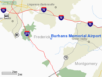
Location & QuickFacts
| FAA Information Effective: | 2008-09-25 |
| Airport Identifier: | 3MD0 |
| Airport Status: | Operational |
| Longitude/Latitude: | 077-20-09.9440W/39-20-53.3710N
-77.336096/39.348159 (Estimated) |
| Elevation: | 490 ft / 149.35 m (Estimated) |
| Land: | 66 acres |
| From nearest city: | 5 nautical miles SE of Frederick, MD |
| Location: | Frederick County, MD |
| Magnetic Variation: | 09W (1980) |
Owner & Manager
| Ownership: | Privately owned |
| Owner: | Amos Denslow Faux-burhans Trust |
| Address: | C/o Mc Evoy & Dean P.c., 8 West Third St
Frederick, MD 21701 |
| Phone number: | 301-694-2752 |
| Manager: | Amos Denslow Faux-burhans Iv |
| Address: | 9401 Ball Road
Ijamsville, MD 21754 |
| Phone number: | 301-401-0235 |
Airport Operations and Facilities
| Airport Use: | Private |
| Wind indicator: | Yes |
| Segmented Circle: | No |
| Control Tower: | No |
| Landing fee charge: | No |
| Sectional chart: | Washington |
| Region: | AEA - Eastern |
| Boundary ARTCC: | ZDC - Washington |
| Tie-in FSS: | DCA - Leesburg |
| FSS on Airport: | No |
| FSS Toll Free: | 1-800-WX-BRIEF |
Airport Communications
Runway Information
Runway 12/30
| Dimension: | 2600 x 24 ft / 792.5 x 7.3 m |
| Surface: | ASPH, |
| |
Runway 12 |
Runway 30 |
| Traffic Pattern: | Left | Left |
| Displaced threshold: | 0.00 ft | 600.00 ft |
| Obstruction: | | 30 ft trees |
|
Radio Navigation Aids
| ID |
Type |
Name |
Ch |
Freq |
Var |
Dist |
| GAI | NDB | Gaithersburg | | 385.00 | 09W | 13.3 nm |
| FND | NDB | Ellicott | | 371.00 | 11W | 26.3 nm |
| GTN | NDB | Georgetown | | 323.00 | 09W | 27.0 nm |
| BUH | NDB | Anne Arundel | | 260.00 | 10W | 31.2 nm |
| GDX | NDB | Goodwin Lake | | 227.00 | 08W | 33.1 nm |
| IUB | NDB | Institute | | 404.00 | 08W | 33.3 nm |
| TZ | NDB | Cogan | | 364.00 | 10W | 37.6 nm |
| DC | NDB | Oxonn | | 332.00 | 11W | 37.9 nm |
| VKX | NDB | Potomac | | 241.00 | 10W | 40.2 nm |
| EUD | NDB | York | | 254.00 | 11W | 40.4 nm |
| MTN | NDB | Martin | | 342.00 | 11W | 44.5 nm |
| MTN | TACAN | Martin | 068X | | 11W | 43.0 nm |
| FDK | VOR | Frederick | | 109.00 | 08W | 4.3 nm |
| HGR | VOR | Hagerstown | | 109.80 | 07W | 32.0 nm |
| DCA | VOR/DME | Washington | 047X | 111.00 | 09W | 32.5 nm |
| EMI | VORTAC | Westminster | 126X | 117.90 | 08W | 18.8 nm |
| MRB | VORTAC | Martinsburg | 058X | 112.10 | 07W | 23.9 nm |
| AML | VORTAC | Armel | 082X | 113.50 | 08W | 25.6 nm |
| BAL | VORTAC | Baltimore | 098X | 115.10 | 11W | 33.2 nm |
| ADW | VORTAC | Andrews | 078X | 113.10 | 10W | 39.2 nm |
| THS | VORTAC | St Thomas | 097X | 115.00 | 07W | 45.2 nm |
| OTT | VORTAC | Nottingham | 084X | 113.70 | 10W | 47.5 nm |
| CSN | VORTAC | Casanova | 110X | 116.30 | 06W | 49.2 nm |
| DCA | VOT | Washington National | | 109.40 | | 33.4 nm |
| ADW | VOT | Andrews Afb | | 109.60 | | 39.8 nm |
Remarks
- PROVIDED A LETTER OF AGREEMENT WITH STOLCREST ARTP IS ENTERED INTO TO AVOID CONFLICTING TRAFFIC PATTERNS.
Images and information placed above are from
http://www.airport-data.com/airport/3MD0/
We thank them for the data!
| General Info
|
| Country |
United States
|
| State |
MARYLAND
|
| FAA ID |
3MD0
|
| Latitude |
39-20-53.371N
|
| Longitude |
077-20-09.944W
|
| Elevation |
490 feet
|
| Near City |
FREDERICK
|
We don't guarantee the information is fresh and accurate. The data may
be wrong or outdated.
For more up-to-date information please refer to other sources.
|
|


