 |
|
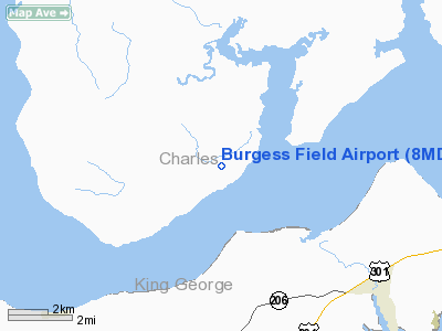
Location & QuickFacts
| FAA Information Effective: | 2008-09-25 |
| Airport Identifier: | 8MD6 |
| Airport Status: | Operational |
| Longitude/Latitude: | 077-08-48.9180W/38-23-49.4480N
-77.146922/38.397069 (Estimated) |
| Elevation: | 35 ft / 10.67 m (Estimated) |
| Land: | 25 acres |
| From nearest city: | 1 nautical miles N of Riverside, MD |
| Location: | Charles County, MD |
| Magnetic Variation: | 09W (1985) |
Owner & Manager
| Ownership: | Privately owned |
| Owner: | Allen G. Burgess |
| Address: | 228 Highland Ave
West Newton, MA 02165 |
| Phone number: | 617-965-6261 |
| Manager: | Allen G. Burgess |
| Address: | 228 Highland Ave
West Newton, MA 02165 |
| Phone number: | 617-332-4236
OR 617-965-6261. |
Airport Operations and Facilities
| Airport Use: | Private |
| Segmented Circle: | No |
| Control Tower: | No |
| Landing fee charge: | No |
| Sectional chart: | Washington |
| Region: | AEA - Eastern |
| Boundary ARTCC: | ZDC - Washington |
| Tie-in FSS: | DCA - Leesburg |
| FSS on Airport: | No |
| FSS Toll Free: | 1-800-WX-BRIEF |
Airport Services
| Airframe Repair: | NONE |
| Power Plant Repair: | NONE |
Runway Information
Runway 15/33
| Dimension: | 2200 x 30 ft / 670.6 x 9.1 m |
| Surface: | GRVL, Poor Condition |
| |
Runway 15 |
Runway 33 |
| Traffic Pattern: | Left | Right |
| Markings: | None, | None, |
| Obstruction: | 60 ft trees, 20.0 ft from runway, 1:1 slope to clear | 60 ft trees, 0.0 ft from runway, 100 ft right of centerline, 1:1 slope to clear |
|
Radio Navigation Aids
| ID |
Type |
Name |
Ch |
Freq |
Var |
Dist |
| EZF | NDB | Shannon | | 237.00 | 10W | 16.3 nm |
| APH | NDB | A P Hill | | 396.00 | 10W | 20.4 nm |
| DC | NDB | Oxonn | | 332.00 | 11W | 22.9 nm |
| VKX | NDB | Potomac | | 241.00 | 10W | 23.0 nm |
| GTN | NDB | Georgetown | | 323.00 | 09W | 32.0 nm |
| CJR | NDB | Culpeper | | 252.00 | 09W | 34.4 nm |
| NHK | NDB | Patuxent | | 400.00 | 10W | 35.7 nm |
| MSQ | NDB | Nailr | | 351.00 | 10W | 35.9 nm |
| IQK | NDB | Louisa | | 382.00 | 09W | 40.5 nm |
| LJK | NDB | Ashey | | 280.00 | 09W | 40.7 nm |
| BUH | NDB | Anne Arundel | | 260.00 | 10W | 45.1 nm |
| GDX | NDB | Goodwin Lake | | 227.00 | 08W | 46.4 nm |
| GAI | NDB | Gaithersburg | | 385.00 | 09W | 46.5 nm |
| DCA | VOR/DME | Washington | 047X | 111.00 | 09W | 28.3 nm |
| BRV | VORTAC | Brooke | 092X | 114.50 | 09W | 10.4 nm |
| OTT | VORTAC | Nottingham | 084X | 113.70 | 10W | 26.5 nm |
| ADW | VORTAC | Andrews | 078X | 113.10 | 10W | 28.0 nm |
| AML | VORTAC | Armel | 082X | 113.50 | 08W | 35.6 nm |
| PXT | VORTAC | Patuxent | 123X | 117.60 | 10W | 35.8 nm |
| CSN | VORTAC | Casanova | 110X | 116.30 | 06W | 36.8 nm |
| ADW | VOT | Andrews Afb | | 109.60 | | 26.6 nm |
| DCA | VOT | Washington National | | 109.40 | | 27.5 nm |
Remarks
- TFC LNDG NW...RGT TURNS,SE...LEFT TURNS.
Images and information placed above are from
http://www.airport-data.com/airport/8MD6/
We thank them for the data!
| General Info
|
| Country |
United States
|
| State |
MARYLAND
|
| FAA ID |
8MD6
|
| Latitude |
38-23-49.448N
|
| Longitude |
077-08-48.918W
|
| Elevation |
35 feet
|
| Near City |
RIVERSIDE
|
We don't guarantee the information is fresh and accurate. The data may
be wrong or outdated.
For more up-to-date information please refer to other sources.
|
|


