 |
|
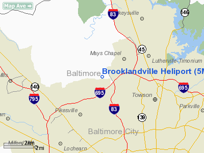
Location & QuickFacts
| FAA Information Effective: | 2008-09-25 |
| Airport Identifier: | 5MD1 |
| Airport Status: | Operational |
| Longitude/Latitude: | 076-40-40.0000W/39-25-00.0000N
-76.677778/39.416667 (Estimated) |
| Elevation: | 312 ft / 95.10 m () |
| Land: | 0 acres |
| From nearest city: | 2 nautical miles NE of Brooklandville, MD |
| Location: | Baltimore County, MD |
| Magnetic Variation: | 11W (1995) |
Owner & Manager
| Ownership: | Privately owned |
| Owner: | Dale M. Lucas |
| Address: | Po Box 1248
Brooklandville, MD 21022 |
| Phone number: | 410-821-5125 |
| Manager: | Dale M. Lucas |
| Address: | 901 Greenspring Valley Rd
Brooklandville, MD 21022 |
| Phone number: | 410-821-5125 |
Airport Operations and Facilities
| Airport Use: | Private |
| Segmented Circle: | No |
| Control Tower: | No |
| Lighting Schedule: | RDO-CTL
ACTVT PERIMETER LGTS & HELIPORT VASI - 122.9. |
| Sectional chart: | Washington |
| Region: | AEA - Eastern |
| Boundary ARTCC: | ZDC - Washington |
| Tie-in FSS: | DCA - Leesburg |
| FSS Toll Free: | 1-800-WX-BRIEF |
Runway Information
Runway 08/26
| Dimension: | 1200 x 120 ft / 365.8 x 36.6 m |
| Surface: | TURF, Fair Condition |
| |
Runway 08 |
Runway 26 |
| Traffic Pattern: | Left | Left |
| Obstruction: | 40 ft tree, 50.0 ft from runway | 40 ft tree, 50.0 ft from runway |
|
Helipad H1
| Dimension: | 90 x 90 ft / 27.4 x 27.4 m |
| Surface: | CONC, |
| |
Runway H1 |
Runway |
| Traffic Pattern: | Left | Left |
|
Radio Navigation Aids
| ID |
Type |
Name |
Ch |
Freq |
Var |
Dist |
| IUB | NDB | Institute | | 404.00 | 08W | 8.2 nm |
| FND | NDB | Ellicott | | 371.00 | 11W | 9.0 nm |
| MTN | NDB | Martin | | 342.00 | 11W | 15.5 nm |
| BUH | NDB | Anne Arundel | | 260.00 | 10W | 20.4 nm |
| GAI | NDB | Gaithersburg | | 385.00 | 09W | 27.1 nm |
| APG | NDB | Aberdeen | | 349.00 | 11W | 27.5 nm |
| EUD | NDB | York | | 254.00 | 11W | 31.6 nm |
| GTN | NDB | Georgetown | | 323.00 | 09W | 35.9 nm |
| VKX | NDB | Potomac | | 241.00 | 10W | 42.2 nm |
| DC | NDB | Oxonn | | 332.00 | 11W | 42.4 nm |
| ESN | NDB | Easton | | 212.00 | 10W | 46.4 nm |
| MTN | TACAN | Martin | 068X | | 11W | 13.4 nm |
| FDK | VOR | Frederick | | 109.00 | 08W | 32.4 nm |
| PPM | VOR/DME | Phillips | 021X | 108.40 | 09W | 23.7 nm |
| DCA | VOR/DME | Washington | 047X | 111.00 | 09W | 37.4 nm |
| EMI | VORTAC | Westminster | 126X | 117.90 | 08W | 14.7 nm |
| BAL | VORTAC | Baltimore | 098X | 115.10 | 11W | 14.8 nm |
| ADW | VORTAC | Andrews | 078X | 113.10 | 10W | 37.7 nm |
| OTT | VORTAC | Nottingham | 084X | 113.70 | 10W | 42.8 nm |
| LRP | VORTAC | Lancaster | 120X | 117.30 | 09W | 45.9 nm |
| AML | VORTAC | Armel | 082X | 113.50 | 08W | 46.8 nm |
| DCA | VOT | Washington National | | 109.40 | | 38.2 nm |
| ADW | VOT | Andrews Afb | | 109.60 | | 38.9 nm |
| MDT | VOT | Harrisburg International | | 110.00 | | 47.1 nm |
Remarks
- PRVDD ONLY ONE OPN AT A TIME, VFR ONLY, CLEAR 20:1 APCH/DEP PATH, FOR NIGHT HELIPORT OPNS GROUND LIGHTING & LGTD WINDSOCK MUST BE PRVDD, VEHICULAR TFC AROUND HELIPORT CONTROLLED, & PILOTS USING ARPT ADVISED OF THESE CONDITIONS.
Images and information placed above are from
http://www.airport-data.com/airport/5MD1/
We thank them for the data!
| General Info
|
| Country |
United States
|
| State |
MARYLAND
|
| FAA ID |
5MD1
|
| Latitude |
39-25-00.000N
|
| Longitude |
076-40-40.000W
|
| Elevation |
312 feet
|
| Near City |
BROOKLANDVILLE
|
We don't guarantee the information is fresh and accurate. The data may
be wrong or outdated.
For more up-to-date information please refer to other sources.
|
|


