 |
|
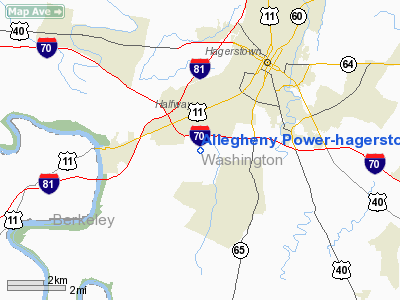
Allegheny Power - Hagerstown Corp Ctr Heliport |
Location & QuickFacts
| FAA Information Effective: | 2008-09-25 |
| Airport Identifier: | 7MD4 |
| Airport Status: | Operational |
| Longitude/Latitude: | 077-45-50.0000W/39-35-57.0000N
-77.763889/39.599167 (Estimated) |
| Elevation: | 578 ft / 176.17 m (Estimated) |
| Land: | 0 acres |
| From nearest city: | 4 nautical miles SW of Hagerstown, MD |
| Location: | Washington County, MD |
| Magnetic Variation: | 10W (1995) |
Owner & Manager
| Ownership: | Privately owned |
| Owner: | Allegheny Power |
| Address: | 10435 Downsville Pike
Hagerstown, MD 21740-1766 |
| Phone number: | 301-790-3400 |
| Manager: | H Edward Peters |
| Address: | 10435 Downsville Pike
Hagerstown, MD 21740-1766 |
| Phone number: | 301-790-6100 |
Airport Operations and Facilities
| Airport Use: | Private |
| Wind indicator: | Yes |
| Segmented Circle: | No |
| Control Tower: | No |
| Sectional chart: | Washington |
| Region: | AEA - Eastern |
| Boundary ARTCC: | ZDC - Washington |
| Tie-in FSS: | DCA - Leesburg |
| FSS Toll Free: | 1-800-WX-BRIEF |
Runway Information
Helipad H1
| Dimension: | 24 x 24 ft / 7.3 x 7.3 m |
| Surface: | CONC, Good Condition |
| |
Runway H1 |
Runway |
| Traffic Pattern: | Left | Left |
|
Radio Navigation Aids
| ID |
Type |
Name |
Ch |
Freq |
Var |
Dist |
| TZ | NDB | Cogan | | 364.00 | 10W | 33.9 nm |
| GAI | NDB | Gaithersburg | | 385.00 | 09W | 37.9 nm |
| GDX | NDB | Goodwin Lake | | 227.00 | 08W | 38.9 nm |
| EUD | NDB | York | | 254.00 | 11W | 45.3 nm |
| CBE | NDB | Cumberland | | 317.00 | 07W | 45.6 nm |
| FND | NDB | Ellicott | | 371.00 | 11W | 49.5 nm |
| HGR | VOR | Hagerstown | | 109.80 | 07W | 7.3 nm |
| FDK | VOR | Frederick | | 109.00 | 08W | 21.2 nm |
| MRB | VORTAC | Martinsburg | 058X | 112.10 | 07W | 13.4 nm |
| THS | VORTAC | St Thomas | 097X | 115.00 | 07W | 21.9 nm |
| EMI | VORTAC | Westminster | 126X | 117.90 | 08W | 36.9 nm |
| AML | VORTAC | Armel | 082X | 113.50 | 08W | 42.3 nm |
| LDN | VORTAC | Linden | 090X | 114.30 | 06W | 49.3 nm |
Remarks
- VFR ONLY; MAINTAIN CLEAR 8:1 APCH SLOPE; INDICATE INRESS/EGRESS ROUTES WITH MARKINGS.
Images and information placed above are from
http://www.airport-data.com/airport/7MD4/
We thank them for the data!
| General Info
|
| Country |
United States
|
| State |
MARYLAND
|
| FAA ID |
7MD4
|
| Latitude |
39-35-57.000N
|
| Longitude |
077-45-50.000W
|
| Elevation |
578 feet
|
| Near City |
HAGERSTOWN
|
We don't guarantee the information is fresh and accurate. The data may
be wrong or outdated.
For more up-to-date information please refer to other sources.
|
|


