 |
|
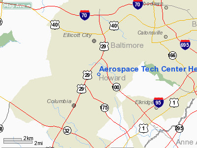
Aerospace Tech Center Heliport |
Location & QuickFacts
| FAA Information Effective: | 2008-09-25 |
| Airport Identifier: | 2MD2 |
| Airport Status: | Operational |
| Longitude/Latitude: | 076-49-33.9050W/39-14-11.3830N
-76.826085/39.236495 (Estimated) |
| Elevation: | 415 ft / 126.49 m (Estimated) |
| Land: | 0 acres |
| From nearest city: | 3 nautical miles NE of Columbia, MD |
| Location: | Howard County, MD |
| Magnetic Variation: | 10W (1984) |
Owner & Manager
| Ownership: | Privately owned |
| Owner: | Allied Corporation |
| Address: | Morristown Municipal Arpt
Morristown, NJ 07960 |
| Phone number: | 201-455-6012 |
| Manager: | Jack Childs |
| Address: | Morristown Municipal Arpt
Morristown, NJ 07960 |
| Phone number: | 201-455-6012 |
Airport Operations and Facilities
| Airport Use: | Private |
| Wind indicator: | Yes |
| Segmented Circle: | No |
| Control Tower: | No |
| Landing fee charge: | No |
| Sectional chart: | Washington |
| Region: | AEA - Eastern |
| Boundary ARTCC: | ZDC - Washington |
| Tie-in FSS: | DCA - Leesburg |
| FSS on Airport: | No |
| FSS Toll Free: | 1-800-WX-BRIEF |
Runway Information
Helipad H1
| Dimension: | 50 x 50 ft / 15.2 x 15.2 m |
| Surface: | ASPH, |
| |
Runway H1 |
Runway |
| Traffic Pattern: | Left | Left |
|
Radio Navigation Aids
| ID |
Type |
Name |
Ch |
Freq |
Var |
Dist |
| FND | NDB | Ellicott | | 371.00 | 11W | 3.8 nm |
| BUH | NDB | Anne Arundel | | 260.00 | 10W | 9.7 nm |
| IUB | NDB | Institute | | 404.00 | 08W | 9.8 nm |
| GAI | NDB | Gaithersburg | | 385.00 | 09W | 16.3 nm |
| MTN | NDB | Martin | | 342.00 | 11W | 21.1 nm |
| GTN | NDB | Georgetown | | 323.00 | 09W | 23.1 nm |
| DC | NDB | Oxonn | | 332.00 | 11W | 29.8 nm |
| VKX | NDB | Potomac | | 241.00 | 10W | 29.9 nm |
| APG | NDB | Aberdeen | | 349.00 | 11W | 38.0 nm |
| EUD | NDB | York | | 254.00 | 11W | 41.2 nm |
| ESN | NDB | Easton | | 212.00 | 10W | 43.8 nm |
| GDX | NDB | Goodwin Lake | | 227.00 | 08W | 49.9 nm |
| MTN | TACAN | Martin | 068X | | 11W | 20.1 nm |
| FDK | VOR | Frederick | | 109.00 | 08W | 27.6 nm |
| DCA | VOR/DME | Washington | 047X | 111.00 | 09W | 24.7 nm |
| PPM | VOR/DME | Phillips | 021X | 108.40 | 09W | 33.4 nm |
| BAL | VORTAC | Baltimore | 098X | 115.10 | 11W | 8.6 nm |
| EMI | VORTAC | Westminster | 126X | 117.90 | 08W | 17.1 nm |
| ADW | VORTAC | Andrews | 078X | 113.10 | 10W | 25.9 nm |
| OTT | VORTAC | Nottingham | 084X | 113.70 | 10W | 32.1 nm |
| AML | VORTAC | Armel | 082X | 113.50 | 08W | 35.0 nm |
| MRB | VORTAC | Martinsburg | 058X | 112.10 | 07W | 48.4 nm |
| DCA | VOT | Washington National | | 109.40 | | 25.4 nm |
| ADW | VOT | Andrews Afb | | 109.60 | | 27.1 nm |
Remarks
- PROVIDED TREE NORTH OF HELIPAD IS REMOVED; OPERATIONS ARE FROM/TO NW & SE ONLY; FIRE PROTECTION IS PROVIDED; VEHICLES & PEDRESTRIANS ARE PROHIBITED FROM AREA.
Images and information placed above are from
http://www.airport-data.com/airport/2MD2/
We thank them for the data!
| General Info
|
| Country |
United States
|
| State |
MARYLAND
|
| FAA ID |
2MD2
|
| Latitude |
39-14-11.383N
|
| Longitude |
076-49-33.905W
|
| Elevation |
415 feet
|
| Near City |
COLUMBIA
|
We don't guarantee the information is fresh and accurate. The data may
be wrong or outdated.
For more up-to-date information please refer to other sources.
|
|


