 |
|
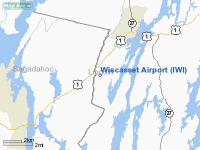
| Wiscasset Airport |
| IATA: ISS – ICAO: KIWI – FAA LID: IWI |
| Summary |
| Airport type |
Public |
| Operator |
Town of Wiscasset |
| Location |
Wiscasset, Maine |
| Elevation AMSL |
70 ft / 21 m |
| Coordinates |
43°57′41″N 069°42′45″W / 43.96139°N 69.7125°W / 43.96139; -69.7125Coordinates: 43°57′41″N 069°42′45″W / 43.96139°N 69.7125°W / 43.96139; -69.7125 |
| Runways |
| Direction |
Length |
Surface |
| ft |
m |
| 7/25 |
3,397 |
1,035 |
Asphalt |
Wiscasset Airport (IATA: ISS, ICAO: KIWI, FAA LID: IWI) is a public-use airport located three miles (5 km) southwest of the central business district of Wiscasset, a town in Lincoln County, Maine, United States. This general aviation airport is publicly owned by Town of Wiscasset. It is currently not served by commercial aircraft, though scheduled air service was once available on Downeast Airlines.
Although most U.S. airports use the same three-letter location identifier for the FAA and IATA, Wiscasset Airport is assigned IWI by the FAA and ISS by the IATA. The airport's ICAO identifier is KIWI.
Facilities
Wiscasset Airport covers an area of 196 acres (79 ha) and has one runway:
- Runway 7/25: 3,397 x 75 ft (1,035 x 23 m), Surface: Asphalt
The above content comes from Wikipedia and is published under free licenses – click here to read more.
Location & QuickFacts
| FAA Information Effective: | 2008-09-25 |
| Airport Identifier: | IWI |
| Airport Status: | Operational |
| Longitude/Latitude: | 069-42-45.2000W/43-57-41.1000N
-69.712556/43.961417 (Estimated) |
| Elevation: | 70 ft / 21.34 m (Surveyed) |
| Land: | 196 acres |
| From nearest city: | 3 nautical miles SW of Wiscasset, ME |
| Location: | Lincoln County, ME |
| Magnetic Variation: | 18W (1985) |
Owner & Manager
| Ownership: | Publicly owned |
| Owner: | Town Of Wiscasset |
| Address: | 51 Bath Rd
Wiscasset, ME 04578 |
| Phone number: | 207-882-5475 |
| Manager: | Ervin Deck |
| Address: | 96 Chewonki Neck Road, 51 Bath Rd
Wiscasset, ME 04578 |
| Phone number: | 207-449-3172
207-504-2357 (CELL) |
Airport Operations and Facilities
| Airport Use: | Open to public |
| Wind indicator: | Yes |
| Segmented Circle: | Yes |
| Control Tower: | No |
| Lighting Schedule: | DUSK-DAWN
ACTVT MIRL RY 07/25; PAPI RYS 07 & 25; REIL RY 25 - CTAF. |
| Beacon Color: | Clear-Green (lighted land airport) |
| Landing fee charge: | No |
| Sectional chart: | New York |
| Region: | ANE - New England |
| Traffic Pattern Alt: | 1000 ft |
| Boundary ARTCC: | ZBW - Boston |
| Tie-in FSS: | BGR - Bangor |
| FSS on Airport: | No |
| FSS Toll Free: | 1-800-WX-BRIEF |
| NOTAMs Facility: | IWI (NOTAM-d service avaliable) |
| Federal Agreements: | NGY |
Airport Communications
| CTAF: | 122.800 |
| Unicom: | 122.800 |
Airport Services
| Fuel available: | 100LLA
24 HR CREDIT CARD FUEL OPN. |
| Airframe Repair: | MAJOR |
| Power Plant Repair: | MINOR |
| Bottled Oxygen: | NONE |
| Bulk Oxygen: | NONE |
Runway Information
Runway 07/25
| Dimension: | 3397 x 75 ft / 1035.4 x 22.9 m |
| Surface: | ASPH, Good Condition |
| Weight Limit: | Single wheel: 22000 lbs. |
| Edge Lights: | Medium |
| |
Runway 07 |
Runway 25 |
| Longitude: | 069-43-03.4640W | 069-42-27.0050W |
| Latitude: | 43-57-30.6840N | 43-57-51.4720N |
| Elevation: | 70.00 ft | 56.00 ft |
| Alignment: | 52 | 127 |
| Traffic Pattern: | Left | Right |
| Markings: | Non-precision instrument, Poor Condition
MARKINGS FADED. | Non-precision instrument, Poor Condition
MARKINGS FADED. |
| Crossing Height: | 40.00 ft | 40.00 ft |
| VASI: | 4-light PAPI on left side | 4-light PAPI on left side |
| Visual Glide Angle: | 4.00° | 3.50° |
| Runway End Identifier: | No | Yes |
| Centerline Lights: | No | No |
| Touchdown Lights: | No | No |
| Obstruction: | 60 ft trees, 268.0 ft from runway, 225 ft right of centerline, 1:1 slope to clear | 70 ft trees, 1440.0 ft from runway, 17:1 slope to clear
6 FOOT TREE, 41 FEET OUT, 152 FEET RIGHT. |
|
Radio Navigation Aids
| ID |
Type |
Name |
Ch |
Freq |
Var |
Dist |
| PH | MARINE NDB | Portland Lhb-p | | 301.00 | 17W | 30.9 nm |
| ISS | NDB | Wiscasset | | 407.00 | 18W | 3.4 nm |
| SUH | NDB | Sprucehead | | 356.00 | 18W | 26.8 nm |
| RL | NDB | Bracy | | 399.00 | 18W | 30.0 nm |
| BST | NDB | Belfast | | 278.00 | 18W | 40.6 nm |
| SZO | NDB | Sebago | | 227.00 | 17W | 46.4 nm |
| BUP | NDB | Burnham | | 348.00 | 18W | 46.8 nm |
| NHZ | TACAN | Brunswick | 099X | | 17W | 10.5 nm |
| AUG | VOR/DME | Augusta | 051X | 111.40 | 18W | 21.9 nm |
| PWM | VOT | Portland Intl Jetport | | 111.00 | | 32.5 nm |
Remarks
- NOISE SENSITIVE AREA OFF END OF RY 07. ARPT HAS NOISE ABATEMENT PROCEDURES CTC AMGR 207-882-5475.
- DEER ON & INVOF ARPT.
- FILED FOR RECORD PURPOSES ONLY.
Images and information placed above are from
http://www.airport-data.com/airport/IWI/
We thank them for the data!
| General Info
|
| Country |
United States
|
| State |
MAINE
|
| FAA ID |
IWI
|
| Latitude |
43-57-41.100N
|
| Longitude |
069-42-45.200W
|
| Elevation |
70 feet
|
| Near City |
WISCASSET
|
We don't guarantee the information is fresh and accurate. The data may
be wrong or outdated.
For more up-to-date information please refer to other sources.
|
|


