 |
|
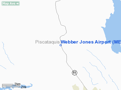
Location & QuickFacts
| FAA Information Effective: | 2008-09-25 |
| Airport Identifier: | ME03 |
| Airport Status: | Operational |
| Longitude/Latitude: | 069-03-03.1480W/45-20-10.1830N
-69.050874/45.336162 (Estimated) |
| Elevation: | 400 ft / 121.92 m (Estimated) |
| Land: | 0 acres |
| From nearest city: | 2 nautical miles NW of Brownville, ME |
| Location: | Piscataquis County, ME |
| Magnetic Variation: | 19W (1985) |
Owner & Manager
| Ownership: | Privately owned |
| Owner: | Donna Jones |
| Address: |
Brownville, ME 04414 |
| Phone number: | 207-965-3341 |
| Manager: | Donna Jones |
| Address: | Rr 1 Box 930
Brownville, ME 04414 |
| Phone number: | 207-965-3341 |
Airport Operations and Facilities
| Airport Use: | Private |
| Wind indicator: | Yes |
| Segmented Circle: | No |
| Control Tower: | No |
| Landing fee charge: | No |
| Sectional chart: | Montreal |
| Region: | ANE - New England |
| Boundary ARTCC: | ZBW - Boston |
| Tie-in FSS: | BGR - Bangor |
| FSS on Airport: | No |
| FSS Toll Free: | 1-800-WX-BRIEF |
Airport Services
| Airframe Repair: | NONE |
| Power Plant Repair: | NONE |
Runway Information
Runway 01/19
| Dimension: | 2500 x 40 ft / 762.0 x 12.2 m |
| Surface: | GRVL, Good Condition |
| |
Runway 01 |
Runway 19 |
| Traffic Pattern: | Left | Left |
| Markings: | None, | None, |
| Obstruction: | 55 ft trees, 50.0 ft from runway | 35 ft bldg, 240.0 ft from runway, 60 ft right of centerline, 6:1 slope to clear |
|
Radio Navigation Aids
| ID |
Type |
Name |
Ch |
Freq |
Var |
Dist |
| LRG | NDB | Lincoln | | 216.00 | 19W | 21.7 nm |
| OLD | NDB | Old Town | | 272.00 | 20W | 26.6 nm |
| LNT | NDB | Milnot | | 344.00 | 19W | 28.2 nm |
| XQA | NDB | Squaw | | 236.00 | 18W | 28.6 nm |
| BUP | NDB | Burnham | | 348.00 | 18W | 40.6 nm |
| MLT | VOR/DME | Millinocket | 126X | 117.90 | 20W | 27.1 nm |
| BGR | VORTAC | Bangor | 095X | 114.80 | 19W | 30.6 nm |
| BGR | VOT | Bangor | | 111.00 | | 33.6 nm |
Remarks
Images and information placed above are from
http://www.airport-data.com/airport/ME03/
We thank them for the data!
| General Info
|
| Country |
United States
|
| State |
MAINE
|
| FAA ID |
ME03
|
| Latitude |
45-20-10.183N
|
| Longitude |
069-03-03.148W
|
| Elevation |
400 feet
|
| Near City |
BROWNVILLE
|
We don't guarantee the information is fresh and accurate. The data may
be wrong or outdated.
For more up-to-date information please refer to other sources.
|
|


