 |
|
| Auburn/Lewiston Municipal Airport |
| IATA: 3B5 – ICAO: none |
| Summary |
| Airport type |
Public |
| Operator |
Turner Aviation Co, Inc. |
| Location |
Turner, Maine |
| Elevation AMSL |
356 ft / 108.5 m |
| Coordinates |
44°11′20.200″N 70°13′58.300″W / 44.188944°N 70.232861°W / 44.188944; -70.232861Coordinates: 44°11′20.200″N 70°13′58.300″W / 44.188944°N 70.232861°W / 44.188944; -70.232861 |
| Runways |
| Direction |
Length |
Surface |
| ft |
m |
| 12/30 |
2,104 |
641 |
Asphalt |
| 11/29 |
2,151 |
656 |
Turf |
| 4W/22W |
10,000 |
3,048 |
Water |
| 15W/33W |
5,000 |
1,524 |
Water |
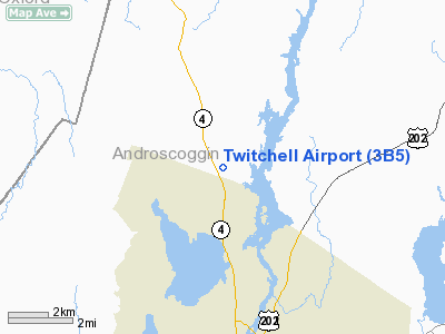
Twitchell Airport, (IATA: 3B5) (aka Twitchell's Airport/Seaplane Base) in Turner, Maine, United States, is a public, privately owned airport. It has one asphalt runway, one turf, and Androscoggin River access for water landings. It averages 98 flights per day, and has approximately 73 aircraft based on its field.
Twitchell Airport has a Fixed Based Operator (FBO) which is Turner Aviation. Services available include fuel, repairs, rentals and training.
The above content comes from Wikipedia and is published under free licenses – click here to read more.
Location & QuickFacts
| FAA Information Effective: | 2008-09-25 |
| Airport Identifier: | 3B5 |
| Airport Status: | Operational |
| Longitude/Latitude: | 070-13-58.3000W/44-11-20.2000N
-70.232861/44.188944 (Estimated) |
| Elevation: | 356 ft / 108.51 m (Surveyed) |
| Land: | 145 acres |
| From nearest city: | 4 nautical miles S of Turner, ME |
| Location: | Androscoggin County, ME |
| Magnetic Variation: | 17W (1985) |
Owner & Manager
| Ownership: | Privately owned |
| Owner: | Crosswinds Air |
| Address: | 40 Airport Road
Turner, ME 04282 |
| Phone number: | 207-225-3490 |
| Manager: | Dale Twitchell |
| Address: | 40 Airport Road
Turner, ME 04282 |
| Phone number: | 207-225-3490 |
Airport Operations and Facilities
| Airport Use: | Open to public |
| Wind indicator: | Yes |
| Segmented Circle: | No |
| Control Tower: | No |
| Landing fee charge: | No |
| Sectional chart: | New York |
| Region: | ANE - New England |
| Boundary ARTCC: | ZBW - Boston |
| Tie-in FSS: | BGR - Bangor |
| FSS on Airport: | No |
| FSS Toll Free: | 1-800-WX-BRIEF |
| NOTAMs Facility: | BGR (NOTAM-d service avaliable) |
Airport Communications
| CTAF: | 122.800 |
| Unicom: | 122.800 |
Airport Services
| Fuel available: | 100LL
FOR FUEL, MAINTENANCE OR SEAPLANE INFO CALL 207-225-3490. |
| Airframe Repair: | MAJOR |
| Power Plant Repair: | MAJOR |
| Bottled Oxygen: | NONE |
| Bulk Oxygen: | NONE |
Runway Information
Runway 04W/22W
| Dimension: | 10000 x 1000 ft / 3048.0 x 304.8 m |
| Surface: | WATER, |
| |
Runway 04W |
Runway 22W |
| Traffic Pattern: | Left | Left |
| Obstruction: | 50 ft trees, 1000.0 ft from runway, 20:1 slope to clear | 50 ft trees, 1000.0 ft from runway, 20:1 slope to clear |
|
Runway 11/29
| Dimension: | 2151 x 100 ft / 655.6 x 30.5 m |
| Surface: | TURF, Good Condition |
| |
Runway 11 |
Runway 29 |
| Longitude: | 070-14-14.2667W | 070-13-45.2725W |
| Latitude: | 44-11-20.8805N | 44-11-16.8859N |
| Elevation: | 354.00 ft | 349.00 ft |
| Traffic Pattern: | Left | Left |
| Markings: | None, | None, |
| Obstruction: | 15 ft road, 15.0 ft from runway, 1:1 slope to clear | 50 ft trees, 580.0 ft from runway, 11:1 slope to clear |
|
Runway 12/30
| Dimension: | 2104 x 50 ft / 641.3 x 15.2 m |
| Surface: | ASPH, Good Condition |
| Weight Limit: | Single wheel: 8500 lbs. |
| |
Runway 12 |
Runway 30 |
| Longitude: | 070-14-10.3598W | 070-13-43.2327W |
| Latitude: | 44-11-25.1339N | 44-11-18.0172N |
| Elevation: | 355.00 ft | 350.00 ft |
| Traffic Pattern: | Left | Left |
| Markings: | Basic, Good Condition
NRS & CNTRLN SMALLER THAN STANDARD. | Basic, Good Condition
NRS & CNTRLN SMALLER THAN STANDARD. |
| Obstruction: | 50 ft trees, 201.0 ft from runway, 50 ft right of centerline
+50 FT TREES 0-200 FT 50 FT LEFT. | 40 ft trees, 200.0 ft from runway, 60 ft right of centerline
+5 FT BRUSH 190 FT FM THLD ON CNTRLN; +40 FT TREES 0-200 FT FM THLD 100 FT RIGHT; +4 FT FENCE 175 FT FM THLD 90 FT RIGHT. |
|
Runway 15W/33W
| Dimension: | 5000 x 1000 ft / 1524.0 x 304.8 m |
| Surface: | WATER, |
| |
Runway 15W |
Runway 33W |
| Traffic Pattern: | Left | Left |
|
Radio Navigation Aids
| ID |
Type |
Name |
Ch |
Freq |
Var |
Dist |
| SZO | FAN MARKER | Grinn | | | 17W | 31.3 nm |
| PH | MARINE NDB | Portland Lhb-p | | 301.00 | 17W | 40.3 nm |
| RL | NDB | Bracy | | 399.00 | 18W | 26.9 nm |
| ISS | NDB | Wiscasset | | 407.00 | 18W | 28.4 nm |
| SZO | NDB | Sebago | | 227.00 | 17W | 29.3 nm |
| HXK | NDB | Hornebrook | | 281.00 | 17W | 46.9 nm |
| BUP | NDB | Burnham | | 348.00 | 18W | 48.4 nm |
| SUH | NDB | Sprucehead | | 356.00 | 18W | 49.4 nm |
| NHZ | TACAN | Brunswick | 099X | | 17W | 23.2 nm |
| AUG | VOR/DME | Augusta | 051X | 111.40 | 18W | 20.4 nm |
| BML | VOR/DME | Berlin | 041X | 110.40 | 17W | 48.9 nm |
| ENE | VORTAC | Kennebunk | 118X | 117.10 | 17W | 48.8 nm |
| PWM | VOT | Portland Intl Jetport | | 111.00 | | 33.1 nm |
Remarks
- EMERGENCY PHONE: 207-754-1160.
- EXISTED PRIOR TO 1959. HEL: FILED FOR RECORD PURPOSES ONLY.
Images and information placed above are from
http://www.airport-data.com/airport/3B5/
We thank them for the data!
| General Info
|
| Country |
United States
|
| State |
MAINE
|
| FAA ID |
3B5
|
| Latitude |
44-11-20.200N
|
| Longitude |
070-13-58.300W
|
| Elevation |
356 feet
|
| Near City |
TURNER
|
We don't guarantee the information is fresh and accurate. The data may
be wrong or outdated.
For more up-to-date information please refer to other sources.
|
|


