 |
|
Location & QuickFacts
| FAA Information Effective: | 2008-09-25 |
| Airport Identifier: | ME26 |
| Airport Status: | Operational |
| Longitude/Latitude: | 070-21-47.1810W/43-40-05.2910N
-70.363106/43.668136 (Estimated) |
| Elevation: | 85 ft / 25.91 m (Estimated) |
| Land: | 5 acres |
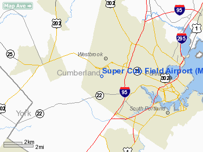
| From nearest city: | 1 nautical miles S of Westbrook, ME |
| Location: | Cumberland County, ME |
| Magnetic Variation: | 17W (1985) |
Owner & Manager
| Ownership: | Privately owned |
| Owner: | Daniel F Chick |
| Address: | 95 Maple St
Westbrook, ME 04092 |
| Phone number: | 207-854-8067 |
| Manager: | Daniel F Chick |
| Address: | 95 Maple St
Westbrook, ME 04092 |
| Phone number: | 207-854-8067 |
Airport Operations and Facilities
| Airport Use: | Private
PERSONAL USE |
| Segmented Circle: | No |
| Control Tower: | No |
| Sectional chart: | New York |
| Region: | ANE - New England |
| Boundary ARTCC: | ZBW - Boston |
| Tie-in FSS: | BGR - Bangor |
| FSS Toll Free: | 1-800-WX-BRIEF |
Runway Information
Runway 12/30
| Dimension: | 1100 x 50 ft / 335.3 x 15.2 m |
| Surface: | TURF, |
| |
Runway 12 |
Runway 30 |
| Traffic Pattern: | Left | Left |
| Obstruction: | 50 ft trees, 500.0 ft from runway | 50 ft pline, 500.0 ft from runway |
|
Radio Navigation Aids
| ID |
Type |
Name |
Ch |
Freq |
Var |
Dist |
| SZO | FAN MARKER | Grinn | | | 17W | 28.4 nm |
| LCI | FAN MARKER | Laconia | | | | 47.3 nm |
| PH | MARINE NDB | Portland Lhb-p | | 301.00 | 17W | 14.6 nm |
| SZO | NDB | Sebago | | 227.00 | 17W | 23.1 nm |
| ESG | NDB | Rollins | | 260.00 | 16W | 33.7 nm |
| ISS | NDB | Wiscasset | | 407.00 | 18W | 36.6 nm |
| NHZ | TACAN | Brunswick | 099X | | 17W | 22.8 nm |
| PSM | VOR/DME | Pease | 112X | 116.50 | 16W | 40.6 nm |
| AUG | VOR/DME | Augusta | 051X | 111.40 | 18W | 46.2 nm |
| ENE | VORTAC | Kennebunk | 118X | 117.10 | 17W | 18.2 nm |
| PWM | VOT | Portland Intl Jetport | | 111.00 | | 2.6 nm |
Remarks
- DAYTIME VFR USE ONLY; FLW PROVISIONS FOR OPNS WI PORTLAND ATCT ARSA.
Images and information placed above are from
http://www.airport-data.com/airport/ME26/
We thank them for the data!
| General Info
|
| Country |
United States
|
| State |
MAINE
|
| FAA ID |
ME26
|
| Latitude |
43-40-05.291N
|
| Longitude |
070-21-47.181W
|
| Elevation |
85 feet
|
| Near City |
WESTBROOK
|
We don't guarantee the information is fresh and accurate. The data may
be wrong or outdated.
For more up-to-date information please refer to other sources.
|
|


