 |
|
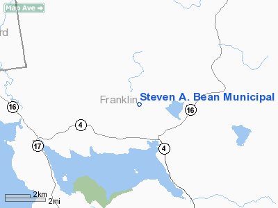
Steven A. Bean Municipal Airport |
Location & QuickFacts
| FAA Information Effective: | 2008-09-25 |
| Airport Identifier: | 8B0 |
| Airport Status: | Operational |
| Longitude/Latitude: | 070-39-52.6490W/44-59-30.8220N
-70.664625/44.991895 (Estimated) |
| Elevation: | 1825 ft / 556.26 m (Estimated) |
| Land: | 125 acres |
| From nearest city: | 2 nautical miles NW of Rangeley, ME |
| Location: | Franklin County, ME |
| Magnetic Variation: | 18W (1985) |
Owner & Manager
| Ownership: | Publicly owned |
| Owner: | Town Of Rangeley |
| Address: | Town Office
Rangeley, ME 04970 |
| Phone number: | 207-864-3326 |
| Manager: | Perry Ellsworth
TOWN MANAGER ALSO ARPT MGR. |
| Address: | 15 School Street
Rangeley, ME 04970 |
| Phone number: | 207-864-2257 |
Airport Operations and Facilities
| Airport Use: | Open to public |
| Wind indicator: | Yes |
| Segmented Circle: | Yes |
| Control Tower: | No |
| Lighting Schedule: | DUSK-DAWN
ACTVT MIRL RWY 14/32 & REIL RWY 32 - 122.8. |
| Beacon Color: | Clear-Green (lighted land airport) |
| Landing fee charge: | No |
| Sectional chart: | Montreal |
| Region: | ANE - New England |
| Boundary ARTCC: | ZBW - Boston |
| Tie-in FSS: | BGR - Bangor |
| FSS on Airport: | No |
| FSS Toll Free: | 1-800-WX-BRIEF |
| NOTAMs Facility: | BGR (NOTAM-d service avaliable) |
| Federal Agreements: | NGY |
Airport Communications
| CTAF: | 122.800 |
| Unicom: | 122.800 |
Airport Services
| Fuel available: | 100LLA
FOR FUEL CALL 207-864-5307. |
| Airframe Repair: | MINOR |
| Power Plant Repair: | MINOR |
| Bottled Oxygen: | NONE |
| Bulk Oxygen: | NONE |
Runway Information
Runway 14/32
| Dimension: | 3200 x 75 ft / 975.4 x 22.9 m |
| Surface: | ASPH, Good Condition |
| Weight Limit: | Single wheel: 13000 lbs. |
| Edge Lights: | Medium |
| |
Runway 14 |
Runway 32 |
| Longitude: | 070-40-11.7790W | 070-39-33.5190W |
| Latitude: | 44-59-38.9030N | 44-59-22.7410N |
| Elevation: | 1823.00 ft | 1818.00 ft |
| Alignment: | 121 | 127 |
| Traffic Pattern: | Left | Left |
| Markings: | Non-precision instrument, Good Condition | Non-precision instrument, Good Condition |
| Runway End Identifier: | No | Yes |
| Centerline Lights: | No | No |
| Touchdown Lights: | No | No |
| Obstruction: | , 50:1 slope to clear | 24 ft tree, 1080.0 ft from runway, 260 ft left of centerline, 37:1 slope to clear |
|
Radio Navigation Aids
| ID |
Type |
Name |
Ch |
Freq |
Var |
Dist |
| RQM | NDB | Rangeley | | 221.00 | 18W | 5.0 nm |
| HXK | NDB | Hornebrook | | 281.00 | 17W | 33.2 nm |
| BML | VOR/DME | Berlin | 041X | 110.40 | 17W | 31.0 nm |
Remarks
- RAMP AREA ADJACENT TO FUEL PUMPS SUBJECT TO SEVERE FROST HEAVES.
- MIGRATORY BIRDS ON & INVOF ARPT.
- MILITARY OPERATIONS IN AREA (F16 & A-10 AIRCRAFT).
- EXISTED PRIOR TO 1959.
Images and information placed above are from
http://www.airport-data.com/airport/8B0/
We thank them for the data!
| General Info
|
| Country |
United States
|
| State |
MAINE
|
| FAA ID |
8B0
|
| Latitude |
44-59-30.822N
|
| Longitude |
070-39-52.649W
|
| Elevation |
1825 feet
|
| Near City |
RANGELEY
|
We don't guarantee the information is fresh and accurate. The data may
be wrong or outdated.
For more up-to-date information please refer to other sources.
|
|


