|
|
Pittsfield Municipal Airport |
176 Harrison Avenue
Pittsfield, ME 04967
p (207) 487-5213
f (207) 487-6917
E-mail: fly@curtisair.com
WEB: http://www.pittsfield.org/
Pittsfield Municipal Airport (FAA LID: 2B7) is a town owned, public use airport located one nautical mile (2 km) southeast of the central business district of Pittsfield, a town in Somerset County, Maine, United States. It is included in the National Plan of Integrated Airport Systems for 2011–2015, which categorized it as a general aviation facility.
Facilities and aircraft
Pittsfield Municipal Airport covers an area of 325 acres (132 ha) at an elevation of 197 feet (60 m) above mean sea level. It has one runway designated 18/36 with an asphalt surface measuring 4,003 by 100 feet (1,220 x 30 m).
For the 12-month period ending August 13, 2011, the airport had 8,700 aircraft operations, an average of 23 per day: 99% general aviation and 1% air taxi. At that time there were 43 aircraft based at this airport: 77% single-engine, 14% multi-engine, and 9% glider.
| Pittsfield Municipal Airport |
| IATA: none – ICAO: none – FAA LID: 2B7 |
| Summary |
| Airport type |
Public |
| Owner |
Town of Pittsfield |
| Serves |
Pittsfield, Maine |
| Elevation AMSL |
197 ft / 60 m |
| Coordinates |
44°46′07″N 069°22′28″W |
| Map |
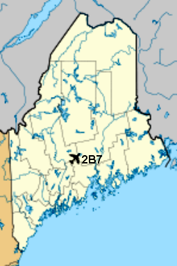
|
Location of airport in Maine |
| Runways |
| Direction |
Length |
Surface |
| ft |
m |
| 18/36 |
4,003 |
1,220 |
Asphalt |
| Statistics (2011) |
| Aircraft operations |
8,700 |
| Based aircraft |
43 |
Information - http://en.wikipedia.org/wiki/Pittsfield_Municipal_Airport_%28Maine%29
Location & QuickFacts
| FAA Information Effective: | 2008-09-25 |
| Airport Identifier: | 2B7 |
| Airport Status: | Operational |
| Longitude/Latitude: | 069-22-27.9000W/44-46-06.7000N
-69.374417/44.768528 (Estimated) |
| Elevation: | 198 ft / 60.35 m (Surveyed) |
| Land: | 325 acres |
| From nearest city: | 1 nautical miles SE of Pittsfield, ME |
| Location: | Somerset County, ME |
| Magnetic Variation: | 18W (1980) |
Owner & Manager
| Ownership: | Publicly owned |
| Owner: | Town Of Pittsfield |
| Address: | 16 Park Street
Pittsfield, ME 04967 |
| Phone number: | 207-487-3136 |
| Manager: | Kathryn Ruth
TOWN MANAGER. |
| Address: | 16 Park Street
Pittsfield, ME 04967 |
| Phone number: | 207-487-3136 |
Airport Operations and Facilities
| Airport Use: | Open to public |
| Wind indicator: | Yes |
| Segmented Circle: | Yes |
| Control Tower: | No |
| Lighting Schedule: | DUSK-DAWN
ACTVT MIRL RY 01/19 & REIL RYS 01 & 19 - CTAF. |
| Beacon Color: | Clear-Green (lighted land airport) |
| Landing fee charge: | No |
| Sectional chart: | Montreal |
| Region: | ANE - New England |
| Boundary ARTCC: | ZBW - Boston |
| Tie-in FSS: | BGR - Bangor |
| FSS on Airport: | No |
| FSS Toll Free: | 1-800-WX-BRIEF |
| NOTAMs Facility: | BGR (NOTAM-d service avaliable) |
| Federal Agreements: | NGY3 |
Airport Communications
| CTAF: | 122.800 |
| Unicom: | 122.800 |
Airport Services
| Fuel available: | 100LLA |
| Airframe Repair: | MAJOR |
| Power Plant Repair: | MAJOR |
| Bottled Oxygen: | NONE |
| Bulk Oxygen: | NONE |
Runway Information
Runway 01/19
| Dimension: | 4000 x 100 ft / 1219.2 x 30.5 m |
| Surface: | ASPH, Good Condition |
| Weight Limit: | Single wheel: 38000 lbs.
Dual wheel: 49000 lbs. |
| Edge Lights: | Medium |
| |
Runway 01 |
Runway 19 |
| Longitude: | 069-22-21.9100W | 069-22-33.9410W |
| Latitude: | 44-45-47.4240N | 44-46-25.9570N |
| Elevation: | 175.00 ft | 198.00 ft |
| Alignment: | 127 | 127 |
| Traffic Pattern: | Left | Left |
| Markings: | Non-precision instrument, Good Condition | Basic, Good Condition |
| VASI: | 4-light PAPI on left side | |
| Runway End Identifier: | Yes | Yes |
| Centerline Lights: | No | No |
| Touchdown Lights: | No | No |
| Obstruction: | 36 ft trees, 1750.0 ft from runway, 170 ft left of centerline, 43:1 slope to clear | 34 ft trees, 940.0 ft from runway, 21:1 slope to clear |
|
Radio Navigation Aids
| ID |
Type |
Name |
Ch |
Freq |
Var |
Dist |
| BUP | NDB | Burnham | | 348.00 | 18W | 4.3 nm |
| RL | NDB | Bracy | | 399.00 | 18W | 24.1 nm |
| BST | NDB | Belfast | | 278.00 | 18W | 26.5 nm |
| OLD | NDB | Old Town | | 272.00 | 20W | 34.7 nm |
| SUH | NDB | Sprucehead | | 356.00 | 18W | 44.7 nm |
| XQA | NDB | Squaw | | 236.00 | 18W | 47.0 nm |
| BH | NDB | Surry | | 330.00 | 19W | 47.7 nm |
| ISS | NDB | Wiscasset | | 407.00 | 18W | 48.6 nm |
| AUG | VOR/DME | Augusta | 051X | 111.40 | 18W | 32.5 nm |
| BGR | VORTAC | Bangor | 095X | 114.80 | 19W | 21.8 nm |
| BGR | VOT | Bangor | | 111.00 | | 24.2 nm |
Remarks
- DEER ON ALL RWYS AT NIGHT.
- PARACHUTE ACTIVITY ON WEEKENDS AT ARPT.
- FBO: CURTIS AIR: 207-487-5213.
- EXISTED PRIOR TO 1959.
Images and information placed above are from
http://www.airport-data.com/airport/2B7/
http://en.wikipedia.org/wiki/Pittsfield_Municipal_Airport_%28Maine%29
We thank them for the data!
| General Info
|
| Country |
United States
|
| State |
MAINE
|
| FAA ID |
2B7
|
| Latitude |
44-46-06.700N
|
| Longitude |
069-22-27.900W
|
| Elevation |
198 feet
|
| Near City |
PITTSFIELD
|
We don't guarantee the information is fresh and accurate. The data may
be wrong or outdated.
For more up-to-date information please refer to other sources.
|
|