 |
|
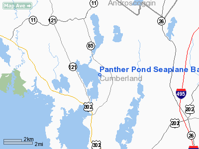
Panther Pond Seaplane Base |
Location & QuickFacts
| FAA Information Effective: | 2008-09-25 |
| Airport Identifier: | ME09 |
| Airport Status: | Operational |
| Longitude/Latitude: | 070-27-11.2000W/43-55-48.2670N
-70.453111/43.930074 (Estimated) |
| Elevation: | 277 ft / 84.43 m (Estimated) |
| Land: | 0 acres |
| From nearest city: | 2 nautical miles N of Raymond, ME |
| Location: | Cumberland County, ME |
| Magnetic Variation: | 17W (1985) |
Owner & Manager
| Ownership: | Privately owned |
| Owner: | William J Fielding Iii |
| Address: | Box 0364
Scarborough, ME 04070-0364 |
| Phone number: | 207-883-3194 |
| Manager: | William J. Fielding Ii |
| Address: | Box 0364
Scarborough, ME 04070-0364 |
| Phone number: | 207-883-3194 |
Airport Operations and Facilities
| Airport Use: | Private |
| Segmented Circle: | No |
| Control Tower: | No |
| Sectional chart: | New York |
| Region: | ANE - New England |
| Boundary ARTCC: | ZBW - Boston |
| Tie-in FSS: | BGR - Bangor |
| FSS Toll Free: | 1-800-WX-BRIEF |
Runway Information
Runway 01/19
| Dimension: | 8200 x 1000 ft / 2499.4 x 304.8 m |
| Surface: | WATER, |
| |
Runway 01 |
Runway 19 |
| Traffic Pattern: | Left | Left |
|
Runway 13/31
| Dimension: | 7000 x 3000 ft / 2133.6 x 914.4 m |
| Surface: | WATER, |
| |
Runway 13 |
Runway 31 |
| Traffic Pattern: | Left | Left |
|
Radio Navigation Aids
| ID |
Type |
Name |
Ch |
Freq |
Var |
Dist |
| SZO | FAN MARKER | Grinn | | | 17W | 18.6 nm |
| LCI | FAN MARKER | Laconia | | | | 48.1 nm |
| PH | MARINE NDB | Portland Lhb-p | | 301.00 | 17W | 28.9 nm |
| SZO | NDB | Sebago | | 227.00 | 17W | 14.3 nm |
| ISS | NDB | Wiscasset | | 407.00 | 18W | 35.3 nm |
| RL | NDB | Bracy | | 399.00 | 18W | 44.4 nm |
| ESG | NDB | Rollins | | 260.00 | 16W | 45.7 nm |
| HXK | NDB | Hornebrook | | 281.00 | 17W | 49.9 nm |
| NHZ | TACAN | Brunswick | 099X | | 17W | 23.3 nm |
| AUG | VOR/DME | Augusta | 051X | 111.40 | 18W | 36.8 nm |
| ENE | VORTAC | Kennebunk | 118X | 117.10 | 17W | 31.1 nm |
| PWM | VOT | Portland Intl Jetport | | 111.00 | | 18.3 nm |
Remarks
Images and information placed above are from
http://www.airport-data.com/airport/ME09/
We thank them for the data!
| General Info
|
| Country |
United States
|
| State |
MAINE
|
| FAA ID |
ME09
|
| Latitude |
43-55-48.267N
|
| Longitude |
070-27-11.200W
|
| Elevation |
277 feet
|
| Near City |
RAYMOND
|
We don't guarantee the information is fresh and accurate. The data may
be wrong or outdated.
For more up-to-date information please refer to other sources.
|
|


