 |
|
Northern Aroostook Regional Airport |
Coordinates: 47°17′08″N 068°18′46″W / 47.28556°N 68.31278°W / 47.28556; -68.31278
| Northern Aroostook Regional Airport |
| IATA: WFK – ICAO: KFVE – FAA LID: FVE |
| Summary |
| Airport type |
Public |
| Owner |
Northern Aroostook Regional Airport Authority |
| Serves |
Frenchville, Maine |
| Elevation AMSL |
988 ft / 301 m |
| Runways |
| Direction |
Length |
Surface |
| ft |
m |
| 14/32 |
4,601 |
1,402 |
Asphalt |
| Statistics (2005) |
| Aircraft operations |
1,400 |
| Source: Federal Aviation Administration |
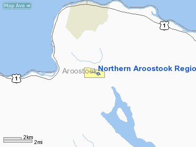
Northern Aroostook Regional Airport (IATA: WFK, ICAO: KFVE, FAA LID: FVE) is a public airport located three miles (5 km) east of the central business district of Frenchville, a town in Aroostook County, Maine, United States. It is owned by the Northern Aroostook Regional Airport Authority.
The airport serves the Madawaska and Fort Kent regions and, to a lesser extent, parts of New Brunswick, Canada. It once had scheduled air service to Boston and Portland via Presque Isle on Aroostook Airways in the 1970s, and via Northeast Express Regional Airlines operating as Northwest Airlink in the 1980s and 1990s. Commercial service to Portland International Jetport via Augusta State Airport and Northern Maine Regional Airport at Presque Isle on New England Air Transport began in September, 2008.
Although most U.S. airports use the same three-letter location identifier for the FAA and IATA, Northern Aroostook Regional Airport is assigned FVE by the FAA and WFK by the IATA. Facilities and aircraft
Northern Aroostook Regional Airport covers an area of 533 acres (216 ha) which contains one runway designated 14/32 with a 4,601 x 75 ft (1,402 x 23 m) asphalt surface. For the 12-month period ending December 31, 2005, the airport had 1,400 aircraft operations: 59% general aviation and 41% air taxi.
Airlines and destinations
No current commercial service. Service ended when New England Air Transport stopped commercial services at the end for 2009, citing the high fuel prices and degrading economy.
The above content comes from Wikipedia and is published under free licenses – click here to read more.
Location & QuickFacts
| FAA Information Effective: | 2008-09-25 |
| Airport Identifier: | FVE |
| Airport Status: | Operational |
| Longitude/Latitude: | 068-18-45.9000W/47-17-07.8150N
-68.312750/47.285504 (Estimated) |
| Elevation: | 988 ft / 301.14 m (Surveyed) |
| Land: | 533 acres |
| From nearest city: | 3 nautical miles E of Frenchville, ME |
| Location: | Aroostook County, ME |
| Magnetic Variation: | 20W (1995) |
Owner & Manager
| Ownership: | Publicly owned |
| Owner: | N Aroostook Rgnl Apt Auth |
| Address: | Po Box 8
Frenchville, ME 04745 |
| Phone number: | 207-543-6300 |
| Manager: | David Fernald |
| Address: | Po Box 8
Frenchville, ME 04745 |
| Phone number: | 207-543-6300
ALTERNATE 207-436-1379 |
Airport Operations and Facilities
| Airport Use: | Open to public |
| Wind indicator: | Yes |
| Segmented Circle: | Yes |
| Control Tower: | No |
| Lighting Schedule: | DUSK-DAWN
ACTVT MIRL RY 14/32 & REIL RYS 14 & 32 - CTAF. |
| Beacon Color: | Clear-Green (lighted land airport) |
| Landing fee charge: | Yes |
| Sectional chart: | Halifax |
| Region: | ANE - New England |
| Traffic Pattern Alt: | 1000 ft |
| Boundary ARTCC: | ZBW - Boston |
| Tie-in FSS: | BGR - Bangor |
| FSS on Airport: | No |
| FSS Toll Free: | 1-800-WX-BRIEF |
| NOTAMs Facility: | FVE (NOTAM-d service avaliable) |
| Federal Agreements: | NGY |
Airport Communications
| CTAF: | 122.800 |
| Unicom: | 122.800 |
Airport Services
| Fuel available: | 100LLA
FOR FUEL AFT HRS CALL AMGR 207-436-1379. |
| Airframe Repair: | NONE |
| Power Plant Repair: | NONE |
| Bottled Oxygen: | NONE |
| Bulk Oxygen: | NONE |
Runway Information
Runway 14/32
| Dimension: | 4601 x 75 ft / 1402.4 x 22.9 m |
| Surface: | ASPH, Fair Condition |
| Weight Limit: | Single wheel: 25000 lbs. |
| Edge Lights: | Medium |
| |
Runway 14 |
Runway 32 |
| Longitude: | 068-19-15.9630W | 068-18-15.7480W |
| Latitude: | 47-17-17.6090N | 47-16-58.0320N |
| Elevation: | 976.00 ft | 988.00 ft |
| Alignment: | 116 | 127 |
| Traffic Pattern: | Left | Left |
| Markings: | Non-precision instrument, Fair Condition | Non-precision instrument, Fair Condition |
| Crossing Height: | 0.00 ft | 40.00 ft |
| VASI: | | 4-light PAPI on left side |
| Visual Glide Angle: | 0.00° | 3.00° |
| Runway End Identifier: | Yes | Yes |
| Obstruction: | 20 ft trees, 205.0 ft from runway, 240 ft right of centerline
+20' TREES 0-200' FRM THRESHOLD, 240' RT, +3' GROUND 0-200' FRM THRESHOLD 245' R | 12 ft , 250.0 ft from runway, 150 ft left of centerline, 4:1 slope to clear
+10' BRUSH 190' FROM THRESHOLD 200' L |
|
Radio Navigation Aids
| ID |
Type |
Name |
Ch |
Freq |
Var |
Dist |
| FVE | NDB | Frenchville | | 257.00 | 20W | 2.5 nm |
| YSL | NDB | St Leonard | | 404.00 | 22W | 18.7 nm |
| LIF | NDB | Limestone | | 220.00 | 19W | 32.8 nm |
| PQI | VOR/DME | Presque Isle | 111X | 116.40 | 21W | 32.0 nm |
Images and information placed above are from
http://www.airport-data.com/airport/FVE/
We thank them for the data!
| General Info
|
| Country |
United States
|
| State |
MAINE
|
| FAA ID |
FVE
|
| Latitude |
47-17-07.815N
|
| Longitude |
068-18-45.900W
|
| Elevation |
988 feet
|
| Near City |
FRENCHVILLE
|
We don't guarantee the information is fresh and accurate. The data may
be wrong or outdated.
For more up-to-date information please refer to other sources.
|
|


