 |
|
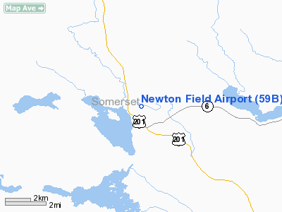
Location & QuickFacts
| FAA Information Effective: | 2008-09-25 |
| Airport Identifier: | 59B |
| Airport Status: | Operational |
| Longitude/Latitude: | 070-14-55.6520W/45-37-57.9210N
-70.248792/45.632756 (Estimated) |
| Elevation: | 1178 ft / 359.05 m (Estimated) |
| Land: | 132 acres |
| From nearest city: | 1 nautical miles W of Jackman, ME |
| Location: | Somerset County, ME |
| Magnetic Variation: | 18W (1985) |
Owner & Manager
| Ownership: | Publicly owned |
| Owner: | Town Of Jackman |
| Address: | Town Office
Jackman, ME 04945 |
| Phone number: | 207-668-2111 |
| Manager: | Kathleen Mackenzie |
| Address: | Town Office
Jackman, ME 04945 |
| Phone number: | 207-668-2111 |
Airport Operations and Facilities
| Airport Use: | Open to public |
| Wind indicator: | Yes |
| Segmented Circle: | Yes |
| Control Tower: | No |
| Lighting Schedule: | DUSK-DAWN
ACTVT MIRL RY 14/32 & REIL RY 32 - CTAF. |
| Beacon Color: | Clear-Green (lighted land airport)
ARPT BCN OTS INDEFLY. |
| Landing fee charge: | No |
| Sectional chart: | Montreal |
| Region: | ANE - New England |
| Boundary ARTCC: | ZBW - Boston |
| Tie-in FSS: | BGR - Bangor |
| FSS on Airport: | No |
| FSS Toll Free: | 1-800-WX-BRIEF |
| NOTAMs Facility: | BGR (NOTAM-d service avaliable) |
| Federal Agreements: | NGY |
Airport Communications
Airport Services
| Fuel available: | 100LL
FUEL AVBL 24 HRS. |
| Airframe Repair: | NONE |
| Power Plant Repair: | NONE |
| Bottled Oxygen: | NONE |
| Bulk Oxygen: | NONE |
Runway Information
Runway 13/31
| Dimension: | 2900 x 60 ft / 883.9 x 18.3 m |
| Surface: | ASPH, Good Condition |
| Edge Lights: | Medium |
| |
Runway 13 |
Runway 31 |
| Longitude: | 070-15-14.8100W | 070-14-36.5000W |
| Latitude: | 45-38-02.8100N | 45-37-53.0300N |
| Elevation: | 1178.00 ft | 1175.00 ft |
| Traffic Pattern: | Left | Left |
| Markings: | Basic, Good Condition | Basic, Good Condition |
| Runway End Identifier: | | Yes |
| Obstruction: | 46 ft trees, 1056.0 ft from runway, 230 ft left of centerline, 19:1 slope to clear | 70 ft trees, 1710.0 ft from runway, 175 ft right of centerline, 20:1 slope to clear |
|
Radio Navigation Aids
| ID |
Type |
Name |
Ch |
Freq |
Var |
Dist |
| XQA | NDB | Squaw | | 236.00 | 18W | 25.1 nm |
| RQM | NDB | Rangeley | | 221.00 | 18W | 47.0 nm |
| VLV | VOR/DME | Beauce | 119X | 117.20 | 18W | 30.6 nm |
Remarks
- BIRDS, DEER & MOOSE ON & INVOF ARPT.
- ARPT PHONE AVBL FOR LOCAL CALLS ONLY.
- BIRDS & DEER ON & INVOF RY.
- EXISTED PRIOR TO 1959.
Images and information placed above are from
http://www.airport-data.com/airport/59B/
We thank them for the data!
| General Info
|
| Country |
United States
|
| State |
MAINE
|
| FAA ID |
59B
|
| Latitude |
45-37-55.168N
|
| Longitude |
070-14-50.242W
|
| Elevation |
1176 feet
|
| Near City |
JACKMAN
|
We don't guarantee the information is fresh and accurate. The data may
be wrong or outdated.
For more up-to-date information please refer to other sources.
|
|


