 |
|
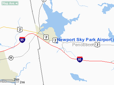
Location & QuickFacts
| FAA Information Effective: | 2008-09-25 |
| Airport Identifier: | ME68 |
| Airport Status: | Operational |
| Longitude/Latitude: | 069-14-18.1710W/44-49-12.2350N
-69.238381/44.820065 (Estimated) |
| Elevation: | 300 ft / 91.44 m (Estimated) |
| Land: | 0 acres |
| From nearest city: | 2 nautical miles SE of Newport, ME |
| Location: | Penobscot County, ME |
| Magnetic Variation: | 19W (1985) |
Owner & Manager
| Ownership: | Privately owned |
| Owner: | Jerry W. Emerson |
| Address: | Box 60
East Newport Me 049333 |
| Manager: | C&m Acft Enterprises |
| Address: | Box 60
East Newport, ME 04933 |
| Phone number: | 207-368-5855 |
Airport Operations and Facilities
| Airport Use: | Private |
| Wind indicator: | Yes |
| Segmented Circle: | No |
| Control Tower: | No |
| Landing fee charge: | No |
| Sectional chart: | Montreal |
| Region: | ANE - New England |
| Boundary ARTCC: | ZBW - Boston |
| Tie-in FSS: | BGR - Bangor |
| FSS on Airport: | No |
| FSS Toll Free: | 1-800-WX-BRIEF |
Airport Communications
Airport Services
| Bottled Oxygen: | NONE |
| Bulk Oxygen: | NONE |
Runway Information
Runway 01/19
| Dimension: | 3200 x 150 ft / 975.4 x 45.7 m
NORTH 800 FT CLSD INDEFLY. |
| Surface: | TURF, Good Condition |
| |
Runway 01 |
Runway 19 |
| Traffic Pattern: | Left | Left |
| Displaced threshold: | 450.00 ft | 600.00 ft |
| Runway End Identifier: | No | No |
| Centerline Lights: | No | No |
| Touchdown Lights: | No | No |
| Obstruction: | 15 ft pline, 360.0 ft from runway, 24:1 slope to clear
APCH RATIO 50:1 TO DSPLCD THR. | 40 ft pole, 0.0 ft from runway
APCH RATIO 15:1 TO DSPLCD THR. |
|
Radio Navigation Aids
| ID |
Type |
Name |
Ch |
Freq |
Var |
Dist |
| BUP | NDB | Burnham | | 348.00 | 18W | 9.0 nm |
| BST | NDB | Belfast | | 278.00 | 18W | 26.4 nm |
| OLD | NDB | Old Town | | 272.00 | 20W | 28.1 nm |
| RL | NDB | Bracy | | 399.00 | 18W | 30.3 nm |
| BH | NDB | Surry | | 330.00 | 19W | 43.3 nm |
| LRG | NDB | Lincoln | | 216.00 | 19W | 43.9 nm |
| XQA | NDB | Squaw | | 236.00 | 18W | 46.0 nm |
| SUH | NDB | Sprucehead | | 356.00 | 18W | 46.6 nm |
| AUG | VOR/DME | Augusta | 051X | 111.40 | 18W | 38.4 nm |
| BGR | VORTAC | Bangor | 095X | 114.80 | 19W | 15.6 nm |
| BGR | VOT | Bangor | | 111.00 | | 18.3 nm |
Remarks
- ARPT CLSD EXCP SKI UNTIL 25 APR 96.
- VFR WX CONDS ONLY
Images and information placed above are from
http://www.airport-data.com/airport/ME68/
We thank them for the data!
| General Info
|
| Country |
United States
|
| State |
MAINE
|
| FAA ID |
ME68
|
| Latitude |
44-49-12.235N
|
| Longitude |
069-14-18.171W
|
| Elevation |
300 feet
|
| Near City |
NEWPORT
|
We don't guarantee the information is fresh and accurate. The data may
be wrong or outdated.
For more up-to-date information please refer to other sources.
|
|


