 |
|
Millinocket Seaplane Base |
| Millinocket Seaplane Base |
| IATA: none – ICAO: none – FAA LID: 70B |
| Summary |
| Airport type |
Public |
| Owner |
Katadin Air Inc. |
| Serves |
Millinocket, Maine |
| Elevation AMSL |
492 ft / 150 m |
| Coordinates |
45°43′42″N 068°50′40″W / 45.72833°N 68.84444°W / 45.72833; -68.84444 |
| Runways |
| Direction |
Length |
Surface |
| ft |
m |
| ALL/WAY |
4,000 |
1,219 |
Water |
| Statistics (2006) |
| Aircraft operations |
7,000 |
| Source: Federal Aviation Administration |
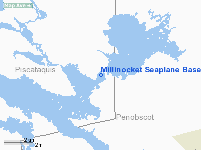
Millinocket Seaplane Base (FAA LID: 70B) is a privately-owned, public-use seaplane base located on Ambajejus Lake in Piscataquis County, Maine, United States, seven nautical miles (13 km) northwest of the central business district of Millinocket, a town in Penobscot County. Facilities and aircraft
Millinocket Seaplane Base has one landing area measuring 4,000 x 500 feet (1,219 x 152 m). For the 12-month period ending August 19, 2006, the airport had 7,000 aircraft operations, an average of 19 per day: 60% general aviation, 20% scheduled commercial and 20% air taxi.
The above content comes from Wikipedia and is published under free licenses – click here to read more.
Location & QuickFacts
| FAA Information Effective: | 2008-09-25 |
| Airport Identifier: | 70B |
| Airport Status: | Operational |
| Longitude/Latitude: | 068-50-40.1480W/45-43-42.1720N
-68.844486/45.728381 (Estimated) |
| Elevation: | 492 ft / 149.96 m (Estimated) |
| Land: | 0 acres |
| From nearest city: | 7 nautical miles NW of Millinocket, ME |
| Location: | Piscataquis County, ME |
| Magnetic Variation: | 19W (1985) |
Owner & Manager
| Ownership: | Privately owned |
| Owner: | Katadin Air Inc |
| Address: | Box 171
Millinocket, ME 04462 |
| Phone number: | 207-723-8378 |
| Manager: | Jim Strang |
| Address: | Box 171
Millinocket, ME 04462 |
| Phone number: | 207-723-8378
ALSO 1-888-742-5527. |
Airport Operations and Facilities
| Airport Use: | Open to public |
| Wind indicator: | Yes |
| Segmented Circle: | No |
| Control Tower: | No |
| Landing fee charge: | No |
| Sectional chart: | Halifax |
| Region: | ANE - New England |
| Boundary ARTCC: | ZBW - Boston |
| Tie-in FSS: | BGR - Bangor |
| FSS on Airport: | No |
| FSS Toll Free: | 1-800-WX-BRIEF |
| NOTAMs Facility: | BGR (NOTAM-d service avaliable) |
Airport Communications
Airport Services
| Fuel available: | 100LL |
| Airframe Repair: | NONE |
| Power Plant Repair: | NONE |
| Bottled Oxygen: | NONE |
| Bulk Oxygen: | NONE |
Runway Information
Runway ALL/WAY
| Dimension: | 4000 x 500 ft / 1219.2 x 152.4 m |
| Surface: | WATER, |
| |
Runway ALL |
Runway WAY |
| Traffic Pattern: | Left | Left |
| Runway End Identifier: | No | No |
| Centerline Lights: | No | No |
| Touchdown Lights: | No | No |
|
Radio Navigation Aids
| ID |
Type |
Name |
Ch |
Freq |
Var |
Dist |
| LNT | NDB | Milnot | | 344.00 | 19W | 13.2 nm |
| LRG | NDB | Lincoln | | 216.00 | 19W | 25.8 nm |
| XQA | NDB | Squaw | | 236.00 | 18W | 37.0 nm |
| OLD | NDB | Old Town | | 272.00 | 20W | 44.3 nm |
| MLT | VOR/DME | Millinocket | 126X | 117.90 | 20W | 16.2 nm |
| HUL | VOR/DME | Houlton | 108X | 116.10 | 21W | 46.2 nm |
Remarks
- WATER LEVEL FLUCTUATES 15'+/- LOWEST IN SEPT AND OCT.
- EXISTED PRIOR TO 1959.
Images and information placed above are from
http://www.airport-data.com/airport/70B/
We thank them for the data!
| General Info
|
| Country |
United States
|
| State |
MAINE
|
| FAA ID |
70B
|
| Latitude |
45-43-42.172N
|
| Longitude |
068-50-40.148W
|
| Elevation |
488 feet
|
| Near City |
MILLINOCKET
|
We don't guarantee the information is fresh and accurate. The data may
be wrong or outdated.
For more up-to-date information please refer to other sources.
|
|


