 |
|
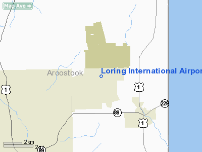
Loring International Airport |
Location & QuickFacts
| FAA Information Effective: | 2008-09-25 |
| Airport Identifier: | ME16 |
| Airport Status: | Operational |
| Longitude/Latitude: | 067-53-09.1000W/46-57-01.5400N
-67.885861/46.950428 (Estimated) |
| Elevation: | 746 ft / 227.38 m (Surveyed) |
| Land: | 0 acres |
| From nearest city: | 3 nautical miles NW of Limestone, ME |
| Location: | Aroostook County, ME |
| Magnetic Variation: | 21W (1985) |
Owner & Manager
| Ownership: | Publicly owned |
| Owner: | Loring Development Authority |
| Address: | 154 Development Drive - Suite F
Limestone, ME 04750 |
| Phone number: | 207-328-7005 |
| Manager: | Loring Development Authority |
| Address: | 154 Development Drive - Suite F
Limestone, ME 04750 |
| Phone number: | 207-328-7005 |
Airport Operations and Facilities
| Airport Use: | Private |
| Wind indicator: | Yes |
| Segmented Circle: | No |
| Control Tower: | No |
| Sectional chart: | Halifax |
| Region: | ANE - New England |
| Boundary ARTCC: | ZBW - Boston |
| Tie-in FSS: | BGR - Bangor |
| FSS on Airport: | No |
| FSS Toll Free: | 1-800-WX-BRIEF |
| NOTAMs Facility: | LIZ (NOTAM-d service avaliable) |
Airport Communications
Airport Services
Runway Information
Runway 01/19
| Dimension: | 12101 x 300 ft / 3688.4 x 91.4 m |
| Surface: | ASPH-CONC, Fair Condition
FIRST 1,000 FT EA RY END CONC, MIDDLE 10,101 FT ASPH. |
| Surface Treatment: | Saw-cut or plastic Grooved
CONC PORTIONS OF RY GRVD 70 FT EITHER SIDE OF CNTRLN. |
| Weight Limit: | Single wheel: 155000 lbs.
Dual wheel: 265000 lbs.
Dual tandem wheel: 445000 lbs. |
| Edge Lights: | Non-standard lighting system
NSTD HIRL DUE TO NO THLD LGTS; NO EDGE LGTS AT TWY INTERSECTIONS & NO AMBER LENSES LAST 2,000 FT EACH END. |
| |
Runway 01 |
Runway 19 |
| Longitude: | 067-52-47.2100W | 067-53-27.1400W |
| Latitude: | 46-56-03.5600N | 46-57-59.8200N |
| Elevation: | 746.00 ft | 744.00 ft |
| Traffic Pattern: | Left | Left |
| Markings: | Nonstandard, Poor Condition
01/19 NSTD MARKINGS; MILITARY PIR MKGS BOTH ENDS; EDGE STRIPES LOCATED 70 FT EITHER SIDE OF CNTRLN ; RY 01 MKGS FADED. | Nonstandard, Poor Condition |
| Arresting: | BAK12B | BAK12B |
| Crossing Height: | 58.00 ft | 58.00 ft |
| VASI: | 12-box on both sides
RY 01 VGSI OTS INDEFLY. | 12-box on both sides
RY 19 VGSI OTS INDEFLY. |
| Visual Glide Angle: | 3.00° | 3.00° |
| Approach lights: | ALSF1
01/19 ALSF1 OTS INDEFLY. | ALSF1 |
| Runway End Identifier: | No | No |
| Touchdown Lights: | No | No |
|
Radio Navigation Aids
| ID |
Type |
Name |
Ch |
Freq |
Var |
Dist |
| LIF | NDB | Limestone | | 220.00 | 19W | 6.8 nm |
| YSL | NDB | St Leonard | | 404.00 | 22W | 15.5 nm |
| FVE | NDB | Frenchville | | 257.00 | 20W | 24.4 nm |
| PQI | VOR/DME | Presque Isle | 111X | 116.40 | 21W | 13.6 nm |
Remarks
- VFR DAYTIME ONLY.
- CTN: EXP STANDING WATER ON RWY APRX 3000' FROM N END OF RWY 01/19 DUR AND SUBSEQUENT TO PERIODS OF PRECIPITATION.
- LARGE BIRDS & MAMMALS INVOF RY.
- 1,000 FT BY 300 FT PAVED OVERRUN AT EACH END OF RY.
- PVDD SMALL ACFT USE; VFR,DAY OPNS; EXCLUDES USE DURG WINTER/SNOW SEASON.
Images and information placed above are from
http://www.airport-data.com/airport/ME16/
We thank them for the data!
| General Info
|
| Country |
United States
|
| State |
MAINE
|
| FAA ID |
ME16
|
| Latitude |
46-57-01.158N
|
| Longitude |
067-53-08.073W
|
| Elevation |
746 feet
|
| Near City |
LIMESTONE
|
We don't guarantee the information is fresh and accurate. The data may
be wrong or outdated.
For more up-to-date information please refer to other sources.
|
|


