 |
|
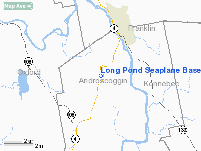
Location & QuickFacts
| FAA Information Effective: | 2008-09-25 |
| Airport Identifier: | 77ME |
| Airport Status: | Operational |
| Longitude/Latitude: | 070-12-58.2090W/44-26-00.2360N
-70.216169/44.433399 (Estimated) |
| Elevation: | 474 ft / 144.48 m (Estimated) |
| Land: | 0 acres |
| From nearest city: | 1 nautical miles SE of North Livermore, ME |
| Location: | Androscoggin County, ME |
| Magnetic Variation: | 18W (1985) |
Owner & Manager
| Ownership: | Privately owned |
| Owner: | International Paper Company |
| Address: | 9 Green Street
Augusta, ME 04330 |
| Manager: | Kevin T Mc Carthy |
| Address: | 9 Green Street
Augusta, ME 04330 |
| Phone number: | 207-897-3986
OR 897-3474 OR G.M. BLAISDELL - 207-897-4443. |
Airport Operations and Facilities
| Airport Use: | Private |
| Wind indicator: | No |
| Segmented Circle: | No |
| Control Tower: | No |
| Landing fee charge: | No |
| Sectional chart: | Montreal |
| Region: | ANE - New England |
| Boundary ARTCC: | ZBW - Boston |
| Tie-in FSS: | BGR - Bangor |
| FSS on Airport: | No |
| FSS Toll Free: | 1-800-WX-BRIEF |
Airport Services
| Fuel available: | 100LL |
| Airframe Repair: | NONE |
| Power Plant Repair: | NONE |
Runway Information
Runway 18/36
| Dimension: | 4000 x 300 ft / 1219.2 x 91.4 m |
| Surface: | WATER, |
| |
Runway 18 |
Runway 36 |
| Traffic Pattern: | Left | Left |
| Obstruction: | 50 ft trees, 1000.0 ft from runway, 20:1 slope to clear | 50 ft trees, 1000.0 ft from runway, 250 ft right of centerline, 20:1 slope to clear |
|
Radio Navigation Aids
| ID |
Type |
Name |
Ch |
Freq |
Var |
Dist |
| SZO | FAN MARKER | Grinn | | | 17W | 40.5 nm |
| RL | NDB | Bracy | | 399.00 | 18W | 20.7 nm |
| ISS | NDB | Wiscasset | | 407.00 | 18W | 36.7 nm |
| RQM | NDB | Rangeley | | 221.00 | 18W | 37.8 nm |
| BUP | NDB | Burnham | | 348.00 | 18W | 40.0 nm |
| SZO | NDB | Sebago | | 227.00 | 17W | 40.1 nm |
| HXK | NDB | Hornebrook | | 281.00 | 17W | 42.2 nm |
| NHZ | TACAN | Brunswick | 099X | | 17W | 36.0 nm |
| AUG | VOR/DME | Augusta | 051X | 111.40 | 18W | 19.3 nm |
| BML | VOR/DME | Berlin | 041X | 110.40 | 17W | 43.3 nm |
| PWM | VOT | Portland Intl Jetport | | 111.00 | | 47.8 nm |
Remarks
Images and information placed above are from
http://www.airport-data.com/airport/77ME/
We thank them for the data!
| General Info
|
| Country |
United States
|
| State |
MAINE
|
| FAA ID |
77ME
|
| Latitude |
44-26-00.236N
|
| Longitude |
070-12-58.209W
|
| Elevation |
474 feet
|
| Near City |
NORTH LIVERMORE
|
We don't guarantee the information is fresh and accurate. The data may
be wrong or outdated.
For more up-to-date information please refer to other sources.
|
|


